MiniScale

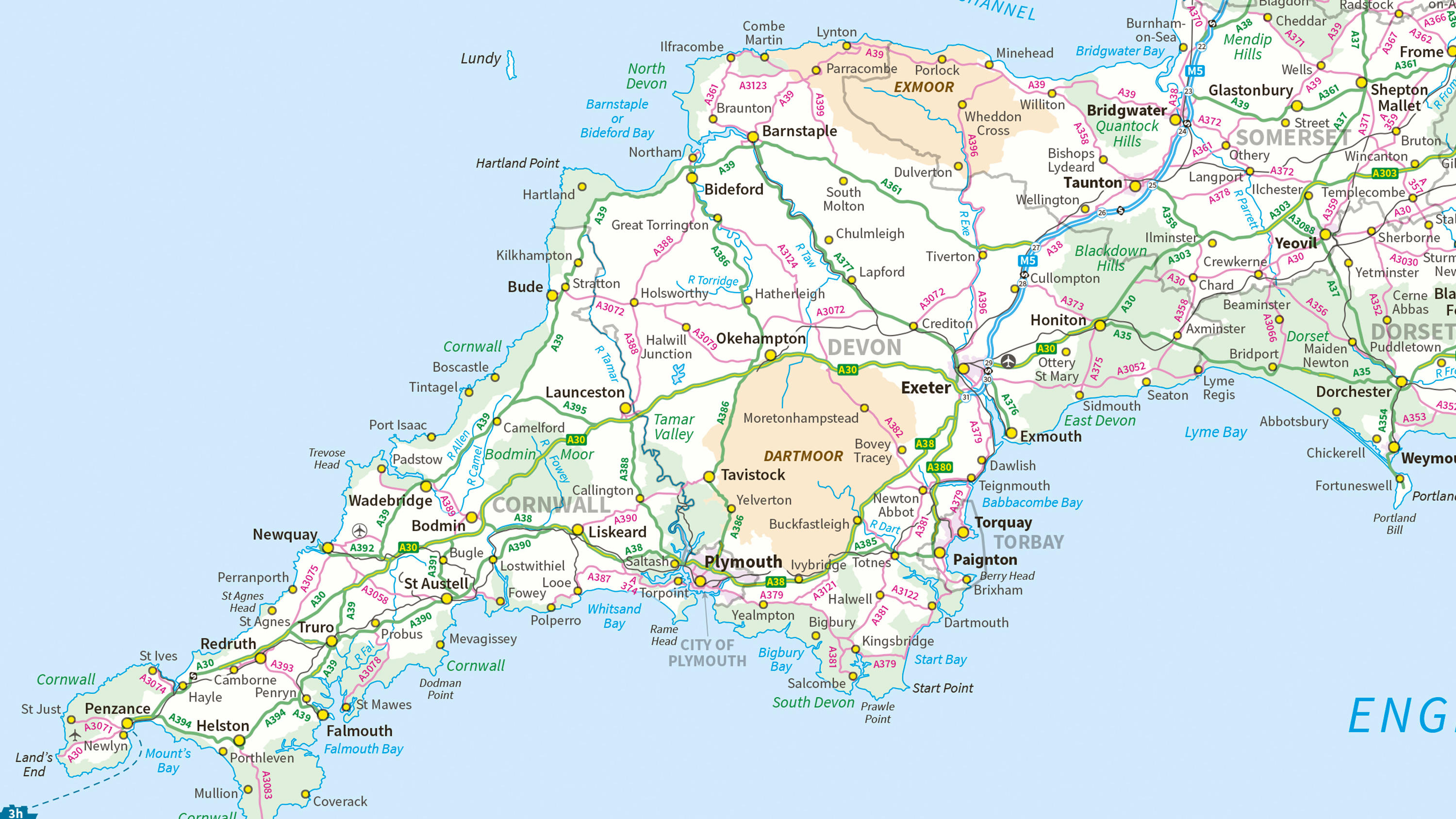
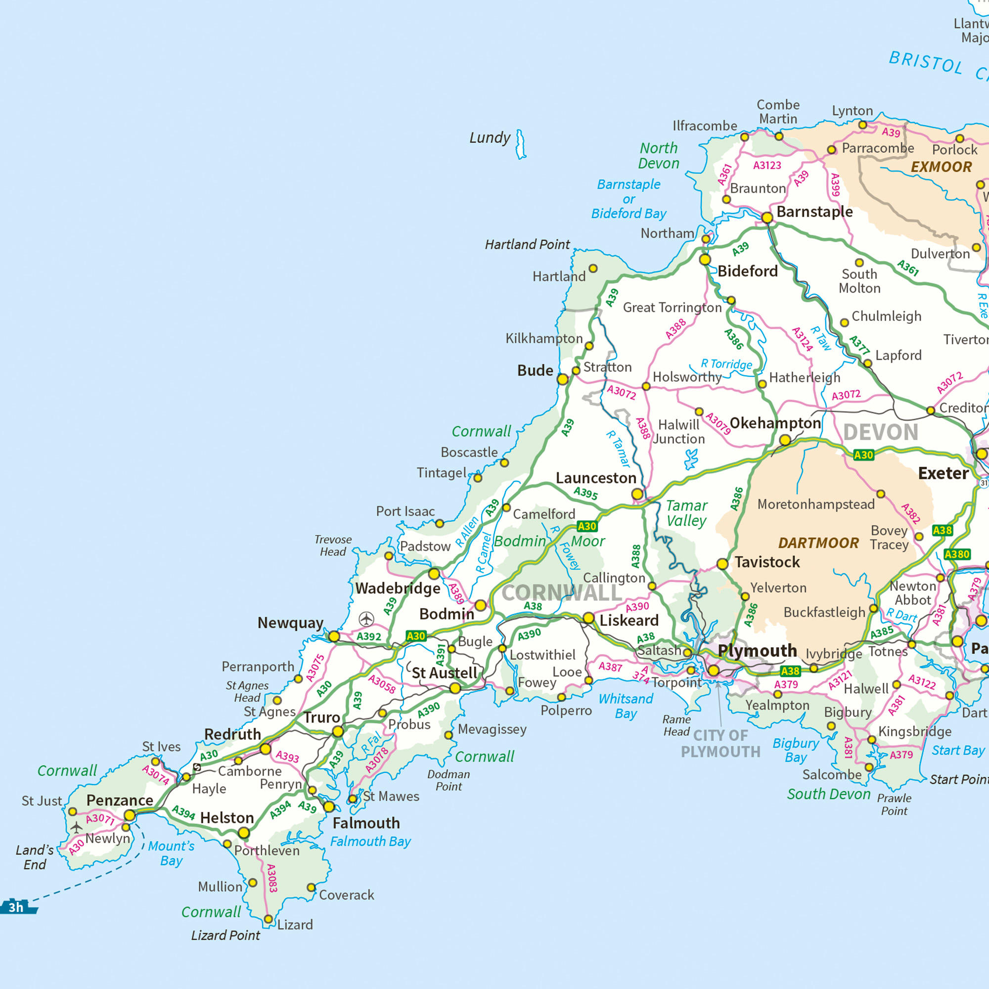
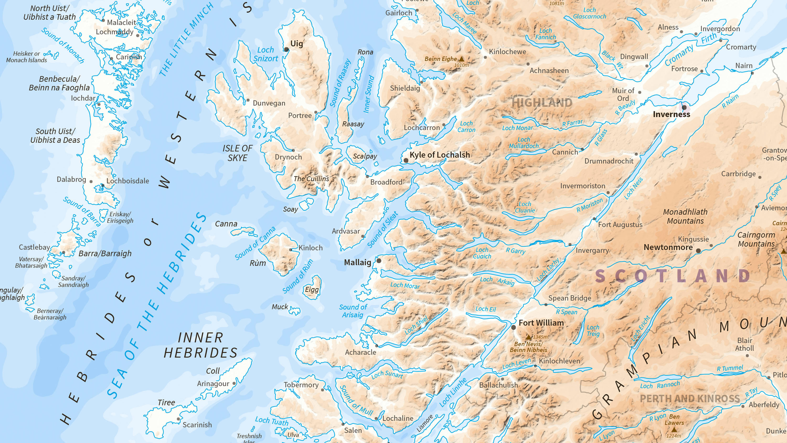
MiniScale is a free small-scale digital map of Great Britain in a single data file that clearly shows towns and cities, motorways, major roads, railways and airports.

  • Contextual or derived mapping
  • Download
  • Energy & Infrastructure Plan
  • OS OpenData Plan (FREE)
  • Premium Plan
  • Public Sector Plan

This product is updated annually

Representation of data provided

What MiniScale provides you with

See the big picture

MiniScale is ideal as a fast-loading national map of Great Britain for your GIS. It's accurate, quality-assured and easy on the eye.

Ideal for desktop publishing

MiniScale maps are great for desktop publishing. You can print them as wall maps or use extracts in sales brochures or project documents.

Flexible for GIS users and graphic designers

Choose the map that’s right for you. MiniScale downloads include files for both GIS users and graphic designers. We provide a map highlighting roads and cities, and another with terrain to the fore.

MiniScale

Technical information

Specifications

Access
  • Download
Data theme
  • Contextual
Data structure
Raster
Coverage
Great Britain
Scale
1:1,000,000
Format
  • Zip file (containing EPS, Illustrator and TIFF-LZW)
Ordering area
  • All of Great Britain
Publication months
  • January
OS Data Hub plan
  • Energy & Infrastructure Plan
  • OS OpenData Plan (FREE)
  • Premium Plan
  • Public Sector Plan

Documents and Support

Getting started guides

  • MiniScale - Product guide
    MiniScale shows the major boundaries, lines of communication, settlements and physical features of Great Britain. This guide provides greater insight into the product and its content.
    pdf
    v3.0
    1.2 mb
    January 4, 2021

Technical specification

  • MiniScale - Technical specifications
    The technical specification provides detailed technical information about the product. It is targeted at technical users and software developers.
    pdf
    v3.0
    622 kb
    December 21, 2020

Supporting documents

  • MiniScale - Legend
    Miniscale clearly shows towns and cities, motorways, major roads, railways and airports.
    pdf
    v1
    2,031 kb
    January 4, 2021

Additional information

Colour and options

Palette of 256 colours in the TIFF version of this product

Customisation options

You can turn off layers in the .ai files, which open in Adobe Illustrator (open source alternatives are available), then export files in other formats for use in your GIS or printed documents.

Image editing

You can open Miniscale files in Photoshop or similar image editing programmes in order use extracts for location maps and other purposes.

MiniScale

Get this product

What you get

Key features
  • See the big picture
  • Ideal for desktop publishing
  • Flexible for GIS users and graphic designers
Category
Contextual or derived mapping
Access
  • Download
Data structure
Raster
Update frequency
Annually

How to access

OS OpenData is free

Ready to get started with OS data?

Take the next step by signing up to the OS Data Hub and create your first project today.

Sign up to the OS Data Hub

Get this product

Access for free and benefit from using OS data

Get help

Further support

For further help about how our data can transform your organisation, contact us today

Contact us