Overview
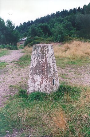
- Type of mark
- Pillar
- Flush bracket
- S2259
- Grid reference
- SK039152
- Access to mark
- foot
- Keys required
- No
- On Landranger sheet
- 128
Click to buy - On Explorer sheet
- 244
Click to buy - Permission required
- No
Coordinates of this station
ETRS89 Cartesian
- X
- 3868136.8080
- Y
- -131309.5608
- Z
- 5052932.2772
ETRS89 Geodetic
- Latitude
- N 52 ° 44' 5.248049"
- Longitude
- W 1 ° 56' 39.272754"
- Ellipsoid height
- 257.457
National Grid (Transformed by OSTN15/OSGM15)
- Eastings
- 403861.676
- Northings
- 315239.125
- Height
- 207.158
NB: If 'permission required' is Yes at top of this form, the land owner or agent's permission must be obtained before accessing the mark.