Overview
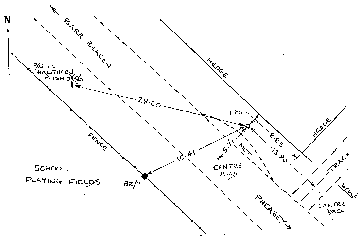
- Type of mark
- Rivet
- Flush bracket
- Not Available
- Grid reference
- SP066965
- Access to mark
- 2WD Vehicle
- Keys required
- No
- On Landranger sheet
- 139
Click to buy - On Explorer sheet
- 220
Click to buy - Permission required
- No
Coordinates of this station
ETRS89 Cartesian
- X
- 3883122.0982
- Y
- -129000.6205
- Z
- 5041540.9523
ETRS89 Geodetic
- Latitude
- N 52 ° 33' 58.527813"
- Longitude
- W 1 ° 54' 9.773268"
- Ellipsoid height
- 240.988
National Grid (Transformed by OSTN15/OSGM15)
- Eastings
- 406690.914
- Northings
- 296494.883
- Height
- 191.005
NB: If 'permission required' is Yes at top of this form, the land owner or agent's permission must be obtained before accessing the mark.