Overview
- Type of mark
- Pillar
- Flush bracket
- S6764
- Grid reference
- SP447026
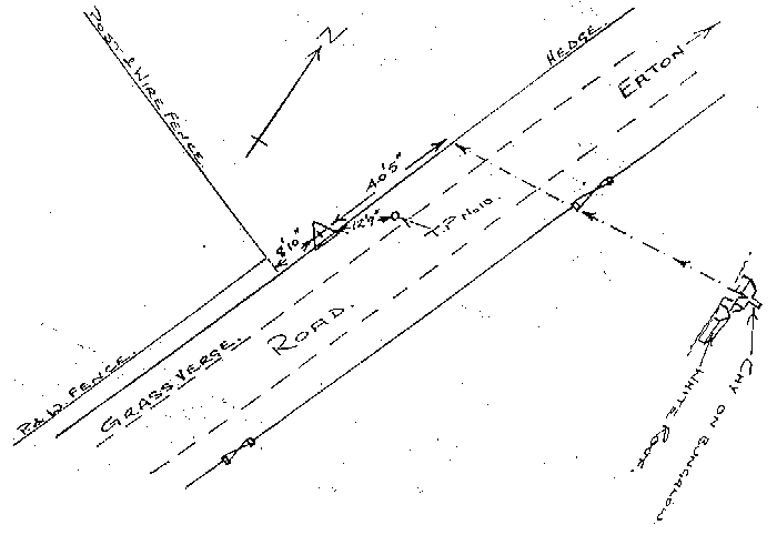
- Access to mark
- 2WD Vehicle
- Keys required
- No
- On Landranger sheet
- 164
Click to buy - On Explorer sheet
- 180
Click to buy - Permission required
- No
Coordinates of this station
ETRS89 Cartesian
- X
- 3958404.5839
- Y
- -93570.8698
- Z
- 4983714.9281
ETRS89 Geodetic
- Latitude
- N 51 ° 43' 13.848322"
- Longitude
- W 1 ° 21' 14.889172"
- Ellipsoid height
- 148.397
National Grid (Transformed by OSTN15/OSGM15)
- Eastings
- 444711.180
- Northings
- 202617.735
- Height
- 100.895
NB: If 'permission required' is Yes at top of this form, the land owner or agent's permission must be obtained before accessing the mark.