Overview
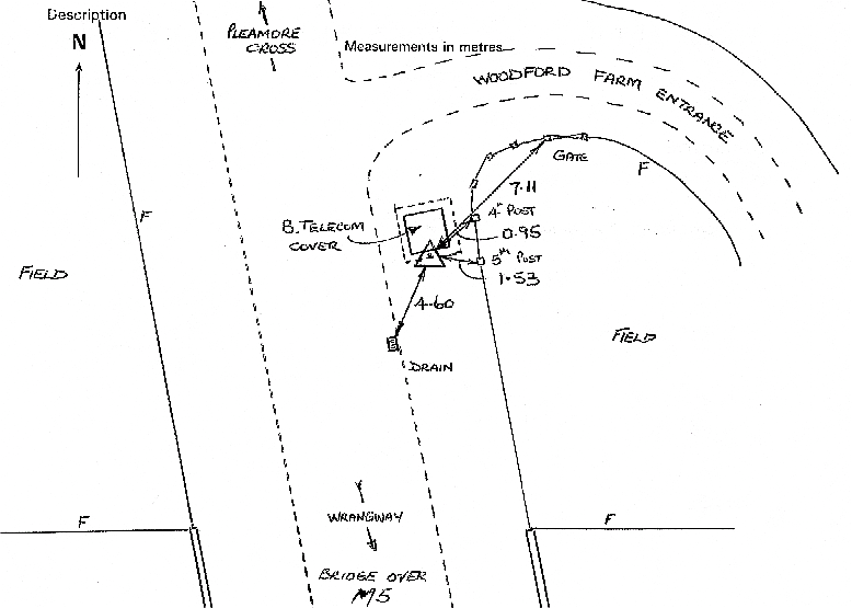
- Type of mark
- Rivet
- Flush bracket
- Not Available
- Grid reference
- ST123181
- Access to mark
- 2WD Vehicle
- Keys required
- No
- On Landranger sheet
- 181
Click to buy - On Explorer sheet
- 128
Click to buy - Permission required
- No
Coordinates of this station
ETRS89 Cartesian
- X
- 4019368.5350
- Y
- -228254.0290
- Z
- 4930689.5869
ETRS89 Geodetic
- Latitude
- N 50 ° 57' 25.951235"
- Longitude
- W 3 ° 15' 0.907622"
- Ellipsoid height
- 183.078
National Grid (Transformed by OSTN15/OSGM15)
- Eastings
- 312285.724
- Northings
- 118276.370
- Height
- 131.772
NB: If 'permission required' is Yes at top of this form, the land owner or agent's permission must be obtained before accessing the mark.