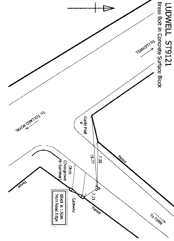
Overview
- Type of mark
- Surface Block
- Flush bracket
- Not Available
- Grid reference
- ST915218
- Access to mark
- 2WD Vehicle
- Keys required
- No
- On Landranger sheet
- 184
Click to buy - On Explorer sheet
- 118
Click to buy - Permission required
- No
Coordinates of this station
ETRS89 Cartesian
- X
- 4019781.8385
- Y
- -148910.0612
- Z
- 4933389.4306
ETRS89 Geodetic
- Latitude
- N 50 ° 59' 44.055442"
- Longitude
- W 2 ° 7' 17.445982"
- Ellipsoid height
- 199.339
National Grid (Transformed by OSTN15/OSGM15)
- Eastings
- 391568.461
- Northings
- 121805.105
- Height
- 151.259
NB: If 'permission required' is Yes at top of this form, the land owner or agent's permission must be obtained before accessing the mark.