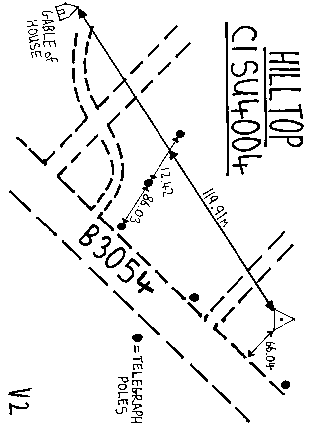
Overview
- Type of mark
- Pillar
- Flush bracket
- Not Available
- Grid reference
- SU403045
- Access to mark
- 2WD Vehicle
- Keys required
- No
- On Landranger sheet
- 196
Click to buy - On Explorer sheet
- 22
Click to buy - Permission required
- Yes
Coordinates of this station
ETRS89 Cartesian
- X
- 4034695.8118
- Y
- -100556.4613
- Z
- 4922353.2611
ETRS89 Geodetic
- Latitude
- N 50 ° 50' 22.071365"
- Longitude
- W 1 ° 25' 39.660356"
- Ellipsoid height
- 86.604
National Grid (Transformed by OSTN15/OSGM15)
- Eastings
- 440394.435
- Northings
- 104594.371
- Height
- 40.358
NB: If 'permission required' is Yes at top of this form, the land owner or agent's permission must be obtained before accessing the mark.