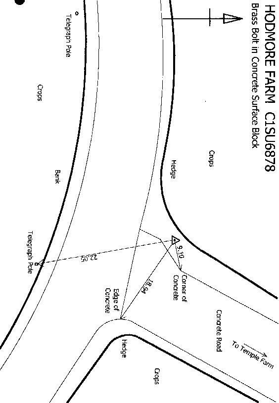
Overview
- Type of mark
- Surface Block
- Flush bracket
- Not Available
- Grid reference
- SU683782
- Access to mark
- 2WD Vehicle
- Keys required
- No
- On Landranger sheet
- 175
Click to buy - On Explorer sheet
- 171
Click to buy - Permission required
- No
Coordinates of this station
ETRS89 Cartesian
- X
- 3978241.1100
- Y
- -70656.3100
- Z
- 4968369.0000
ETRS89 Geodetic
- Latitude
- N 51 ° 29' 54.561288"
- Longitude
- W 1 ° 1' 3.020307"
- Ellipsoid height
- 142.065
National Grid (Transformed by OSTN15/OSGM15)
- Eastings
- 468296.342
- Northings
- 178184.917
- Height
- 95.428
NB: If 'permission required' is Yes at top of this form, the land owner or agent's permission must be obtained before accessing the mark.