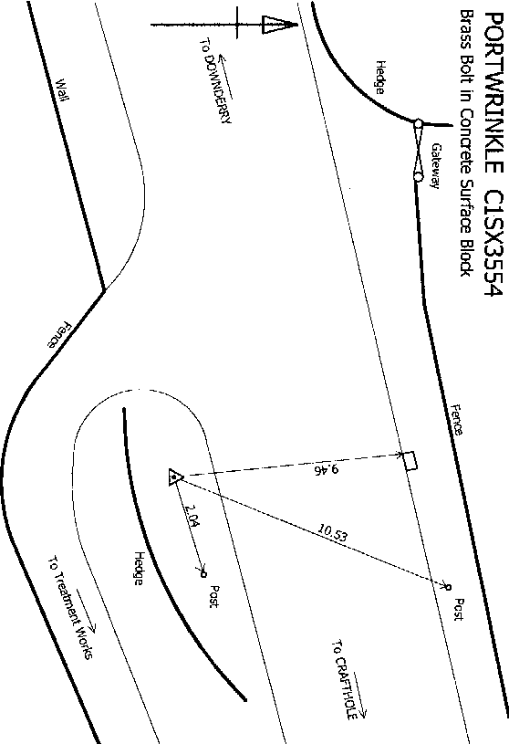
Overview
- Type of mark
- Surface Block
- Flush bracket
- Not Available
- Grid reference
- SX355545
- Access to mark
- 2WD Vehicle
- Keys required
- No
- On Landranger sheet
- 201
Click to buy - On Explorer sheet
- 108
Click to buy - Permission required
- No
Coordinates of this station
ETRS89 Cartesian
- X
- 4065258.2270
- Y
- -306417.4190
- Z
- 4888844.1357
ETRS89 Geodetic
- Latitude
- N 50 ° 21' 52.438209"
- Longitude
- W 4 ° 18' 37.794841"
- Ellipsoid height
- 114.289
National Grid (Transformed by OSTN15/OSGM15)
- Eastings
- 235770.816
- Northings
- 54183.364
- Height
- 61.900
NB: If 'permission required' is Yes at top of this form, the land owner or agent's permission must be obtained before accessing the mark.