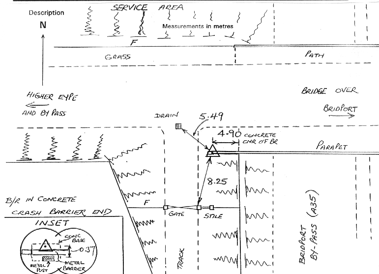
Overview
- Type of mark
- Rivet
- Flush bracket
- Not Available
- Grid reference
- SY452921
- Access to mark
- 2WD Vehicle
- Keys required
- No
- On Landranger sheet
- 193
Click to buy - On Explorer sheet
- 116
Click to buy - Permission required
- No
Coordinates of this station
ETRS89 Cartesian
- X
- 4040990.2995
- Y
- -196025.1398
- Z
- 4914382.9159
ETRS89 Geodetic
- Latitude
- N 50 ° 43' 33.459349"
- Longitude
- W 2 ° 46' 37.900087"
- Ellipsoid height
- 103.502
National Grid (Transformed by OSTN15/OSGM15)
- Eastings
- 345239.076
- Northings
- 92104.963
- Height
- 53.804
NB: If 'permission required' is Yes at top of this form, the land owner or agent's permission must be obtained before accessing the mark.