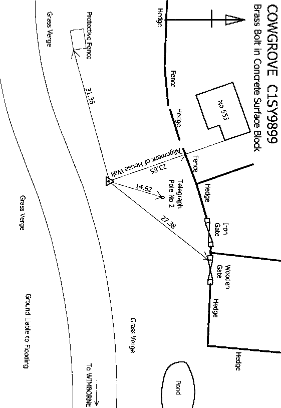
Overview
- Type of mark
- Surface Block
- Flush bracket
- Not Available
- Grid reference
- SY985999
- Access to mark
- 2WD Vehicle
- Keys required
- No
- On Landranger sheet
- 195
Click to buy - On Explorer sheet
- 15
Click to buy - Permission required
- No
Coordinates of this station
ETRS89 Cartesian
- X
- 4036884.9578
- Y
- -142575.8332
- Z
- 4919514.6033
ETRS89 Geodetic
- Latitude
- N 50 ° 47' 57.413384"
- Longitude
- W 2 ° 1' 21.89142"
- Ellipsoid height
- 67.840
National Grid (Transformed by OSTN15/OSGM15)
- Eastings
- 398492.780
- Northings
- 99970.231
- Height
- 20.232
NB: If 'permission required' is Yes at top of this form, the land owner or agent's permission must be obtained before accessing the mark.