Overview
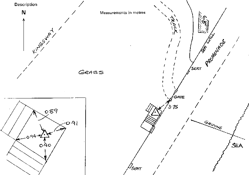
- Type of mark
- Rivet
- Flush bracket
- Not Available
- Grid reference
- SZ864929
- Access to mark
- foot
- Keys required
- No
- On Landranger sheet
- 197
Click to buy - On Explorer sheet
- 120
Click to buy - Permission required
- No
Coordinates of this station
ETRS89 Cartesian
- X
- 4045018.9443
- Y
- -54879.9386
- Z
- 4914600.8447
ETRS89 Geodetic
- Latitude
- N 50 ° 43' 46.711991"
- Longitude
- W 0 ° 46' 38.282427"
- Ellipsoid height
- 50.152
National Grid (Transformed by OSTN15/OSGM15)
- Eastings
- 486390.108
- Northings
- 92938.675
- Height
- 4.806
NB: If 'permission required' is Yes at top of this form, the land owner or agent's permission must be obtained before accessing the mark.