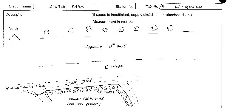
Overview
- Type of mark
- Pillar
- Flush bracket
- S7863
- Grid reference
- TQ827501
- Access to mark
- 2WD Vehicle
- Keys required
- No
- On Landranger sheet
- 188
Click to buy - On Explorer sheet
- 148
Click to buy - Permission required
- No
Coordinates of this station
ETRS89 Cartesian
- X
- 4002733.0165
- Y
- 43055.9910
- Z
- 4949156.0022
ETRS89 Geodetic
- Latitude
- N 51 ° 13' 17.370505"
- Longitude
- E 0 ° 36' 58.632395"
- Ellipsoid height
- 181.277
National Grid (Transformed by OSTN15/OSGM15)
- Eastings
- 582794.491
- Northings
- 150173.955
- Height
- 136.452
NB: If 'permission required' is Yes at top of this form, the land owner or agent's permission must be obtained before accessing the mark.