Overview
- Type of mark
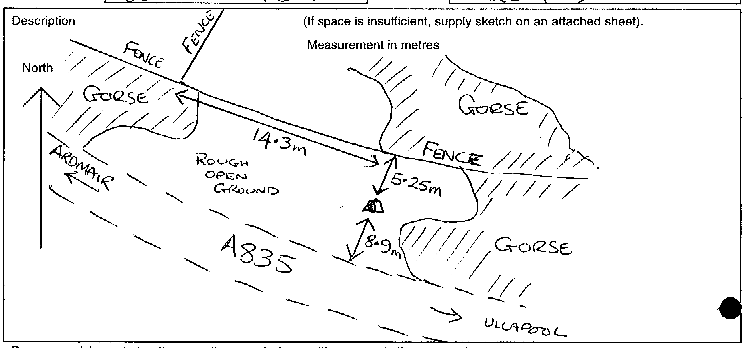
- FBM
- Flush bracket
- Not Available
- Grid reference
- NH120953
- Access to mark
- foot
- Keys required
- No
- On Landranger sheet
- 19
Click to buy - On Explorer sheet
- Not Available
- Permission required
- No
Coordinates of this station
ETRS89 Cartesian
- X
- 3382970.6812
- Y
- -306321.6832
- Z
- 5380378.4738
ETRS89 Geodetic
- Latitude
- N 57 ° 54' 28.433455"
- Longitude
- W 5 ° 10' 26.099268"
- Ellipsoid height
- 98.746
National Grid (Transformed by OSTN15/OSGM15)
- Eastings
- 212046.572
- Northings
- 895361.621
- Height
- 43.751
NB: If 'permission required' is Yes at top of this form, the land owner or agent's permission must be obtained before accessing the mark.