Overview
- Type of mark
- FBM
- Flush bracket
- Not Available
- Grid reference
- NJ967057
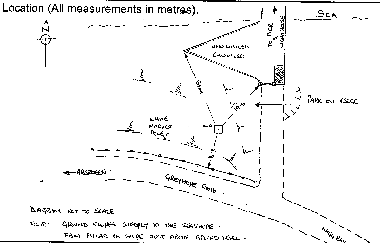
- Access to mark
- 2WD Vehicle
- Keys required
- No
- On Landranger sheet
- 38
Click to buy - On Explorer sheet
- Not Available
- Permission required
- No
Coordinates of this station
ETRS89 Cartesian
- X
- 3466516.6678
- Y
- -124428.1751
- Z
- 5334548.2538
ETRS89 Geodetic
- Latitude
- N 57 ° 8' 31.240276"
- Longitude
- W 2 ° 3' 20.552793"
- Ellipsoid height
- 61.177
National Grid (Transformed by OSTN15/OSGM15)
- Eastings
- 396728.085
- Northings
- 805682.475
- Height
- 11.490
NB: If 'permission required' is Yes at top of this form, the land owner or agent's permission must be obtained before accessing the mark.