Overview
- Type of mark
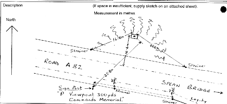
- FBM
- Flush bracket
- Not Available
- Grid reference
- NN210821
- Access to mark
- foot
- Keys required
- No
- On Landranger sheet
- 41
Click to buy - On Explorer sheet
- Not Available
- Permission required
- No
Coordinates of this station
ETRS89 Cartesian
- X
- 3478790.7580
- Y
- -300647.0923
- Z
- 5319752.6916
ETRS89 Geodetic
- Latitude
- N 56 ° 53' 46.931072"
- Longitude
- W 4 ° 56' 21.814735"
- Ellipsoid height
- 174.959
National Grid (Transformed by OSTN15/OSGM15)
- Eastings
- 221066.685
- Northings
- 782185.651
- Height
- 120.318
NB: If 'permission required' is Yes at top of this form, the land owner or agent's permission must be obtained before accessing the mark.