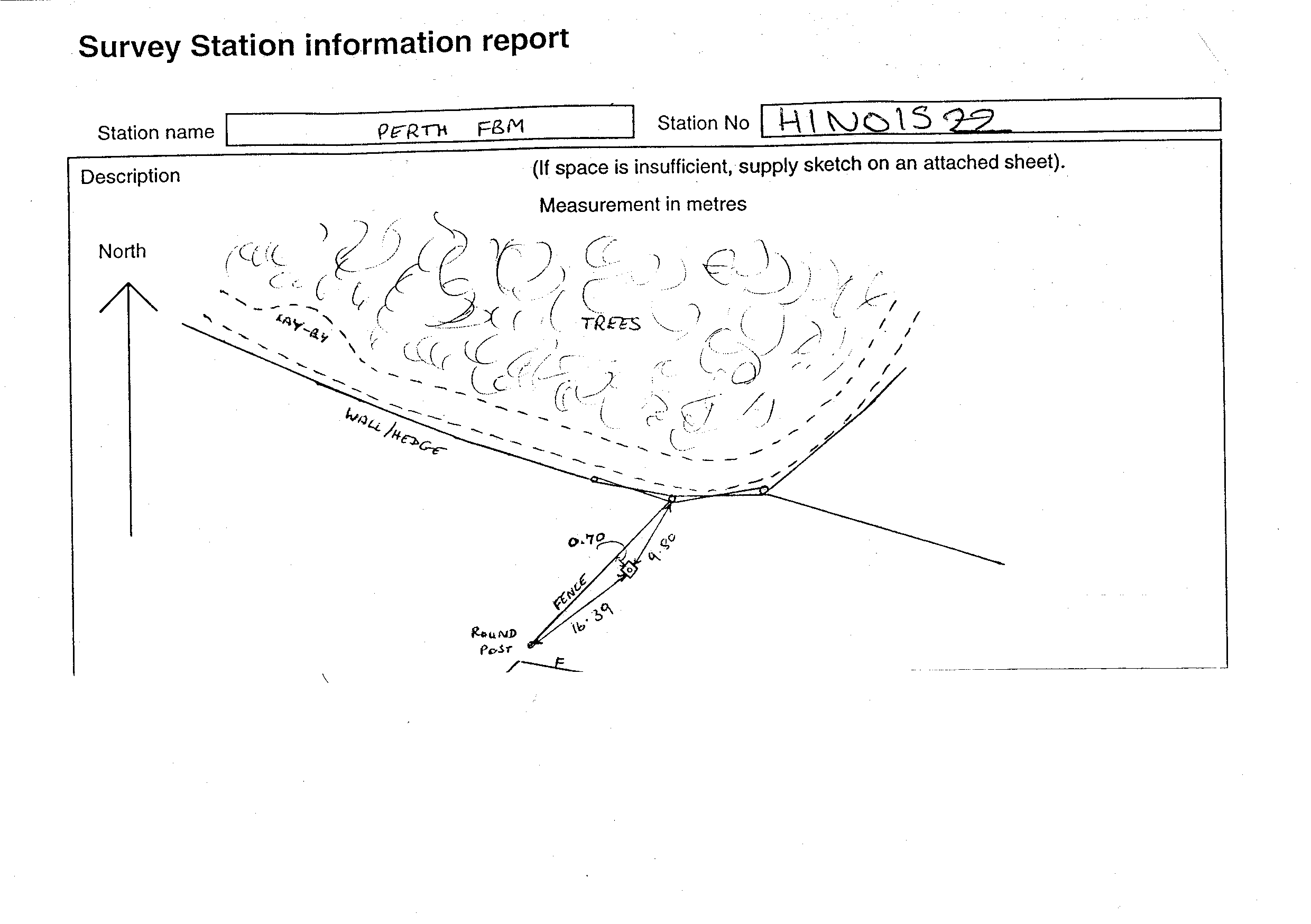
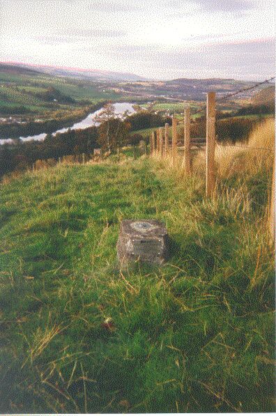
Overview
- Type of mark
- FBM
- Flush bracket
- Not Available
- Grid reference
- NO153228
- Access to mark
- foot
- Keys required
- No
- On Landranger sheet
- 53
Click to buy - On Explorer sheet
- Not Available
- Permission required
- No
Coordinates of this station
ETRS89 Cartesian
- X
- 3532686.9421
- Y
- -208158.6079
- Z
- 5288792.3807
ETRS89 Geodetic
- Latitude
- N 56 ° 23' 25.9222"
- Longitude
- W 3 ° 22' 19.826712"
- Ellipsoid height
- 188.715
National Grid (Transformed by OSTN15/OSGM15)
- Eastings
- 315384.692
- Northings
- 722875.272
- Height
- 136.365
NB: If 'permission required' is Yes at top of this form, the land owner or agent's permission must be obtained before accessing the mark.