Overview
- Type of mark
- FBM
- Flush bracket
- Not Available
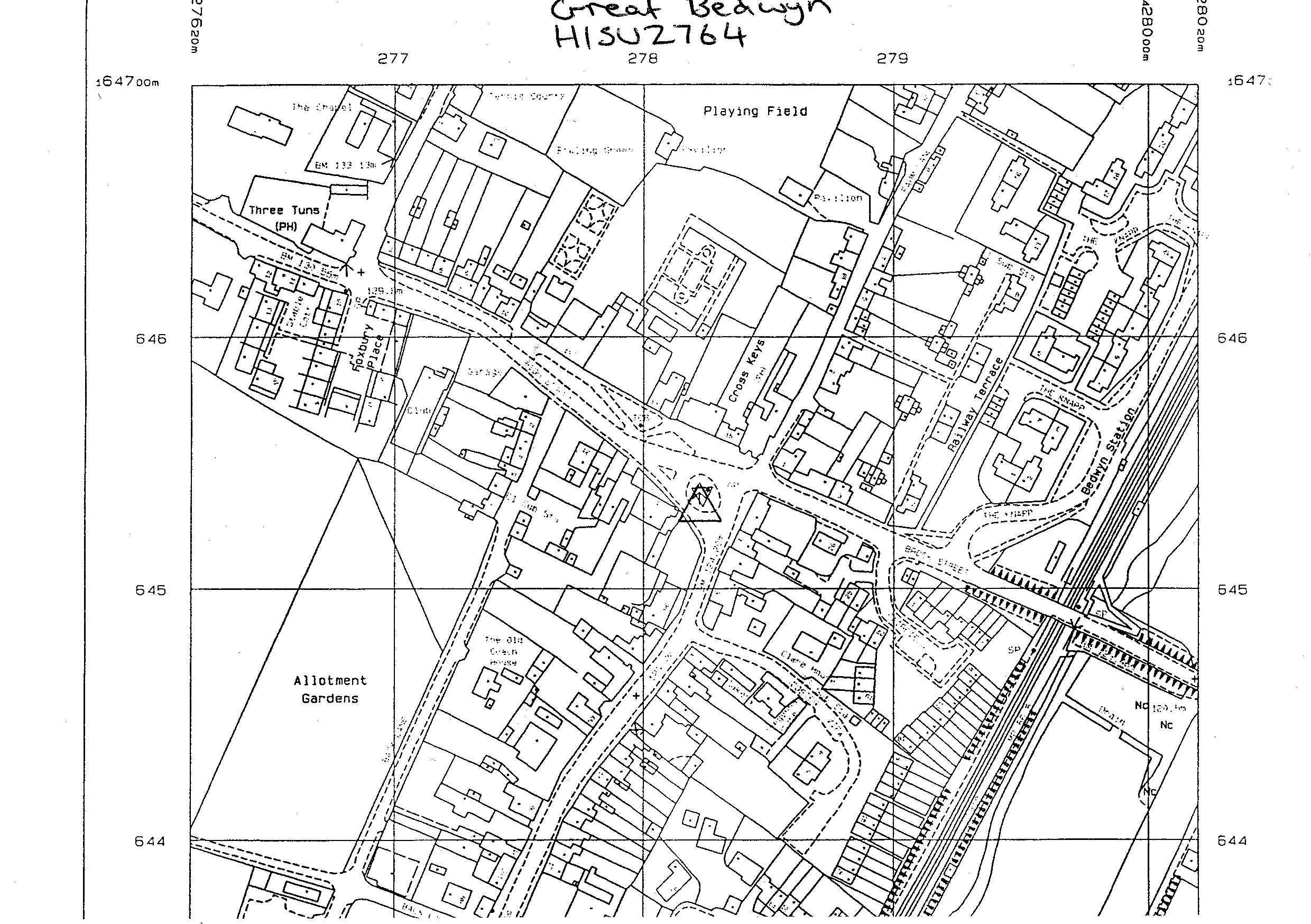
- Grid reference
- SU278645
- Access to mark
- 2WD Vehicle
- Keys required
- No
- On Landranger sheet
- 174
Click to buy - On Explorer sheet
- 157
Click to buy - Permission required
- No
Coordinates of this station
ETRS89 Cartesian
- X
- 3987702.0160
- Y
- -111493.2584
- Z
- 4960122.7135
ETRS89 Geodetic
- Latitude
- N 51 ° 22' 45.311042"
- Longitude
- W 1 ° 36' 5.512471"
- Ellipsoid height
- 171.676
National Grid (Transformed by OSTN15/OSGM15)
- Eastings
- 427828.305
- Northings
- 164542.338
- Height
- 124.199
NB: If 'permission required' is Yes at top of this form, the land owner or agent's permission must be obtained before accessing the mark.