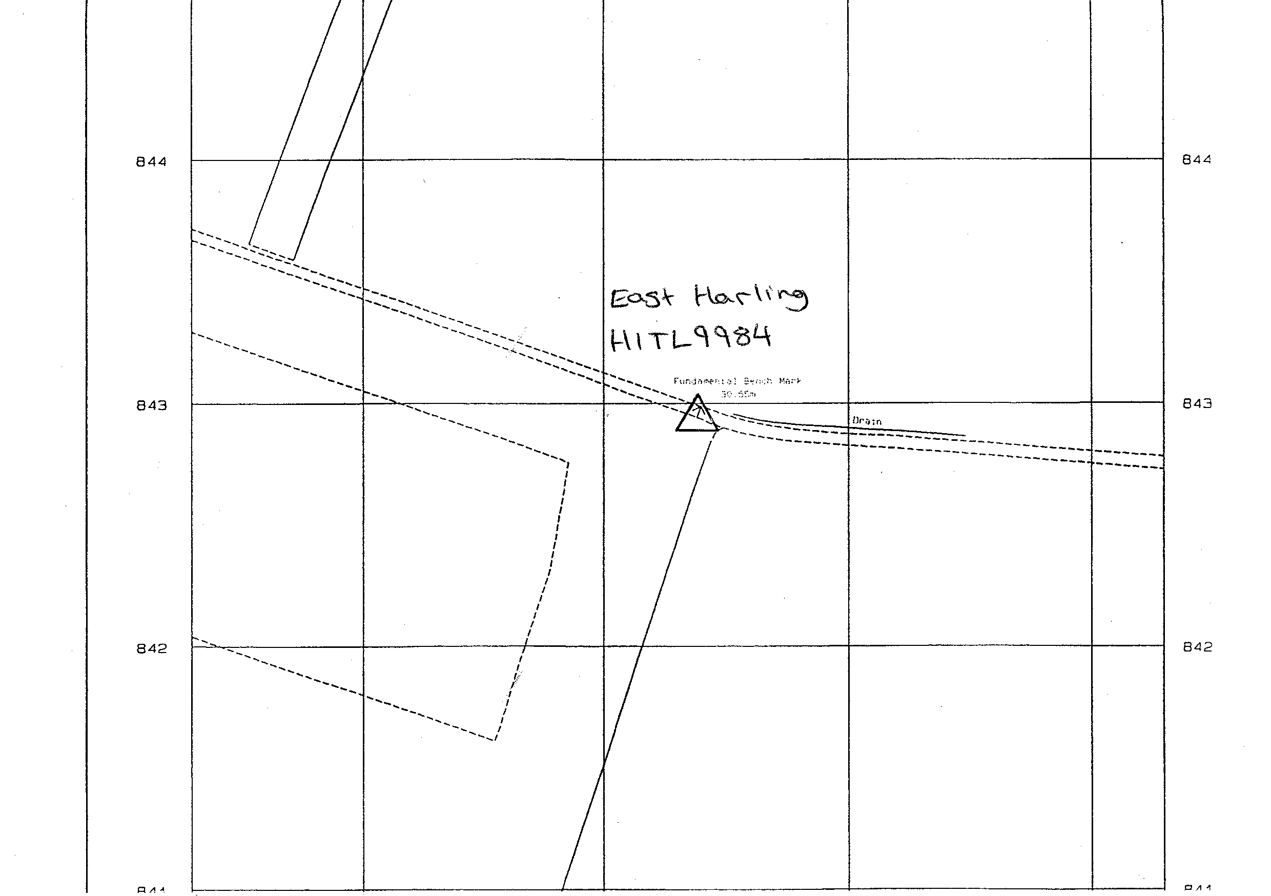
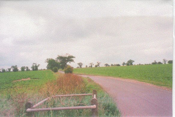
Overview
- Type of mark
- FBM
- Flush bracket
- Not Available
- Grid reference
- TL997843
- Access to mark
- 2WD Vehicle
- Keys required
- No
- On Landranger sheet
- 144
Click to buy - On Explorer sheet
- 230
Click to buy - Permission required
- No
Coordinates of this station
ETRS89 Cartesian
- X
- 3897534.8040
- Y
- 63573.3451
- Z
- 5031516.9262
ETRS89 Geodetic
- Latitude
- N 52 ° 25' 12.874573"
- Longitude
- E 0 ° 56' 4.121589"
- Ellipsoid height
- 75.748
National Grid (Transformed by OSTN15/OSGM15)
- Eastings
- 599640.562
- Northings
- 284298.368
- Height
- 30.517
NB: If 'permission required' is Yes at top of this form, the land owner or agent's permission must be obtained before accessing the mark.