Overview
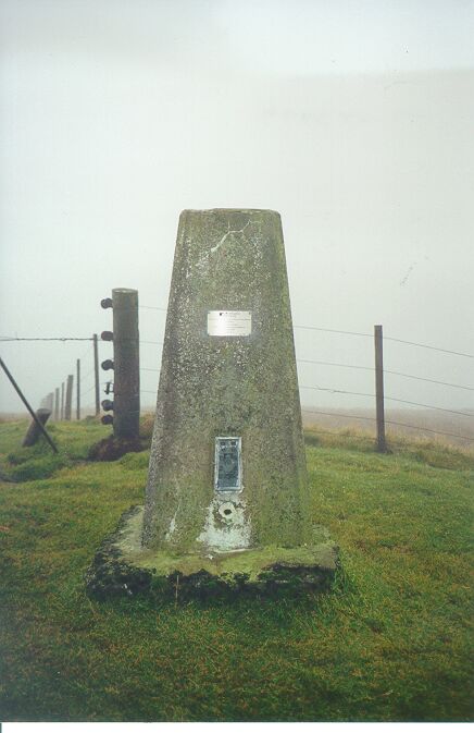
- Type of mark
- Pillar
- Flush bracket
- S1554
- Grid reference
- NY386993
- Access to mark
- foot
- Keys required
- No
- On Landranger sheet
- 79
Click to buy - On Explorer sheet
- 323
Click to buy - Permission required
- No
Coordinates of this station
ETRS89 Cartesian
- X
- 3636098.3092
- Y
- -188493.3344
- Z
- 5220013.3254
ETRS89 Geodetic
- Latitude
- N 55 ° 17' 3.909378"
- Longitude
- W 2 ° 58' 3.091181"
- Ellipsoid height
- 648.342
National Grid (Transformed by OSTN15/OSGM15)
- Eastings
- 338644.911
- Northings
- 599347.694
- Height
- 595.477
NB: If 'permission required' is Yes at top of this form, the land owner or agent's permission must be obtained before accessing the mark.