Code-Point

Code-Point is a postcode locator with postcode units in Great Britain and Northern Ireland. Get started with geographical analysis, simple route planning and asset management using Code-Point.

  • Addressing and location
  • Download
  • Public Sector Plan
  • Premium Plan
  • Energy & Infrastructure Plan

This product is updated quarterly

Representation of data provided
© Crown copyright and database rights. Ordnance Survey 2024

What Code-Point provides you with

Authoritative data

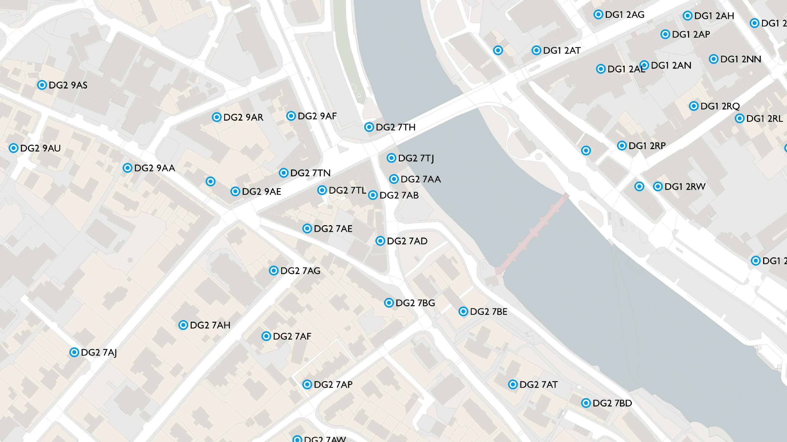
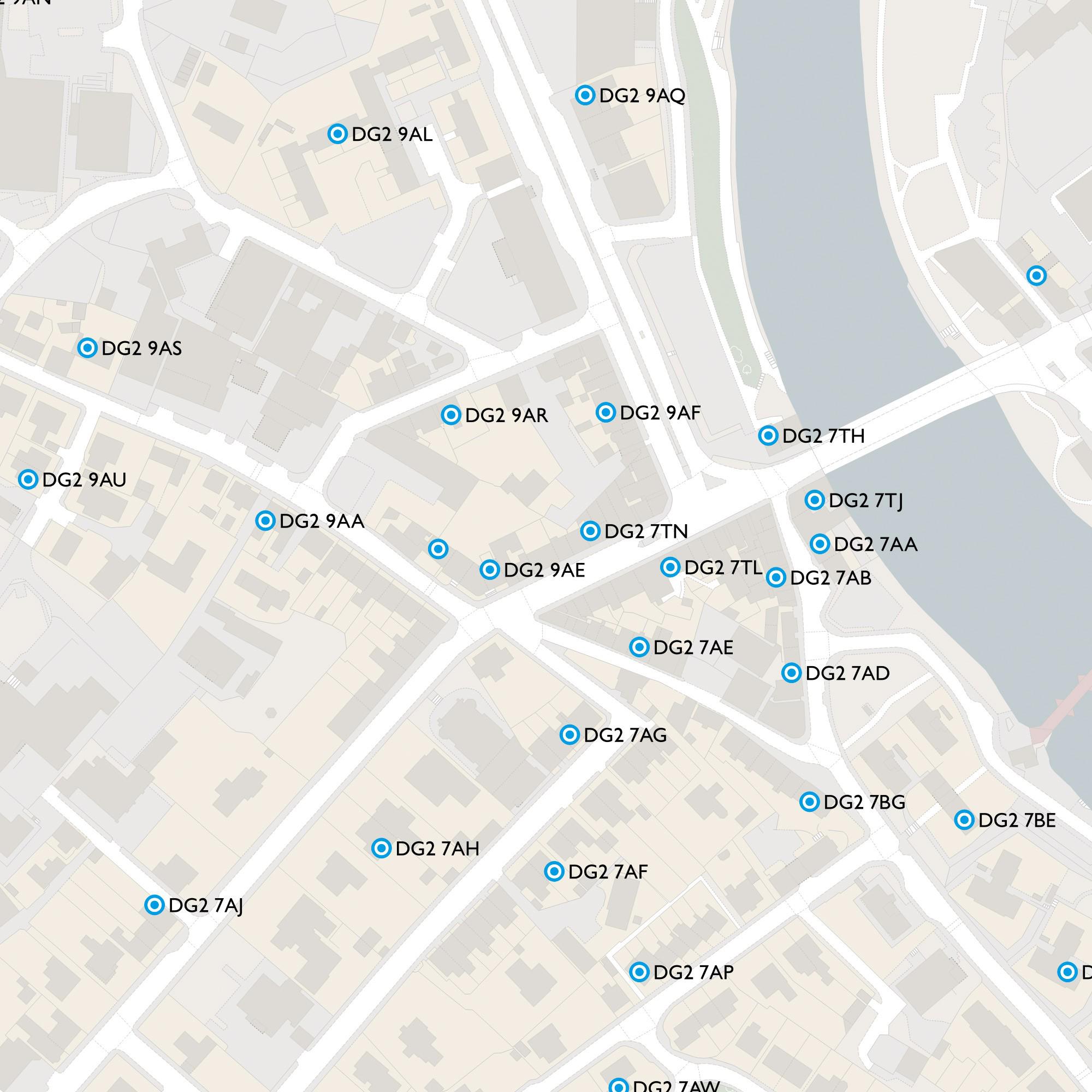
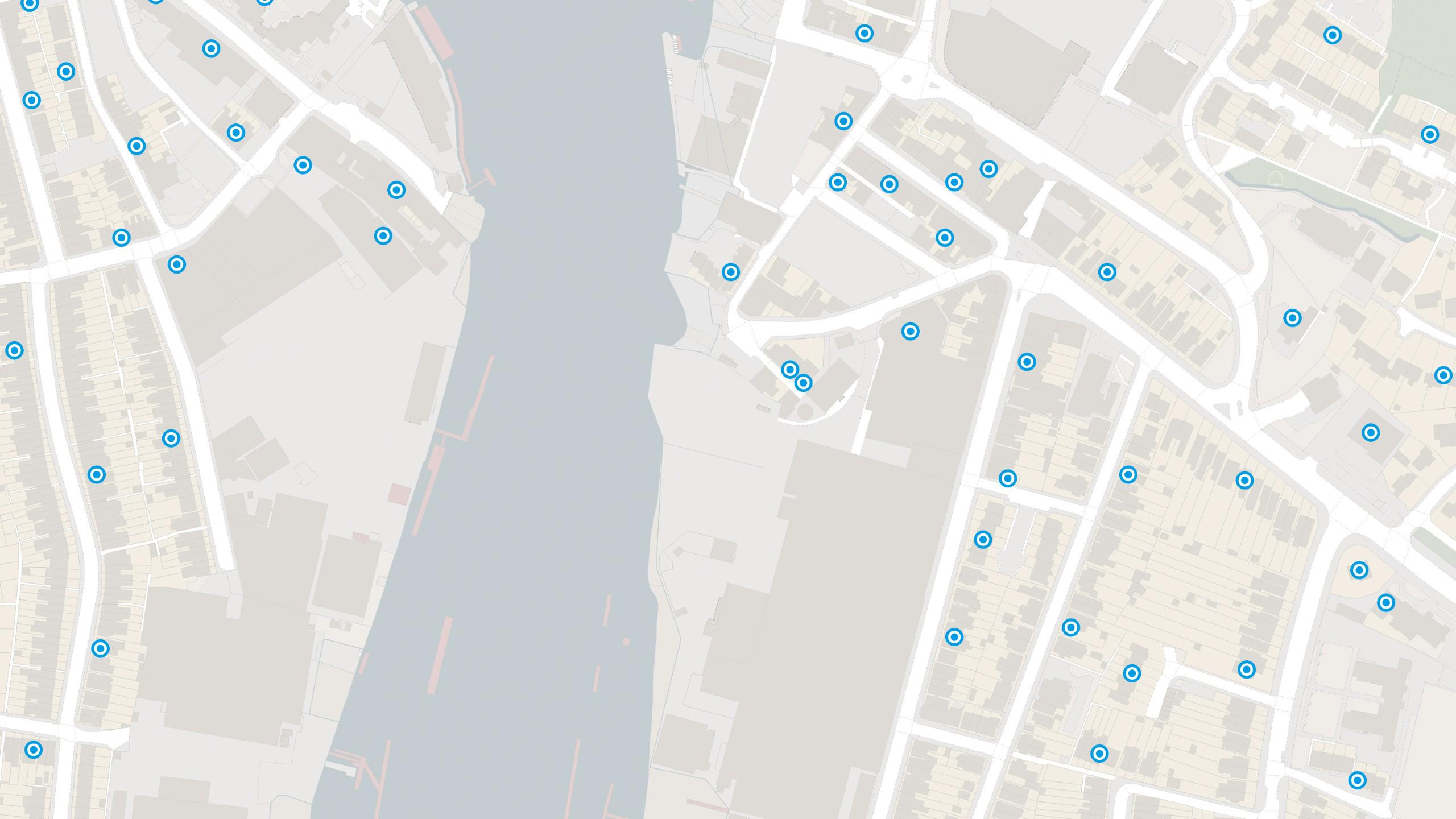
Coverage of over 1.7 million postcodes in Great Britain and Northern Ireland updated quarterly – accurate depiction of all live postcodes in GB and NI.

Get more from your postcode data

Understand the split of residential and commercial delivery points within a postcode area for a greater depth of analysis.

Interoperable data

Combine your statistical and health datasets with postcode data by linking to ONS administrative codes and Health Authority codes provided with Code-Point.

Code-Point

Technical information

© Crown copyright and database rights. Ordnance Survey 2024

Specifications

Use cases

Code-Point data provides:

  • information about the number and type of postal delivery points in the postcode;
  • a positional quality indicator (PQI), indicating the quality of the data underlying the Code-Point location coordinate (CPLC);
  • the country indicator (either England, Scotland, Wales or Northern Ireland);
  • the postcode type;
  • the National Health Service region and area codes; and
  • the local government county, district and ward codes.
Access
  • Download
Data theme
  • Postcodes
Data structure
Vector - Points
Coverage
Great Britain
Scale
1:1250 to 1:10,000
Format
  • GeoPackage
  • CSV
Ordering area
  • All of Great Britain
Publication months
  • February
  • May
  • August
  • November
OS Data Hub plan
  • Public Sector Plan
  • Premium Plan
  • Energy & Infrastructure Plan

Documents and Support

Getting started guides

  • Code-Point - Getting started guide
    The getting started guide provides instructions for using the product in different software applications. Users with limited technical knowledge will be able to follow this guide.
    pdf
    v3.1
    314 kb
    August 4, 2022

Technical specification

  • Code-Point - Technical specification
    The technical specification provides detailed technical information about the product. It is targeted at technical users and software developers.
    pdf
    v1.6
    378 kb
    December 12, 2022

Supporting documents

  • Code-Point - Overview
    The overview introduces the product and gives context for all users. It highlights key features, provides examples of potential uses for the product and lists details like file sizes, supply formats, etc.
    pdf
    v3.1
    212 kb
    August 4, 2022
  • Code-Point - Column headers
    Use this link to open a CSV file of our already supplied column headers to support your use of Code-Point.
    csv
    v1
    1 kb
    March 27, 2019
  • Getting started with GeoPackage
    This guide helps you to get started using GeoPackage - a lightweight format that can contain large amounts of complex data in a single, easy to distribute and ready to use file.
    pdf
    v2
    1.11 mb
    September 30, 2021
  • Product refresh dates
    Find out the update frequencies of our premium products and the calendar months that they are updated.
    link
  • A guide to NHS codes
    This document provides Names and codes for health areas in the UK.
    link
  • Comparison document of Code-Point products
    Use this comparison document to see which product is right for you.
    pdf
    v1
    78.4 kb
    August 23, 2019
  • Irish Grid
    Northern Ireland postcode information within Code-Point includes Irish Grid co-ordinates, as used by Ordnance Survey Ireland and Ordnance Survey Northern Ireland, rather than British Grid co-ordinates. Therefore the BT postcode area will need to be geo-referenced to the Irish Grid (PDF) within a GIS.
    pdf
    v1.3
    563 kb
    August 14, 2019

Additional information

Code-Point postcode coverage

Code-Point includes 121 postcode areas in England, Scotland, Wales and Northern Ireland, but does not include the Isle of Man or the Channel Islands.

It can take some time for a new postcode to work its way through the system into Code-Point

Until our surveyors have visited the area to complete the very precise large-scale mapping, we allocate a calculated map reference to the postcode that, depending on the level of development in the area, can be somewhat inaccurate. When this has been done, a positional quality indicator in the Code-Point record makes it clear that the coordinates provided are temporary, and will be improved to a full quality match as soon as possible.

Code-Point accuracy and resolution

Code-Point is created by taking the average of the coordinates of all the individual addresses in a postcode (provided we have any of sufficient quality), then snapping to the nearest of those addresses. Code-Point then delivers the coordinates of that address, as representative of the whole postcode, to a resolution of 1 metre.

The accuracy of a Code-Point Open record could be expressed as, that the coordinated position will always be within the notional geographical extent of the postcode. The accuracy of each postcode unit coordinate pair is defined by the positional quality indicator (PQI) which provides a quality statement of a Code-Point record.

Code-Point contains five admin ward codes for postcodes on the Isles of Scilly

These have been issued by ONS for statistical purposes only, because there are no wards on the Isles of Scilly. The Codelist.xls file supplied with Code-Point is generated from Boundary-Line. Boundary-Line does not contain these ward codes as they do not exist for political purposes. Therefore, these codes are not available in the Codelist.xls file supplied in the Doc folder with Code-Point. All other ward codes should exist in both Code-Point and the Codelist.xls file.

What administrative and NHS codes are included in each Administrative and NHS field?

Column

Object definition

Administrative County

  • Counties

Administrative District

  • Unitary Authorities
  • Metropolitan and Non-Metropolitan Districts
  • London Boroughs
  • Scottish Council Areas

Administrative Ward

  • Electoral Wards/Divisions

NHS Regional Health Authority

  • English Pan Strategic Health Authorities

NHS Health Authority

  • English Strategic Health Authorities
  • Scottish Health Board areas
Code-Point

Get this product

What you get

Key features
  • Authoritative data
  • Get more from your postcode data
  • Interoperable data
Category
Addressing and location
Access
  • Download
Data structure
Vector - Points
Update frequency
Quarterly

How to access

Businesses

Ordnance Survey's commercial network of Partners can help you with bespoke location solutions, derived from OS data

Ranging from global giants to single entrepreneurs, our Partners all use our location data to create innovative products and services. Their expertise ensures customers can benefit from using our data for a range of services. Find a partner for contextual or derived mapping requirements.

Find a Partner

Developers

Ready to get started with our data and APIs?

Choose your plan and create your account. Take the next step by signing up to the OS Data Hub and create your first project today.

Sign up to the OS Data Hub

Our Partners

Download Premium data from the OS Data Hub

If you're an OS Licensed Partner you can use the OS Data Hub to access OS data products and manage your account all in one place.

Read guidance for Partners

Government and public sector

OS Data Hub for PSGA members

If your organisation is a member of the Public Sector Geospatial Agreement, access the OS Data Hub to access our products.

Go to the OS Data Hub

Utilities and Telecoms

OS Connect support

Our Ordnance Survey Account Managers have specialist knowledge of projects for utilities and telecoms customers and should be your first point of contact for product enquiries.

Find OS Connect support

Get help

Further support

For further help about how our data can transform your organisation, contact us today

Contact us