Mapping the Southampton Blitz
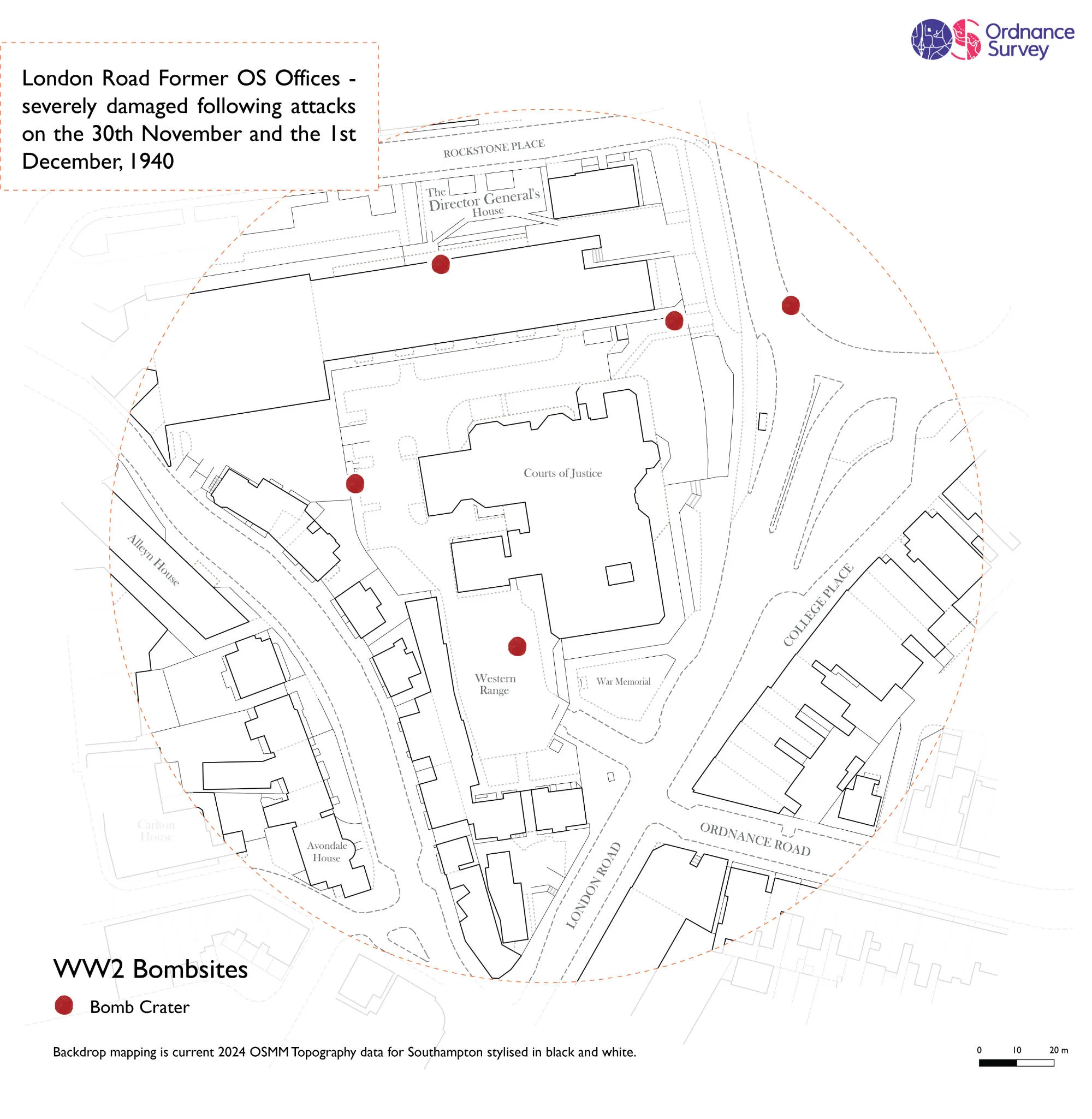
During the nights of 30 November and 1 December 1940, the Southampton Blitz reached its climax as the city came under sustained attack. Hundreds of tonnes of bombs were dropped during the two nights, whilst on 30 November alone some 634 individual properties were left ablaze – including Ordnance Survey's former head office on London Road.
A report by the Ministry of Food describes how the resulting destruction “equalled anything so far in aerial attack on this country” but even so, it is very hard to now comprehend the scale of the damage, let alone the impact it had on the people who lived through it.
So with the help of The National Archives and Southampton City Council, we built a map using OS OpenSpace that pinpoints where 712 of the bombs fell based on records from the time. We hope that by seeing the bomb sites overlaid on modern mapping, it will help people better relate to the scale of the damage and the courage and suffering of those who lived through it. We want to remember the events of 1940, and those who gave their lives for our freedom.
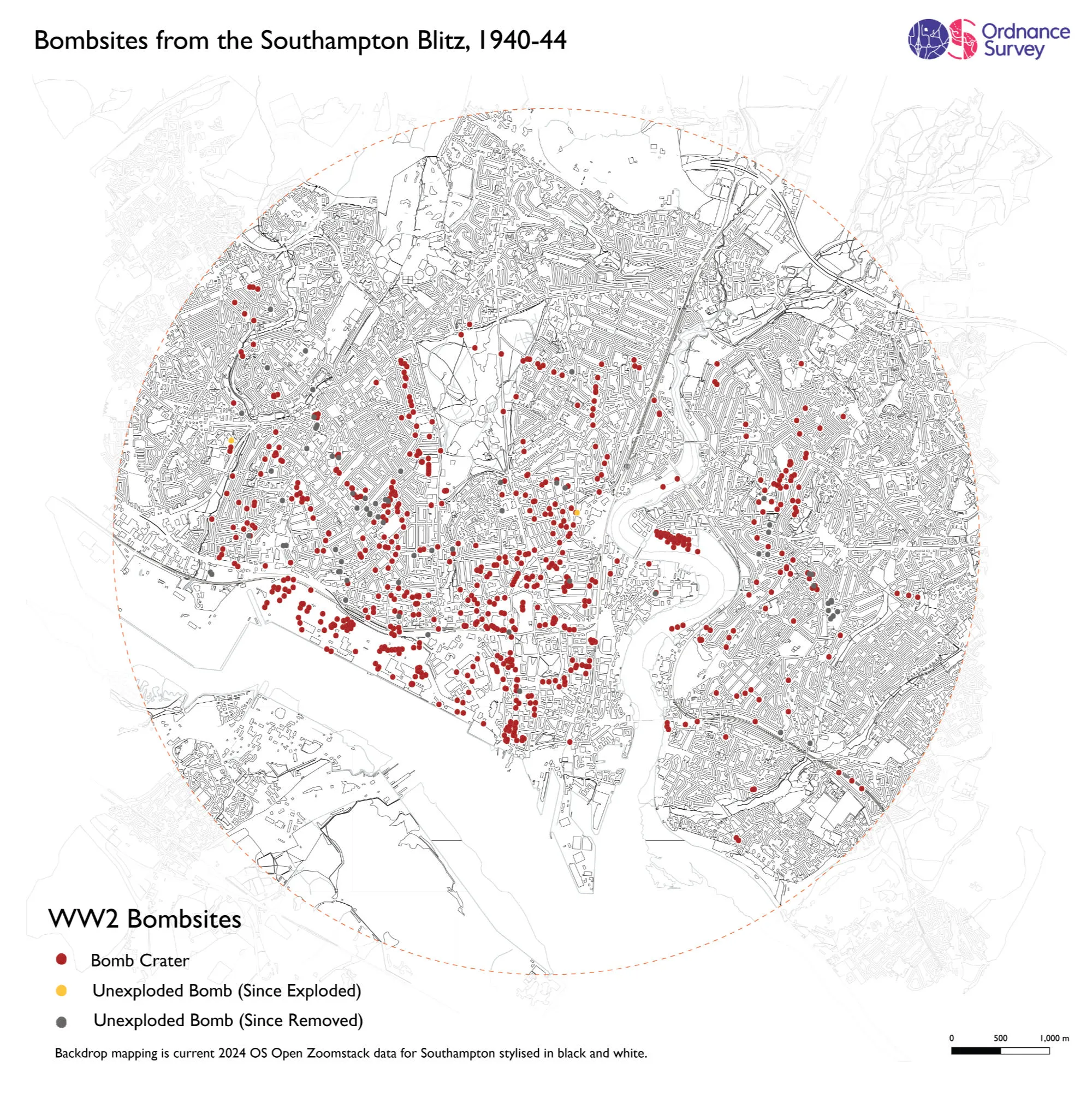
You can clearly see the heavy concentration of direct hits around the docks and industrial areas in Woolston and Itchen, as well as the city centre itself.
In terms of the damage to the Ordnance Survey offices, thankfully no one was killed, but many valuable documents were destroyed including height survey records; drawings for the New Popular One Inch map series, and almost all Object Name Books, which recorded the place and feature names published on the maps of England and Wales.
Perhaps the most precious object lost was the 3 foot Theodolite of 1787 made by Jesse Ramsden and used in the scientific triangulation survey from the Greenwich Observatory to the Kent Coast in 1787-88 by Major General William Roy – the precursor to the founding of Ordnance Survey in 1791.

Our highly accurate geospatial data and printed maps help individuals, governments and companies to understand the world, both in Britain and overseas.