Challenge
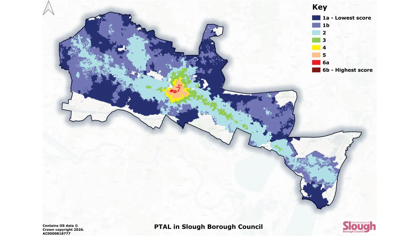
The Public Transport Accessibility Level throughout Slough Borough Council's District
The council needed an updated, evidence-based understanding of public transport accessibility across the borough, to inform transport planning and policy decision-making. In particular, the council wanted to identify transport inequalities, and to better understand how access to public transport varied spatially across communities.
Solution
"The OS NGD data was in such good detail, and so accurate, I was very impressed! "
Using the Transport layer of the OS National Geographic Database (OS NGD), the council were able to adapt London’s Public Transport Accessibility Level model – the benchmark for transport accessibility analysis – for Slough. The council were then able to compare accessibility across different locations.
Result
The project delivers social value, empowering the council to focus not just on cost or time savings, but fairer access to transport. The mapping clearly highlights significant spatial inequalities in access to public transport across the borough, including a strong link between low accessibility and areas considered high in generalised deprivation. This clear visual evidence supports more inclusive planning and policy decision-making for a fairer future.