Challenge
The council wanted to improve safety for women travelling between council offices and transport hubs, with a goal to identify well-lit routes, and highlight areas that were poorly lit – providing female staff with safer options.
Solution
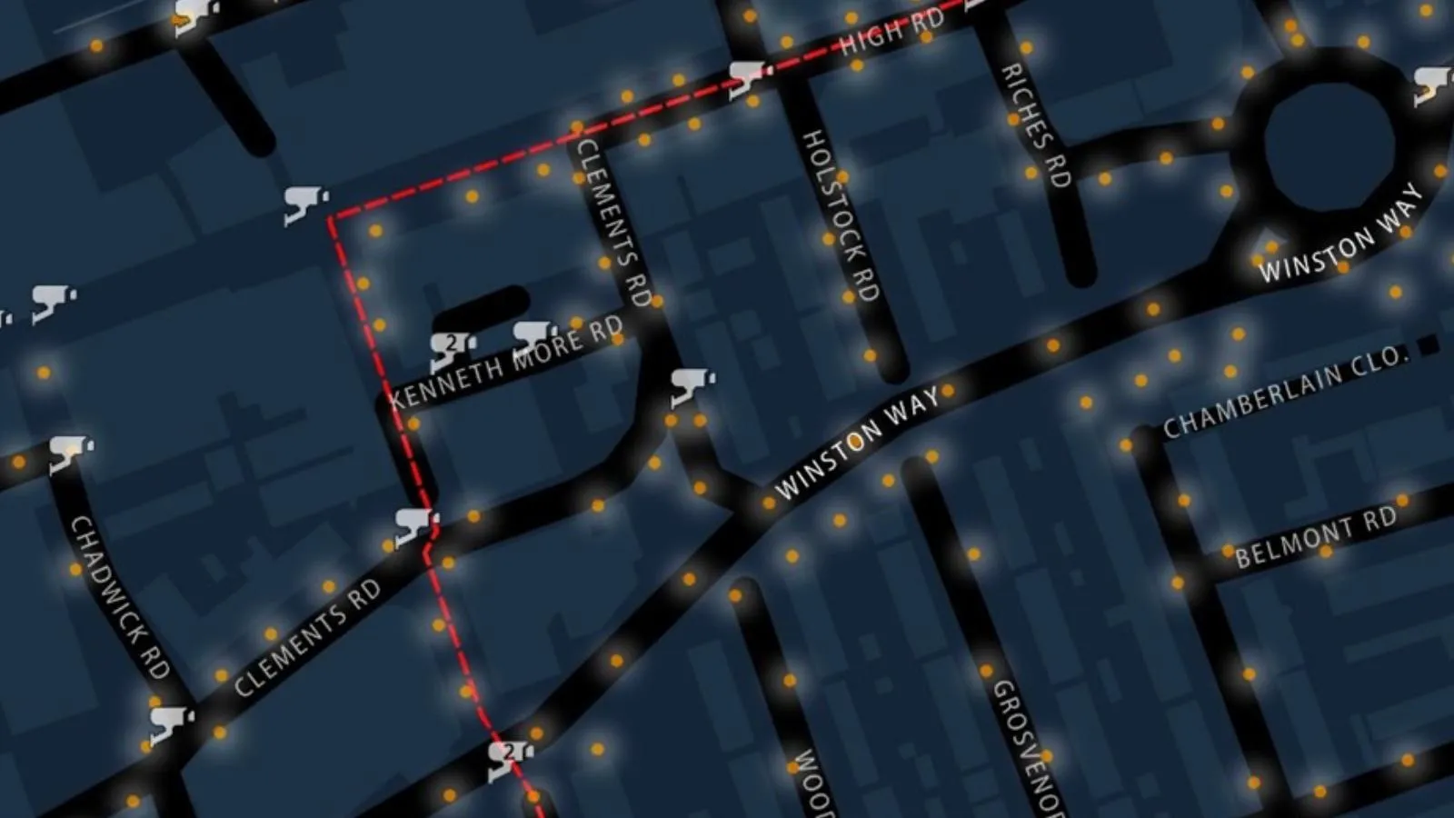
To achieve this, the council leveraged OS data – OS Open Zoomstack for the base map and OS NGD Transport for street lighting data – alongside internal CCTV information. Using this data, well-lit and poorly lit areas were identified, and safe walking routes were mapped between key locations. This information was published internally via the Redbridge Women’s Network as stage one of the project, ensuring all female staff had access to safer travel options.
Result
"These maps highlight both CCTV coverage and lighting along these routes, so colleagues are aware of where cameras and lighting is while walking. In the darker months, knowing the brightest routes is really beneficial for colleagues that feel apprehensive to walk on their own. "
The initiative is enhancing safety and peace of mind for all women commuting to and between these locations. Stage two will extend this resource to the public, amplifying its impact across the borough. While the benefit cannot be measured in numbers, its value to women’s safety and confidence is undeniable.
"It’s great policies are now in place, the mapping was fun to play around with, and people have found it useful. "
Similar mapping could help other members of the council, or the wider community, and could be replicated by other organisations to help more people feel comfortable commuting in winter.