Ordnance Survey marks 225 years since publishing the blueprint for modern mapping
Ordnance Survey (OS) is celebrating the anniversary of the 1801 map of Kent, an incredible endeavour that took more than 10 years to complete and was driven by the threat of a Napoleonic invasion of Britain’s southern coast.
Press Office
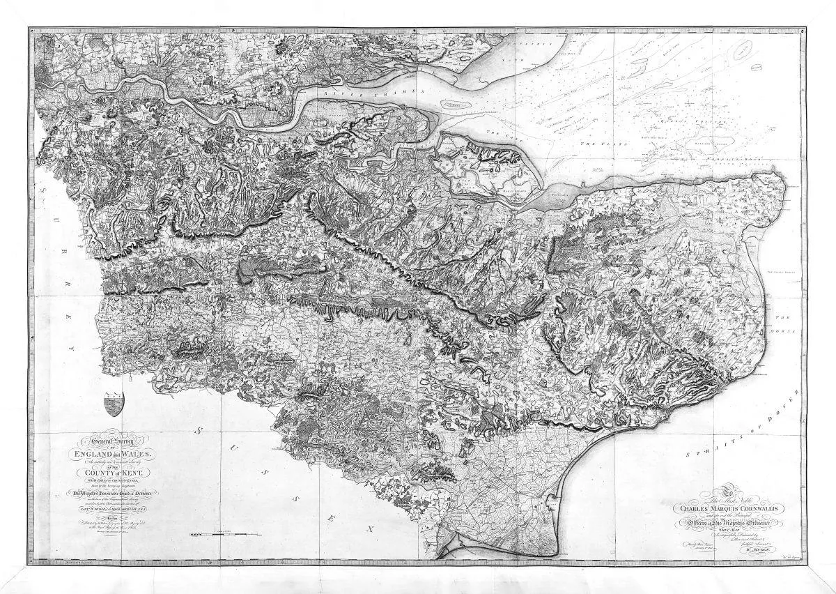
It took until 1870 for all of England and Wales to be mapped to a similar standard, and until 1887 for Scotland. Today, the same area of Kent can be mapped using satellites, aerial imagery, GPS and digital surveying technologies in around 10 days.
In the past, the largest departments at Britain’s national mapping service were surveying and cartography. Today, it is the technology department, which develops the systems that underpin modern geospatial services. OS’s data team is now the second largest, employing as many data scientists as it does surveyors.
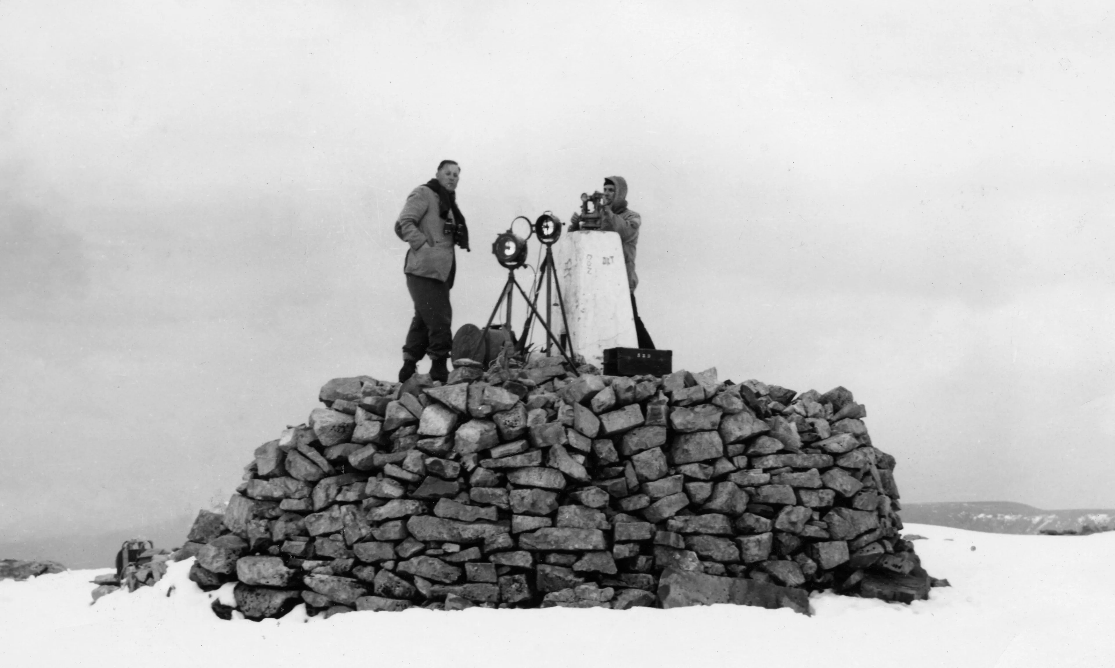
While the 1801 map of Kent was primarily for military use and focused on communication links and terrain, fast forward 225 years and the OS map of today contains far richer and much more granular detail. Its accurate and trusted data forms the invisible backbone of modern life in Britain. The average person in Britain comes into contact with OS data 42 times a day, and a vast range of sectors and markets depend upon it.
OS mapping is not only of vital importance to Britain’s national security, but it is also relied upon to support economic growth, infrastructure planning, emergency response and environmental resilience.
"The innovation behind triangulation and the use of the Ramsden Theodolite in 1801 was cutting-edge at the time. That set the DNA of what Ordnance Survey is today. We're still in the map-making business, but today the maps are digital, and the value comes from the data behind them, meaning we’re as relevant today as we’ve ever been. Our purpose is to manage, maintain, and update the most detailed digital map of Britain ever created, which supports a range of customers from weekend ramblers to government, through to business leaders in the boardroom."

Nick added: “We're still innovating. We've pushed the boundaries of the data we capture through advanced technologies such as computer vision and AI, while still maintaining a human-in-the-loop approach. This ensures we deliver the trusted and authoritative data our customers need to generate valuable insights.”
More than two centuries after it was established, OS has evolved from a traditional paper map maker into a leader in digital mapping. Today, that data is helping to handle some of society’s biggest challenges, from tackling climate change and supporting national security to identifying the best places to build new homes and infrastructure, protecting communities from flooding, and planning for a more resilient future.
For every £1 of public funding invested in OS, the organisation generates £9.50 in societal benefit, returning significant value to the nation.
Factfile – How mapping Kent has developed
In 1801, the map displayed:
|
More than 500 towns, villages and hamlets across Kent and Essex
|
|
Major roads and strategic transport routes
|
|
Coastline and ports
|
|
Rivers and waterways
|
|
Hills and relief features
|
|
Farms, estates, churches, windmills and other significant landmarks
|
In 2026, the map displays:
(examples below taken from the 2026 OS National Geographic Database for Kent)
|
2,553,705 residential addresses
|
|
30,094.02 km of road network
|
|
705.65 km² of land covered by trees
|
|
2,323.38 km² of arable or grazing land
|
|
3,004 play spaces
|
|
71,998 solar panels
|
|
2,009 school sites
|
For more information about OS, visit What we do | About us | OS.
Sharing the latest news about OS. We can license you to use OS maps in print, online and film format. For more information and resources for journalists, bloggers and media professionals, email pressoffice@os.uk or call 023 8005 5565.
Find more news
- Government and public sectornews articles
- National security and resiliencenews articles
- Economy and businessnews articles