How Geovation startups are using innovation in very different ways to combat the impact and cost of flooding
Press Office
Floodwise, co-founded by Ben Angwin and Oliver Bradburne, is on a mission to help homeowners and insurers reduce flood damage before it occurs. Aside from the huge emotional impact on residents, flooding costs UK insurers upwards of £1bn a year in claims and up to £60,000 per property. Their vision is to send out modern temporary defence kits to properties at risk of flooding to prevent water getting into buildings in the first place, by using door barriers, water pumps, air brick covers and other property flood resilience measures.
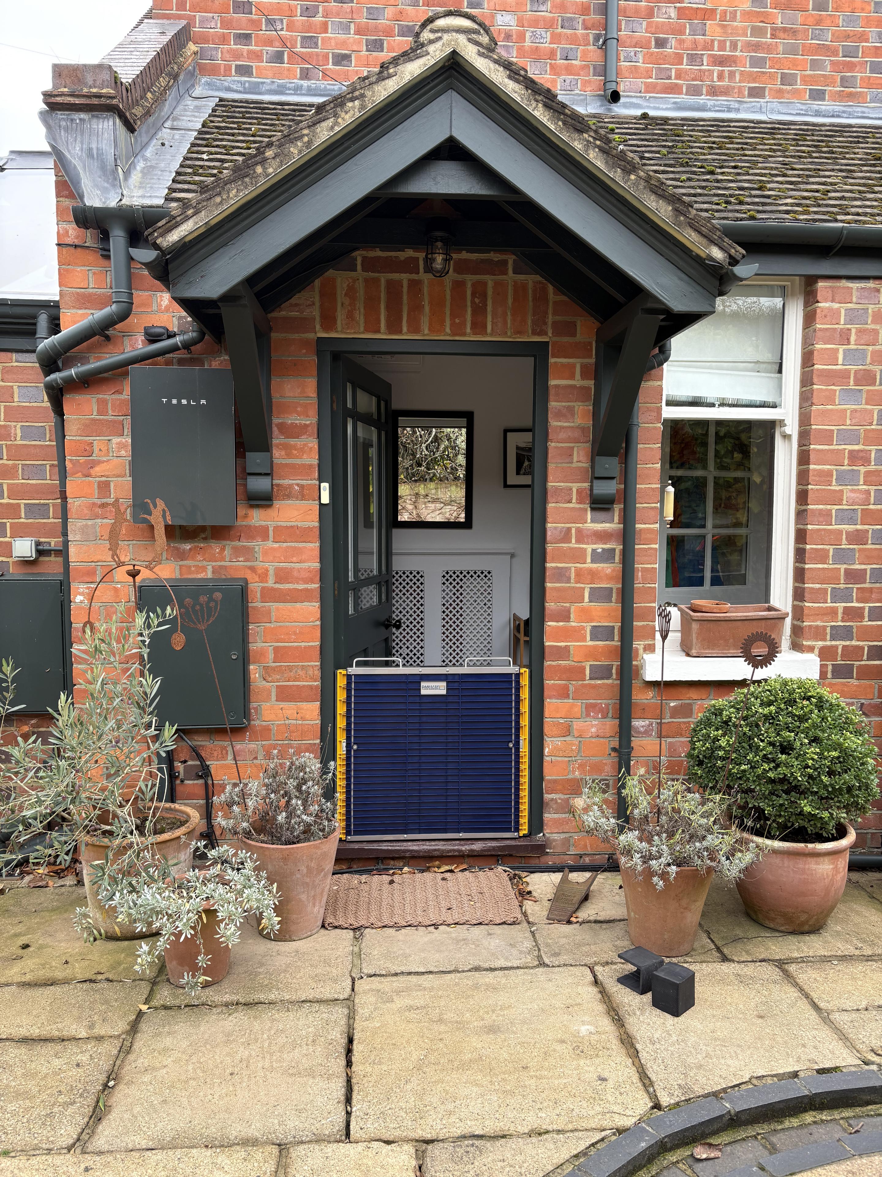
"Floodwise gives homeowners and business owners a chance to prevent flood water entering their property. We’re building a rapid response service that provides modern temporary flood resilience measures when people need them most, all paid for by Insurers. Being part of Geovation accelerated our growth and allowed us to bring together the best in flood alerting, location data, logistics, and property flood resilience in one agile platform that can really make a difference."
The platform combines Environment Agency (EA) risk and warning data with Unique Property Reference Numbers (UPRN) to track flood alerts and monitor locations. In partnership with Covéa Insurance, Floodwise’s first pilot last year concentrated on the Oxfordshire area, where they were able to send kits to a number of Covéa policyholders living in residential properties at risk of flooding. The success of the pilot has led to a recently signed second contract with Covéa Insurance and phase two of operations across a larger geographic region of the UK. They are also exploring how to incorporate detailed OS National Geographic Database (NGD) data into the platform with the aim to support larger non-residential properties in the future.
Stephen Long, Chief Operating Officer at Covéa Insurance, said:
"Flooding can have a devastating impact on customers, their homes, and their communities; prevention and protection are therefore incredibly important to us. These pilots with Floodwise form part of our ongoing work to explore practical ways of helping customers become more resilient to flood risk. They are providing valuable insight into how preventative measures could support those most at risk."
Another Geovation startup, Stratum, has found a completely different way to combat the effects of flooding on homes. Co-founders Brogan McCawley and Alexander Brown are using AI to help engineers and local authorities make new developments more flood resilient from the start of the planning process.
Their platform combines advanced multi-agent AI systems with expert knowledge to support engineering work across flood risk, including Flood Risk Assessments. It helps engineers and local authorities produce and review this work to a higher standard and with greater consistency. This safeguards communities and supports sustainable development. Alongside this, it brings significant time and cost savings, helping developers secure approvals quicker and with less risk.
Incorporating OS base mapping and datasets from the OS NGD, alongside EA flood information, Stratum has been able to improve and streamline what is often a complex and resource-intensive process.
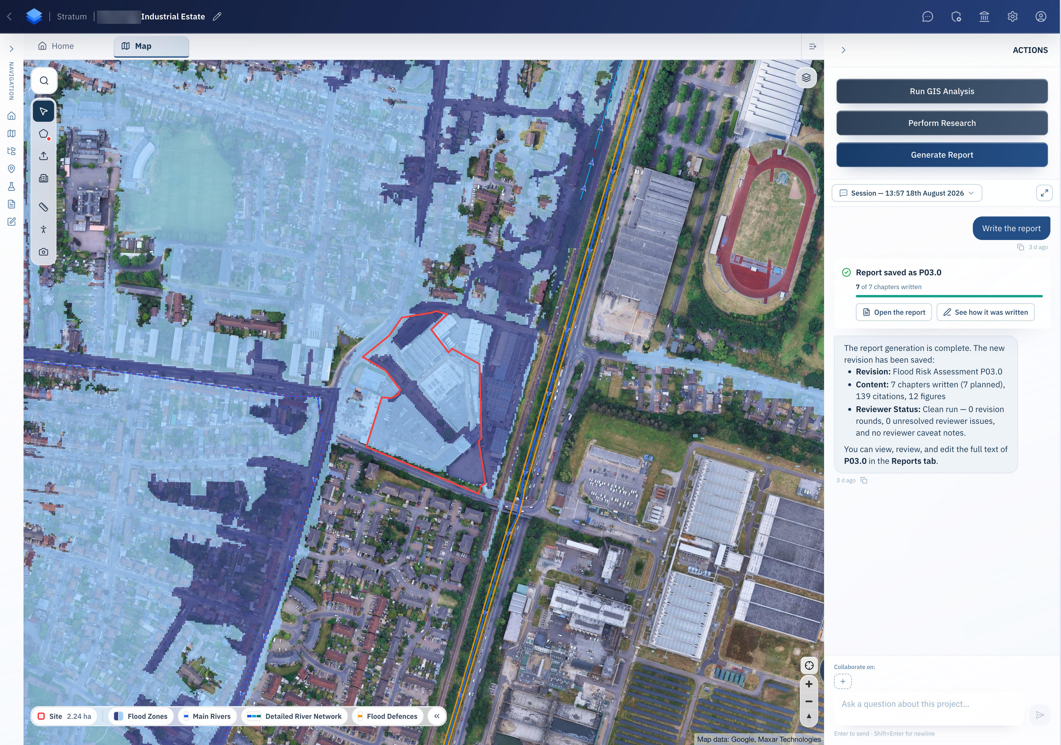
"Good flood risk work depends on having the right data, guidance, and tools. With support from Geovation and access to trusted OS location data, our platform helps engineers and consultants produce higher-quality Flood Risk Assessments more consistently. This saves significant time and cost while supporting safer developments."
Stratum has already been working with Northumberland County Council, through a government-funded pilot project, to test how AI can support council officers reviewing flood risk in thousands of planning applications a year.
Nick Watson, the council’s Flood and Coastal Erosion Risk Management Manager said: "Stratum has helped our team review flood risk information more quickly and consistently. It saves our officers time on routine checks and lets them focus on the most complex cases. It has also given the team capability we did not have before, which helps us keep up with demand without losing quality."
"As flooding becomes more frequent and its impacts more costly, trusted location data is essential to understanding where risk is greatest and where action can make the biggest difference. Supporting innovators such as these through Geovation can help organisations and local authorities plan more effectively, strengthen resilience, and protect homes, infrastructure, and communities from the significant impact of flooding."
Earlier this year, OS identified the road and rail pinch points across England most vulnerable to river and sea flooding. This highlighted how climate-related events could isolate communities, disrupt critical transport networks, and leave England’s towns and cities partially, or completely cut off during extreme weather events.
More information can be found here: Flooding to cut off more towns and commuter routes | OS
Sharing the latest news about OS. We can license you to use OS maps in print, online and film format. For more information and resources for journalists, bloggers and media professionals, email pressoffice@os.uk or call 023 8005 5565.
Geovation Accelerator Programme
Find out more and register your interest for the Geovation Accelerator Programme - backed by Ordnance Survey and HM Land Registry.
Products and solutions featured in this news article
OS NGD API – Features
Perform powerful geospatial analysis. Filter the data to receive exactly what you need, as and when you need it.
Find more news
- Climate resilience
- Built environment
- Government and public sector
- Land and property
- National security and resilience
- Environment