This category provides detailed network and extent data for transport routes across Great Britain. It supports routing, asset management and transport planning, with topologically structured datasets, and authoritative identifiers.

Transport networks data
Data about roads, paths, trams, ferries and railways

What is transport networks data?
Features of transport networks data
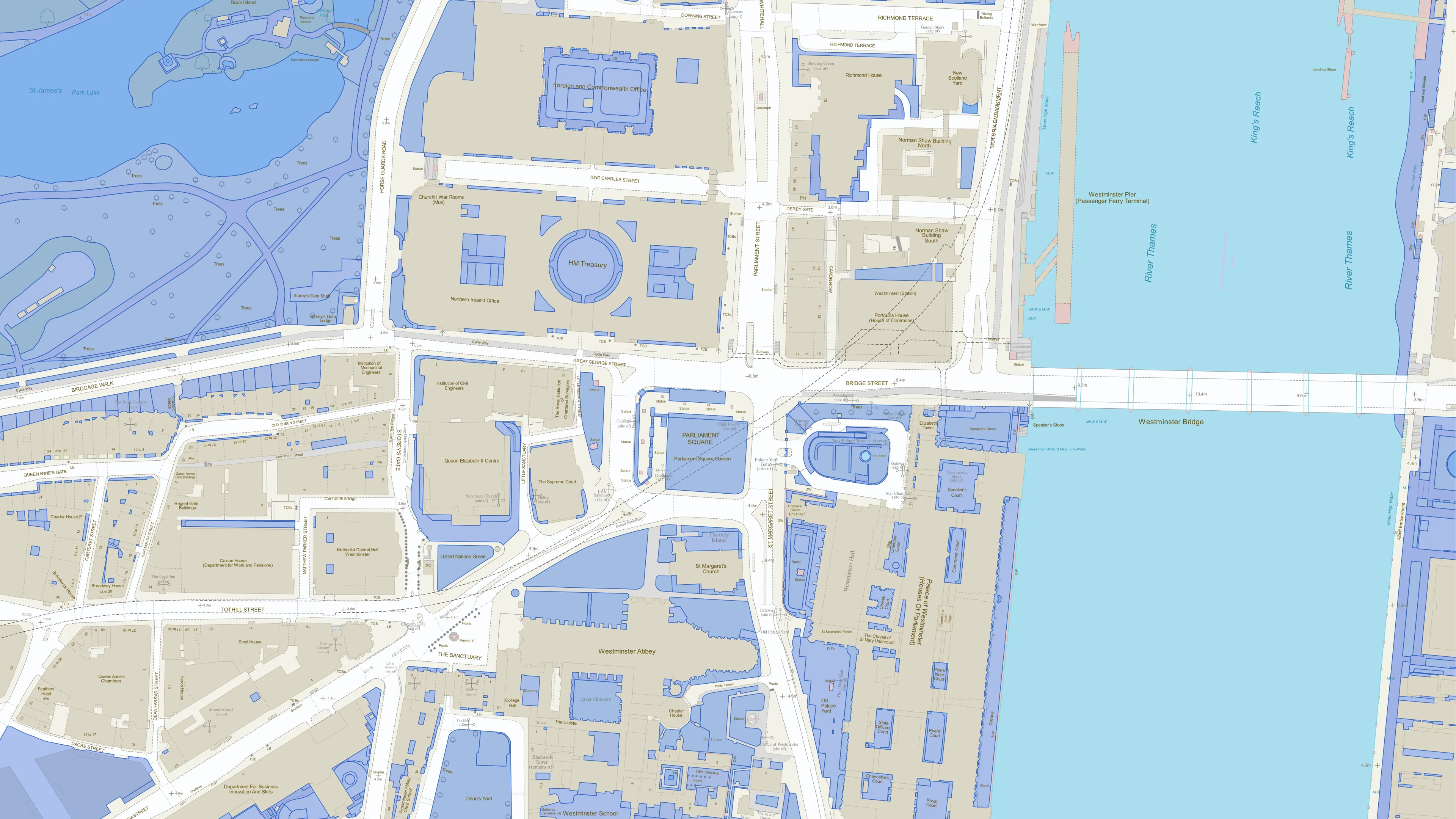
Road networks
Road network data, integrated with authoritative local gazetteers, provides accurate road geometry and identifiers for planning and emergency response.
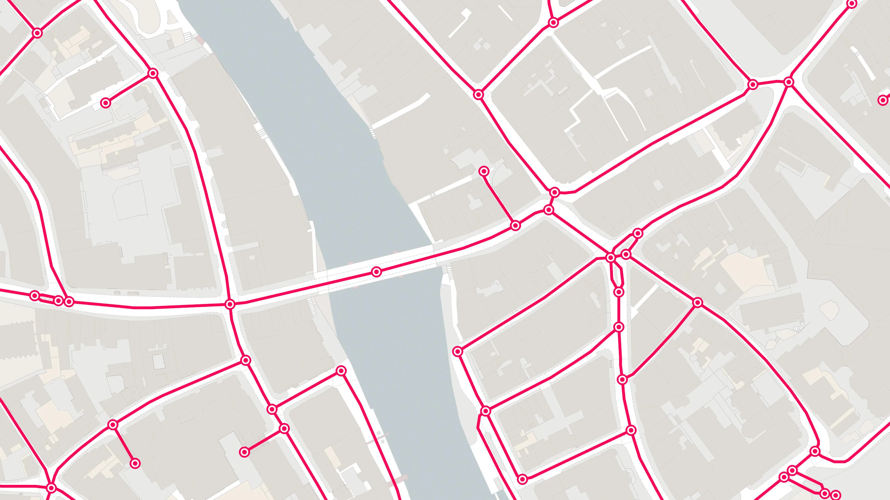
Routing and hazard intelligence
Perform travel time and risk analysis with average speed data, and identify routing hazards such as low bridges, turn restrictions, and vehicle limitations, to support risk-aware route planning.
Asset management
Quickly identify protected streets, associated conditions, which authority is responsible for a street, and how it should be restored following works.
Active travel mapping
Visualise and analyse paths and cycleways with surface type and function attributes to support active travel policies, route optimisation, and recreational planning.
Street-level and lighting insights
Visualise streetlights coverage, to support safe route planning, and infrastructure development such as identifying opportunities to repurpose streetlights.
Multi-modal network integration
Explore seamless connectivity across road, rail, path, and ferry networks to support journey planning, freight logistics, and sustainable transport strategies.
Products offering these key features
This features table highlights which features are available in transport networks products.
| Feature | Products |
| Road network |
OS Transport Network, |
| Path and track network |
OS Transport Network, |
| Bus and cycle lanes | OS Transport Network |
| Rail network | OS Transport Network, OS Multi-modal Routing Network |
| Routing information | OS Routing and Asset Management Information, OS Multi-modal Routing Network, OS MasterMap Highways Network – RAMI |
| Road ownership information | OS Routing and Asset Management Information, OS MasterMap Highways Network – RAMI |
| Road, railway, track and path extents | OS Transport Features |
| Streetlights | OS Transport Features |
Transport networks products
OS Transport Features
Visualise transport features including roads, tracks, railways, and paths across Great Britain. Analyse streetlight coverage to support safe, well-lit, active travel routes.
OS Transport Network
A visual representation of Great Britain's transport networks including road, ferry, rail, and path networks, and the connectivity between them all.
OS Routing and Asset Management Information
Access a fully routable network of Great Britain, including hazards, restrictions, and speed limits, for in-depth route planning and asset management.
OS Multi-modal Routing Network
OS Multi-modal Routing Network is a fully connected network dedicated for the multi-modal routing of people and goods, designed for use in routing applications.
OS Open USRN
An open dataset containing all USRNs from OS MasterMap Highways Network with a simplified line geometry.
OS Open Roads
An open dataset of the high-level view of the road network in Great Britain.
OS MasterMap Highways Network – Roads
A navigable road network dataset with detailed information about planned roads and roads under construction for Great Britain.
OS MasterMap Highways Network – Paths
A path network dataset for Great Britain showing who is responsible for all the footpaths through towns and cities.
OS MasterMap Highways Network – RAMI
OS MasterMap® Highways Network is the most complete, detailed and accurate navigable road network dataset for Great Britain.


Data access APIs
NGD API – Features
Perform powerful geospatial analysis. Filter the data to receive exactly what you need, as and when you need it.
OS Features API
With OS Features API, you can filter Ordnance Survey data for buildings, roads, rivers, hospitals, playing fields, and greenspaces.