Mapping climate change to build resilience
Ordnance Survey (OS) has been mapping Great Britain for more than 230 years, documenting a landscape that continues to evolve alongside a changing climate. Location data has never been more important, particularly when it comes to understanding and responding to climate-related challenges.
One example of the value of data-led insight is an OS analysis revealing that more than 1.8 million homes are located within 100 metres of urban boundaries. These properties sit close to areas where a significant proportion of wildfires have occurred in recent years. While most fires are relatively small, covering less than one hectare, they can still cause major disruption to communities and local infrastructure.
While not all these homes face the same level of risk, their proximity to vegetation and human activity means they should be considered in wildfire preparedness planning.
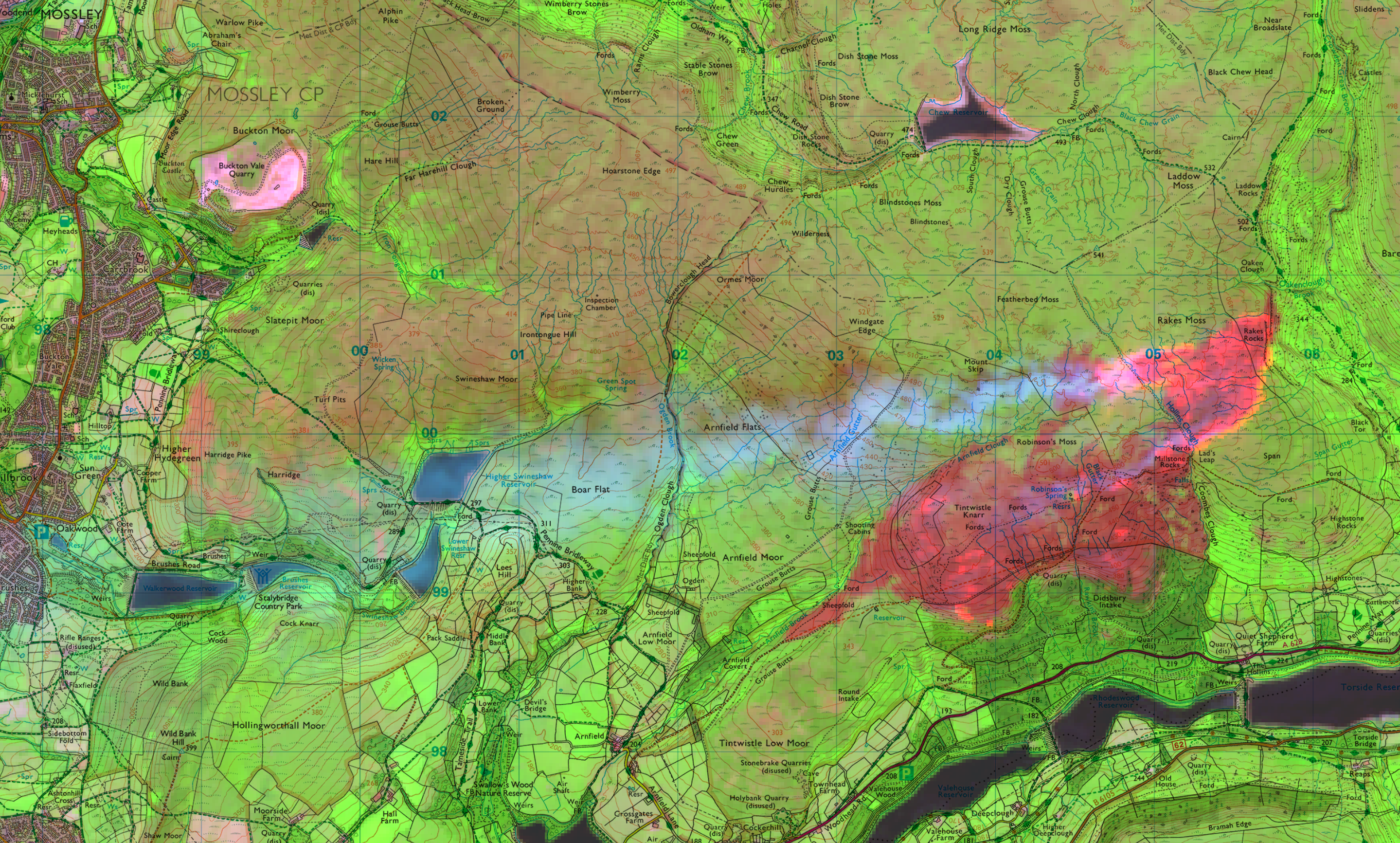
OS's authoritative, highly detailed location data is proving indispensable in addressing the growing impacts of climate change and helping organisations understand, respond to, and build resilience against these challenges across Britain. From modelling flood risk and tracking coastal erosion, to identifying wildfire-prone landscapes and mapping urban heat islands, location data provides the trusted insights needed to understand where and how climate impacts are occurring.
Yet recent OS research suggests that many organisations still lack confidence in the data available to support climate-related decision-making. The study found that climate and environmental risk planning has the lowest level of data confidence of any strategic decision-making area tested, with 17% of organisations reporting low confidence in the data used to support these decisions. At the same time, 29% of decision-makers said location intelligence plays a critical role in future-proofing major business and investment decisions.
Understanding location is fundamental to understanding impact. Whether protecting agricultural land and crops, assessing infrastructure resilience or helping insurers better understand climate-related risks to homes and businesses, accurate location data enables better-informed decision-making. By improving understanding of risk and vulnerability, government, local authorities and organisations can implement targeted adaptation and mitigation measures that help protect communities, safeguard critical assets, and strengthen national resilience in the face of a changing climate.
Through the Public Sector Geospatial Agreement (PSGA), OS provides authoritative data that underpins national and economic resilience. It is this data that helps emergency services navigate challenging terrain, position resources effectively, develop fire response plans, coordinate teams and accurately identify at-risk properties.
This level of situational awareness and geospatial intelligence can help save lives and protect vital infrastructure. That is why OS works closely with the National Fire Chiefs Council (NFCC), alongside the Natural Hazards Partnership, to support wildfire analysis and planning, helping to improve readiness and strengthen resilience ahead of wildfire risk during heatwaves and drought conditions.
Better understanding flooding risk and subsidence
According to the British Geological Survey (BGS), subsidence is one of the most damaging geohazards affecting Great Britain, costing the economy an estimated £3 billion over the last decade. The exceptionally warm and dry spring of 2025 highlighted that vulnerability, with subsidence-related insurance claims reaching £153 million during the first half of the year alone.
The impacts of ground instability extend far beyond homes and insurance claims. Adverse weather, coastal storms, and ground movement have repeatedly disrupted critical infrastructure, causing landslips, subsidence and sinkholes that have affected key rail routes across Devon, including sections near Dawlish and on the Avocet and Dartmoor lines. As climate pressures increase, trusted location intelligence is becoming increasingly important in help organisations better understand and respond to climate-related ground movement and the risk this poses to the resilience of Britain's infrastructure networks.
OS partnered with BGS to provide hyper-local, building-level subsidence risk assessments. By combining precise OS location data with BGS geological datasets, homeowners, insurers and developers can identify ground movement risks at individual property level.
In the recent poll by OS, findings showed that 29% of decision makers said that location intelligence plays a critical role in future proofing major business or investment decisions, with 47% of respondents from financial services saying better access to high-quality, trusted data would enable faster decision-making.
OS data enhances climate risk analysis by enabling insurers to move beyond postcode-level assessments and better understand the resilience or vulnerability for individual buildings. Detailed information on topography, elevation, and land use significantly improves the accuracy of flood and subsidence modelling, supporting property-specific climate risk assessments and helping organisations understand how risks may evolve over time.
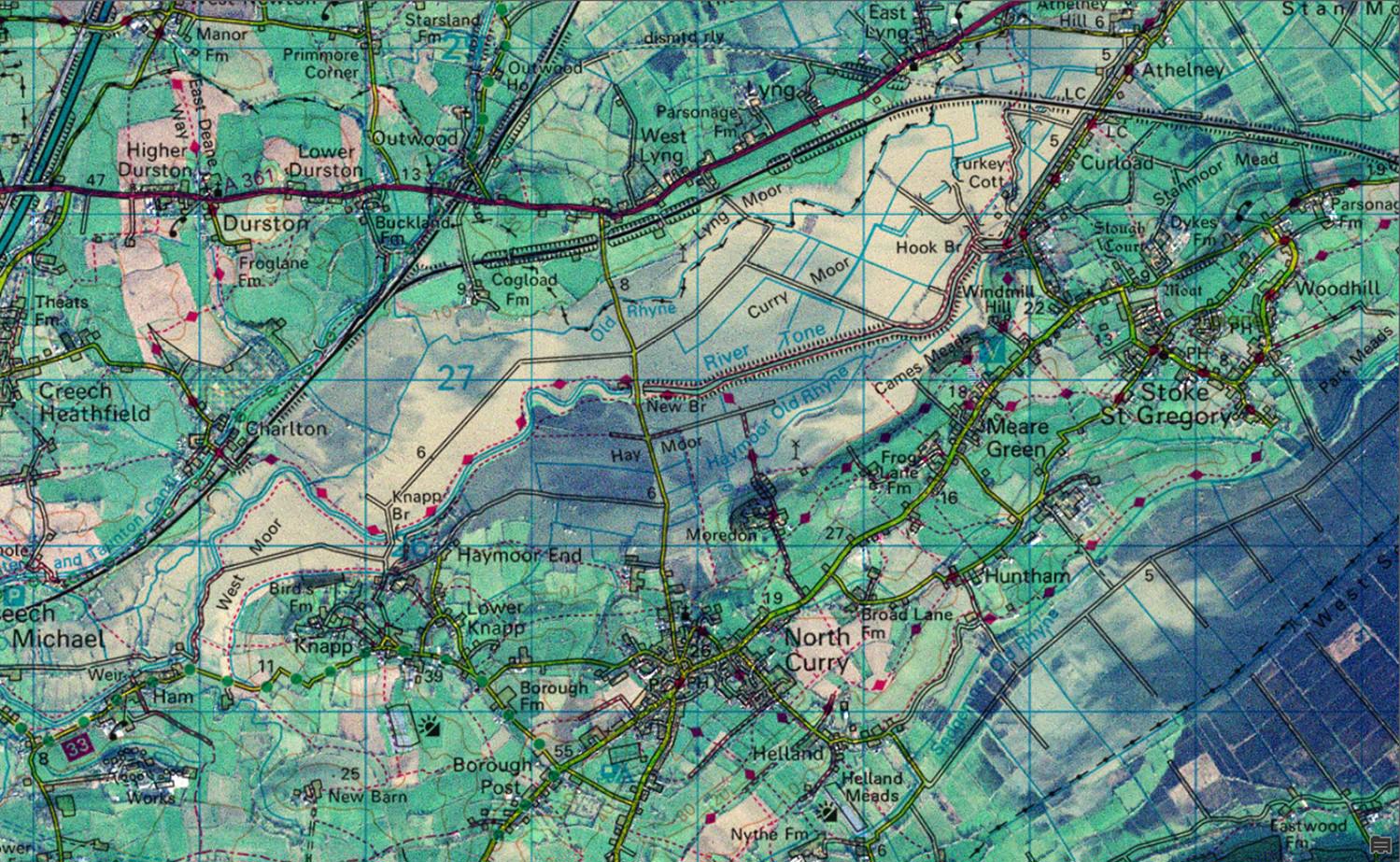
Flooding does not occur only during periods of prolonged rainfall. It can also happen during hot, dry periods when hardened ground is less able to absorb water.
OS has identified road and rail pinch points across England that are most vulnerable to river and coastal flooding, highlighting how climate-related events could isolate communities, disrupt critical transport networks, and leave towns and cities partially or completely cut off during extreme weather.
Britain's transport network underpins national productivity, yet new geospatial analysis reveals the increasing scale of its exposure to flooding. By combining the latest Environment Agency flood data with the OS National Geographic Database (OS NGD), OS has mapped rail lines and road access routes alongside flood defences to identify the commuter corridors, economic routes and access points most vulnerable to flooding.
At a national level, the scale of exposure is significant. An estimated 7,564 kilometres of road, representing 12% of England's total road network, and 3,003 kilometres of rail, representing 20% of the rail network, intersect areas at highest risk from river and sea flooding.
OS is also working with local authorities on projects that assess the impact of changing land use. One example is modelling the conversion of gardens into hard surfaces such as driveways, helping to understand the effect this has on water absorption and surface water flood risk.
Monitoring a changing coastline
Last year, the Environment Agency updated its national flood risk assessment to include projected changes resulting from climate change. The assessment showed that around 6.3 million homes and businesses in England are currently at risk of flooding, equivalent to approximately one in five properties. This could rise to one in four by 2050.
The Environment Agency has also updated its national coastal erosion risk map, showing that around 3,500 properties are expected to be at risk from coastal erosion by 2055.
OS's new continuous tidelines dataset, Tidal Boundary Continuous High and Tidal Boundary Continuous Low, can help organisations better monitor and manage coastal erosion and flooding as sea levels rise and rainfall patterns become more extreme.
The dataset supports environmental monitoring and regulation, coastal erosion and flood modelling, boundary management, climate change assessment and improved understanding of Britain's foreshore environments.
Harnessing heat for good
Not all climate-related challenges come with negative outcomes. Solar energy and excess heat can provide opportunities to improve sustainability and support communities.
OS supported energy specialists EnergiRaven on a project examining the potential to reuse surplus heat in Greater Manchester. Using OS data, EnergiRaven found that excess heat generated by industries across the region could meet the heating requirements of approximately 85% of Manchester's homes.
Taking account of waste heat from data centres, power generation, water treatment facilities, breweries and other industrial sites, the study estimated that a heat network could save £8.83 billion over 20 years compared with conventional gas and direct electric heating systems.
Arup and OS have recently secured a second contract to support the Department for Energy Security and Net Zero (DESNZ) in the development of the national heat network zoning model, helping to deliver the Government's ambition for heat networks to provide 20% of the UK's heating demand by 2050.
Last year, OS also released new roof data covering more than 40 million buildings. This included information on the presence of solar panels, supporting energy efficiency assessments and renewable energy incentive schemes. At the time, the data showed that nearly 1.3 million of mostly domestic buildings across Britain had solar panels on their roofs, with the majority in Scotland. Most recent figures show that has risen to 1.5 million.
OS’s roof attributes are just one part of a comprehensive dataset on buildings. The OS NGD already holds information such as their use (eg commercial, retail, residential), construction material, age, number of floors, address count, and basement presence. This can be cross-referenced with other OS NGD themes such as Address and Land Use to unlock valuable insights. All of which can support projects and businesses across the public and private sector, whether for emergency planning and response for blue light services, helping insurers assess risk in buildings and understanding energy efficiency for sustainability.
Conclusion
As climate risks become more complex and interconnected, the need for accurate, trusted and up-to-date data has never been greater. Climate-related risks cannot be understood in isolation or based solely on future projections of temperature and weather patterns. They must be viewed in the context of the places, communities, and infrastructure they may affect.
By helping organisations understand not only what is changing, but where change is happening, OS provides the trusted insight needed to make informed decisions with confidence. In an increasingly dynamic world, authoritative location data enables decision-makers to move at pace, respond more effectively to risk and build resilience for the future.
For more information visit https://www.ordnancesurvey.co.uk/
Our highly accurate geospatial data and printed maps help individuals, governments and companies to understand the world, both in Britain and overseas.
Explore the OS National Geographic Database
A single store of our authoritative data for Great Britain
Products and solutions featured in this insight
OS Maps API
OS Maps API offers the most convenient way to add detailed OS data to your application. Benefit from unrivalled levels of detail in your GIS, web or mobile app.
Find more Insights
- Biodiversity and nature recovery