New digital tool helps farmers boost biodiversity in Scotland
The app is underpinned by trusted data from Ordnance Survey
Press Office
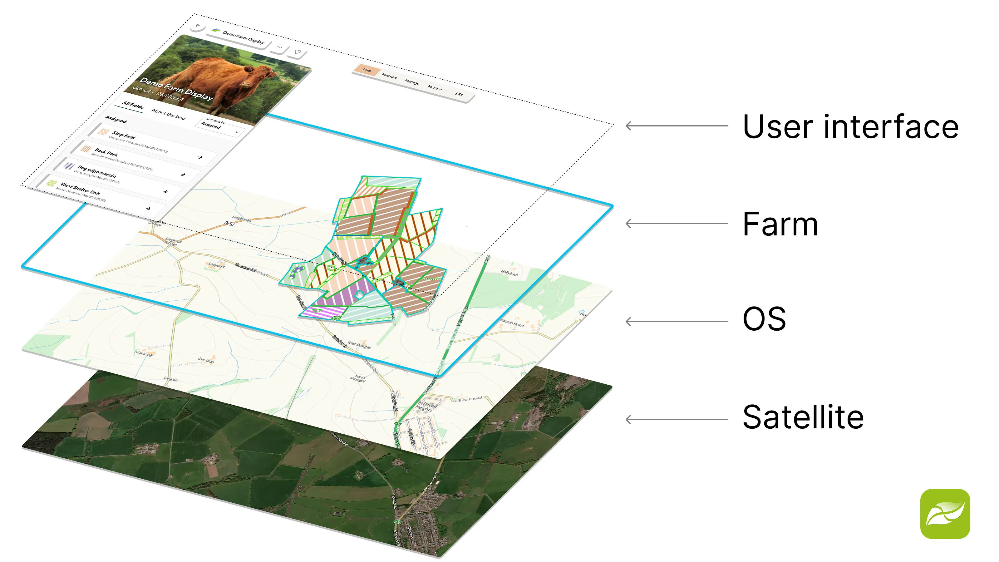
Farm Biodiversity Scotland (FarmBioScot) enables users to map habitats, record wildlife observations and track biodiversity improvements on their land through a simple platform, available via both app and web. The tool supports the Scottish Government’s wider ambitions to restore nature while helping farmers demonstrate the environmental value of the land they manage.
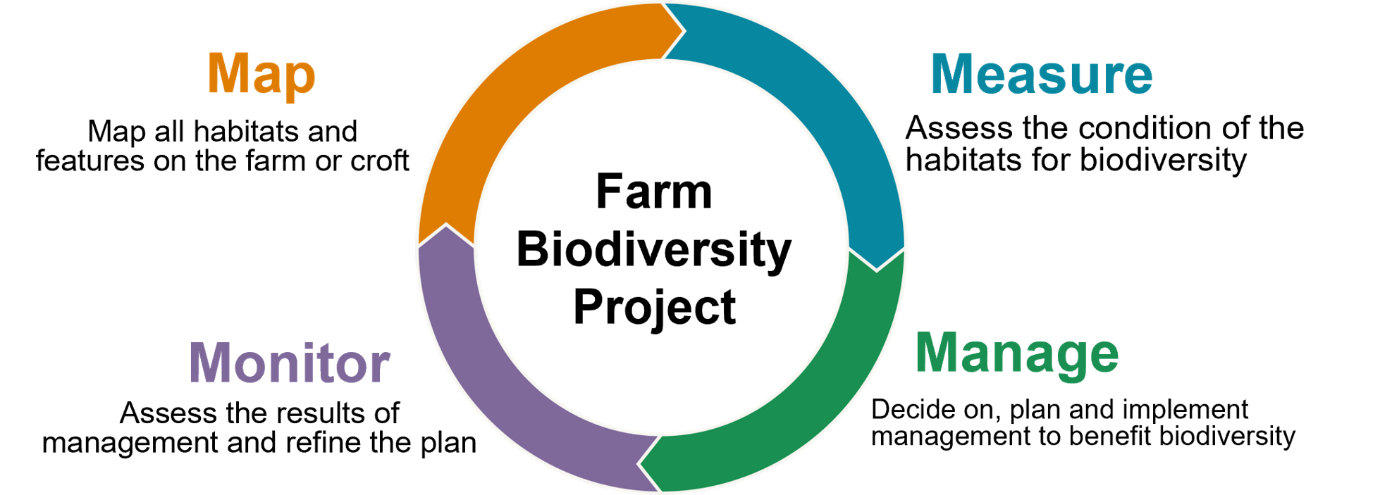
NatureScot is testing a standard approach to farm biodiversity auditing and planning through the Farm Biodiversity Project, using a four-step ‘map, measure, manage, and monitor’ process. This allows farmers and crofters to record habitat condition through simple assessments, log species observations linked directly to mapped areas, and generate a detailed dataset combining location, habitat type, and condition.
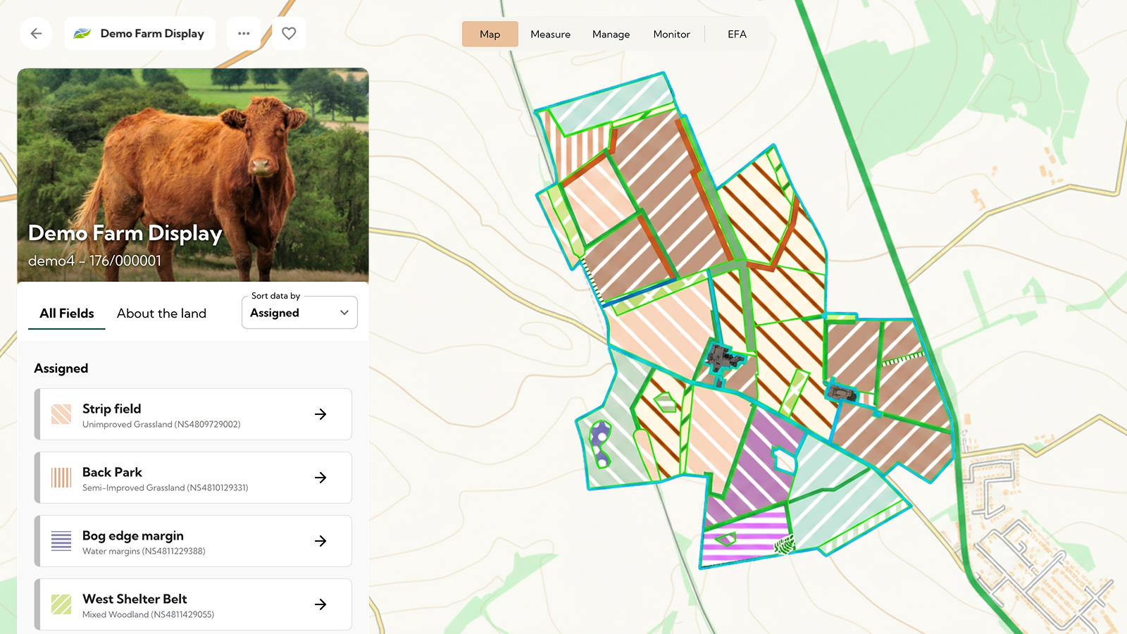
This mapping and data is then used to produce biodiversity insights, including baseline audits, habitat summaries, and details of actions and changes over time, all within a simple, self-service system designed for everyday use. It uses existing government data to pre-populate field boundaries for the farm or croft, enabling users to create detailed habitat maps by assigning habitat types and adding features such as hedgerows and watercourses from OS Open Rivers.
"We work with farmers and crofters to develop and improve the skills, tools, and support needed for a future where nature recovery and high-quality food production go hand in hand. Farmers and crofters who have already tested FarmBioScot say they find it a simple digital tool for habitat mapping using OS data that shows the extent to which they are providing valuable contributions for nature and their businesses."
FarmBioScot provides an option for users to create their own habitat map to meet the biodiversity audit requirements for their Whole Farm Plan, which is needed to claim government agricultural payments in Scotland. OS Maps API is used as a base layer and OS Features API is used with the magic wand functionality to map more detailed polygons. Future plans for the tool will include data from the OS National Geographic Database, which is already being used by NatureScot in other applications.
Building on habitat mapping, FarmBioScot raises awareness and understanding of the habitats and features among farmers and crofters, increasing interest and engagement with nature, with the ultimate aim of helping users improve biodiversity and increase resilience for the future.
"Modern crofting and farming can be quite complicated but FarmBioScot provides me with a clear, easy-to-use solution to monitoring biodiversity across our croft which I can easily update. It has saved me a significant amount of time and effort in mapping and assessing habitat types, while providing a simple way to pass the required standardised return to Scottish Government that can hopefully find a wider benefit for Scottish wildlife."
Dominic Cuthbert, Customer Development Manager at OS, said:
“Ordnance Survey data is playing a vital role in underpinning this new tool, giving users the trusted location intelligence they need to map habitats, record biodiversity features, and make more informed decisions about their land. By combining authoritative mapping with practical assessments, the platform is helping turn biodiversity data into actionable insights for Scotland’s rural communities.”
In another project which puts nature at the heart of decision-making, NatureScot has used OS MasterMap data to create a Natural Capital Tool. This is a free, easy-to-use, geospatial decision-support tool that facilitates a natural capital approach to land management in Scotland at a landscape scale. It maps and models how land-use changes affect ecosystem services, helping users prioritise actions that maximise environmental and societal benefits.
Sharing the latest news about OS. We can license you to use OS maps in print, online and film format. For more information and resources for journalists, bloggers and media professionals, email pressoffice@os.uk or call 023 8005 5565.
Explore the OS National Geographic Database
A single store of our authoritative data for Great Britain
Products and solutions featured in this news article
OS Maps API
OS Maps API offers the most convenient way to add detailed OS data to your application. Benefit from unrivalled levels of detail in your GIS, web or mobile app.
OS Features API
With OS Features API, you can filter Ordnance Survey data for buildings, roads, rivers, hospitals, playing fields, and greenspaces.
Find more news
- Economy and business