Challenge
NatureScot carried out a review of the suite of natural capital tools available to land managers wanting to support nature restoration, finding that most required a high level of tech expertise, involved high costs to access, and were focused on England and Wales exclusively. NatureScot found there was a demand for a tool that was open access and free to use, allowing people in Scotland to take a natural capital approach to land management. NatureScot describe a natural capital approach as ‘the full suite of benefits that nature provides being taken into account during decision-making’.
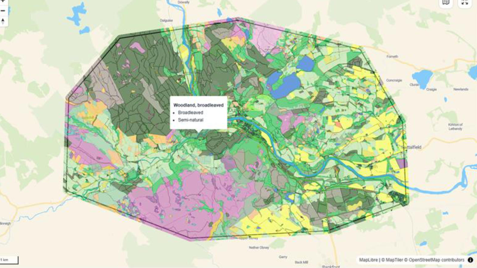
"The Natural Capital Tool gives a geospatial visual on where the priorities are – it really helps to see it visually. "
Solution
NatureScot based the Natural Capital Tool on one of the methodologies captured within their review – EcoservR, an R-based methodology developed by Liverpool John Moores University.
OS data forms the basis of the tool’s habitat baseline, on which they run their models.
"OS data is really the foundation of the tool. "
Result
NatureScot worked with key stakeholders to codesign the features they needed, developing directly with the end users. 83% of those giving feedback describe NatureScot’s Natural Capital Tool as ‘simple and easy to use’.
The tool is a standardised platform for use across Scotland, free of charge.
"Such a strength of the tool is that it can be tailored to your priorities. "
Other benefits include the empowerment it gives communities – from grassroots collectives to landscape-scale decision-makers – and the ability to bolster funding applications, assuring funders that proposals have accurate location data at their core, as well as nature.