How Ordnance Survey data is underpinning an Environment Agency tool helping to reduce flood risk
The tool has unlocked savings in both time and money
Press Office
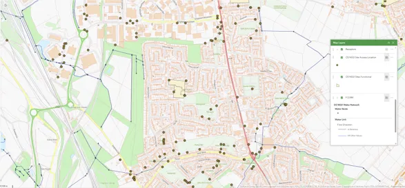
The Environment Agency’s (EA) Stakeholder and Beneficiary Mapping Tool (SBMT), developed with Esri, brings trusted data together in one easy-to-use platform. The tool is available to all EA staff, and all organisations which are signed up to the Public Sector Geospatial Agreement (PSGA). It helps users see who could benefit from flood projects, where partners can support delivery, and who owns land that may be affected. This replaces time-consuming manual searches and supports more joined-up planning and decision-making.
The results are already clear. In its first year, the SBMT saved more than 400 hours and delivered nearly £130,000 in financial benefits by reducing manual analysis, cutting reporting costs and helping teams reach decisions faster. More than 300 EA and other Risk Management Authority staff now use the platform to support project planning, partnership funding discussions and more joined-up environmental delivery.
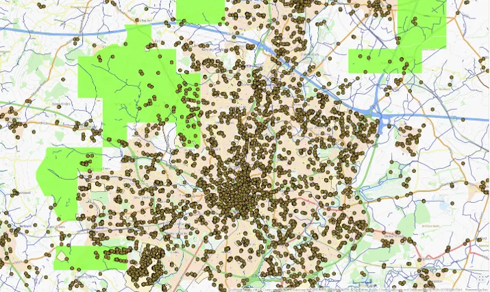
At the heart of the SBMT is Ordnance Survey (OS) data, provided under the PSGA, which gives users a trusted and authoritative view of places, properties, land, boundaries and assets. Currently, OS National Geographic Database (NGD) data such as OS Buildings and Water Networks are being used, alongside boundary line and topographic products. By combining OS data with flood and erosion risk, land ownership, environmental, socio-demographic, and EA programme datasets, the SBMT enables users to quickly understand project locations, identify who may be affected or benefit, understand land ownership, and spot opportunities to work with additional partners.
The tool supports the Department for Environment, Food and Rural Affairs’s record £10.5 billion investment in flood protection schemes until 2036, recognising the devastating impact of flooding caused by climate change.
Users who have already benefitted from the tool include supermarket giant Tesco. The EA’s National Partnership Funding Team used the SBMT to complete a risk analysis for Tesco to help it better understand flood risk in its top 200 priority stores. The use of the tool meant the task was completed in minutes, saving approximately 40 hours of analyst time.
In another example, Area Flood Risk Specialists assessed four projects, saving 16 hours and avoiding an estimated £28,000 in consultant costs while identifying an additional 250 non-residential properties that could benefit from flood protection. Asset teams have also used SBMT to identify and contact landowners responsible for defective assets in the water network, replacing manual searches and creating an estimated annual saving of 140 hours across 14 Environment Agency asset teams.
"This week, our Flood Action Week is a timely reminder that as our climate changes, the tools we use need to be innovative and forward looking so we can prepare for and respond to increasing flood risk. The Stakeholder and Beneficiary Mapping Tool is helping us do exactly that, giving our teams and partners the ability to make faster, more informed decisions on the projects that matter most in reducing flood risk. Ordnance Survey's data has been central to this, allowing us to work collaboratively with our partners and target our efforts where they will have the greatest impact in protecting communities from flooding. "
Chief Customer Officer at OS Tina Kennedy said:
"When organisations can see a complete and trusted picture of the places they serve, they can make better decisions and deliver greater impact. By providing the authoritative location data that underpins the SBMT, Ordnance Survey is helping the Environment Agency and its partners identify opportunities faster, target investment more effectively, and work together to better protect communities from flooding while delivering wider environmental benefits."
The EA is continuing to improve the SBMT by listening to users and adding more data that will make the tool even more powerful. Feedback is gathered each month through area super users, helping teams measure benefits, share learning nationally and shape future improvements. Planned developments include adding further Natural Capital, Natural England and Indices of Multiple Deprivation data, as well as more OS NGD datasets.
The EA is also exploring how to extend access to partners such as water companies and rivers and wildlife trusts, helping more organisations work together on shared environmental priorities.
As part of Flood Action Week 2026, the government has launched Flood Action Online, a new website hosted on GOV.UK. It acts as a one stop shop for understanding flood risk and preparing for flooding.
Earlier this year, OS released its own analysis of how climate-related flooding is threatening Britain’s transport networks. For more information, visit Flooding to cut off more towns and commuter routes | OS.
To understand more about OS’s role as Great Britain’s National Mapping Service, visit https://www.ordnancesurvey.co.uk/about/what-we-do.
Sharing the latest news about OS. We can license you to use OS maps in print, online and film format. For more information and resources for journalists, bloggers and media professionals, email pressoffice@os.uk or call 023 8005 5565.
Products and solutions featured in this news article
OS Building Features
Access data on buildings and building features, including building heights, lines, and access points, across Great Britain.
OS Water Features
See water network and river network data across Great Britain, including water area features such as watercourses, lakes, drains, springs, and intertidal watercourses.
Boundary-Line
Ordnance Survey's Boundary-Line is an open dataset of every administrative boundary in Great Britain.
OS MasterMap Topography Layer
OS MasterMap Topography layer provides a map dataset of Great Britain's landscape – from roads to fields, to buildings and trees, fences, paths and more.
Find more news
- Climate resilience
- Innovation
- PSGA members
- Businesses
- National security and resilience
- Environment
- Land and property
- Government and public sector