GB Overview Maps
What GB Overview Maps provides you with
Our simplest maps of the British Isles
Free to view, download and use for commercial, educational and personal purposes.
Clutter-free map
Your message will stand out as there is no clutter on this map. It's also great for hand-outs, desktop publishing and classroom use.
Zoom in from here
This is ideal as an initial map for your analysis. It highlights Britain while showing neighbouring countries of Europe.
Use cases
- Suitable for visual communications, whether public-facing documents or policy briefings.
- The uncluttered design serves as an initial layer for GIS, orientating users to a national context before layering in more detail.
- GB Overview Maps is available under the Open Government License and can be freely used in both commercial and personal projects.
Related products
MiniScale
Ordnance Survey's MiniScale is an open national backdrop map of Great Britain.
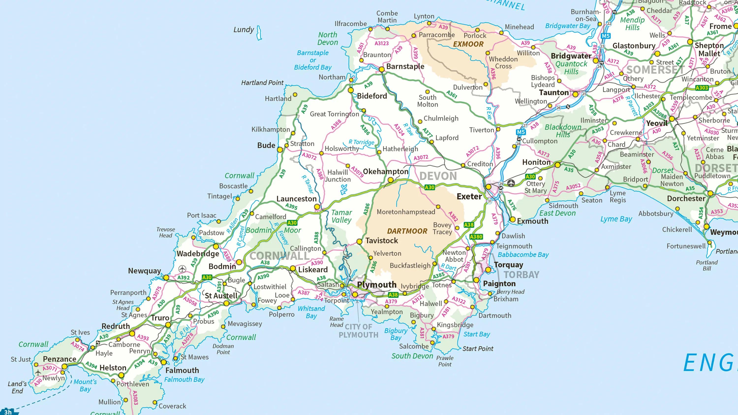
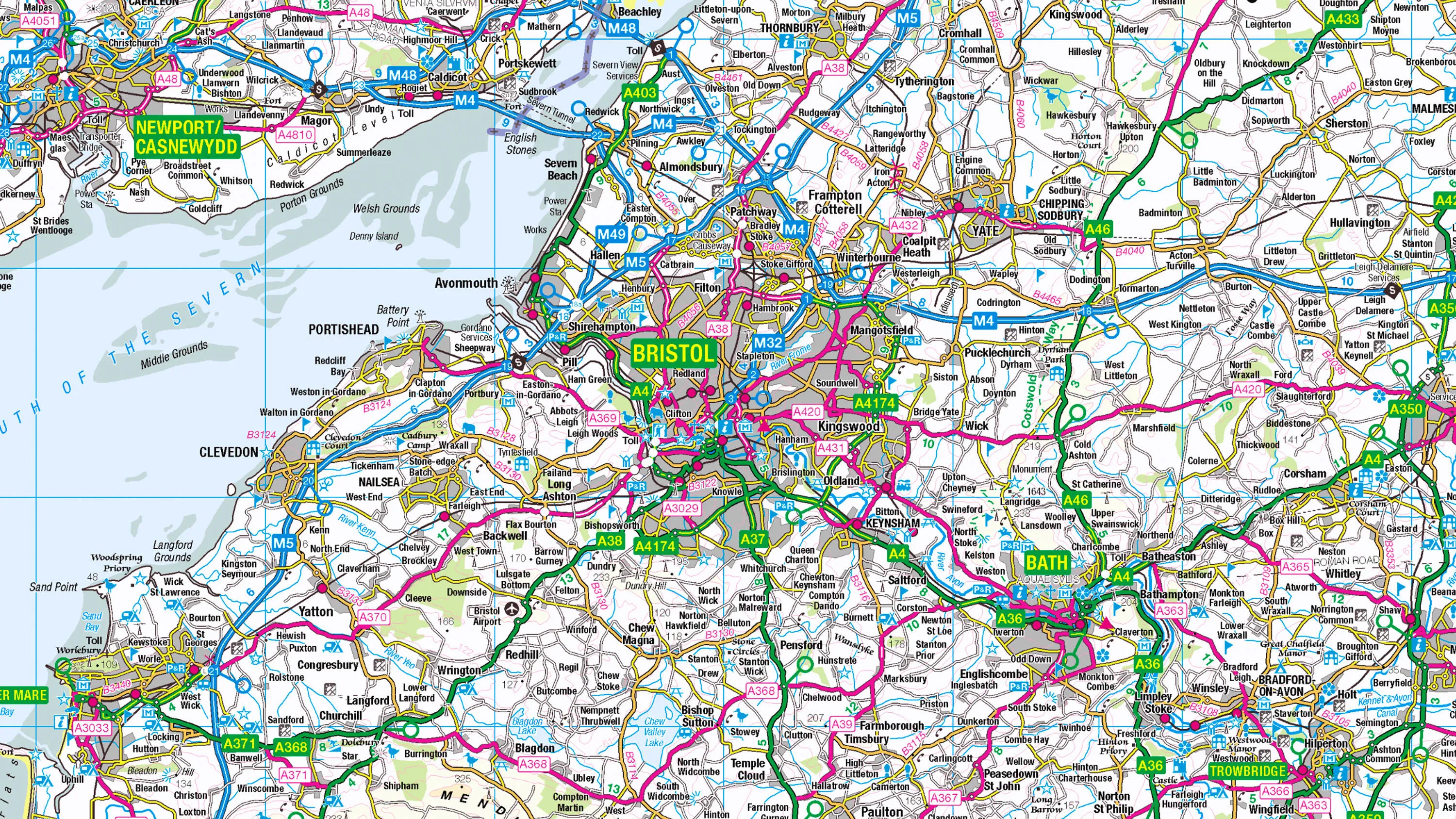
1:250 000 Scale Colour Raster
1:250 000 Scale Colour Raster is an open dataset of the regional view of towns and villages, roads and places of interest.
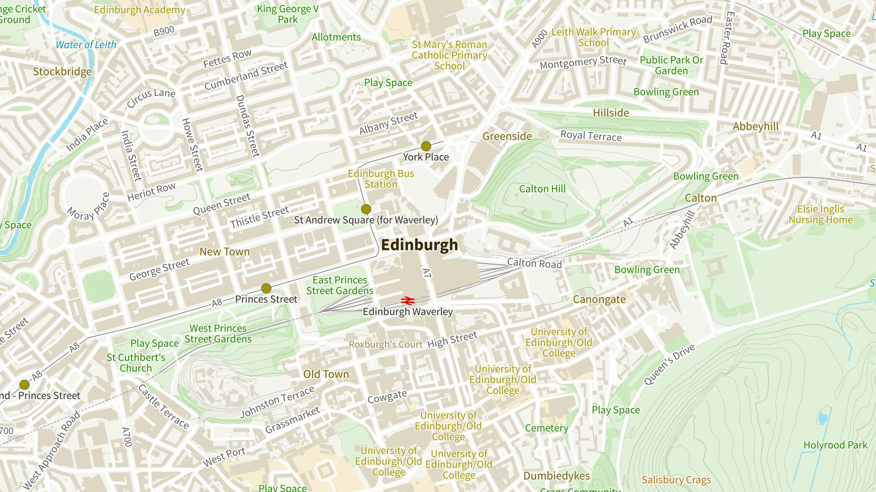
OS Open Zoomstack
Ordnance Survey's OS Open Zoomstack is an open vector basemap showing coverage of Great Britain from a national level, right down to street detail.