1:250 000 Scale Colour Raster

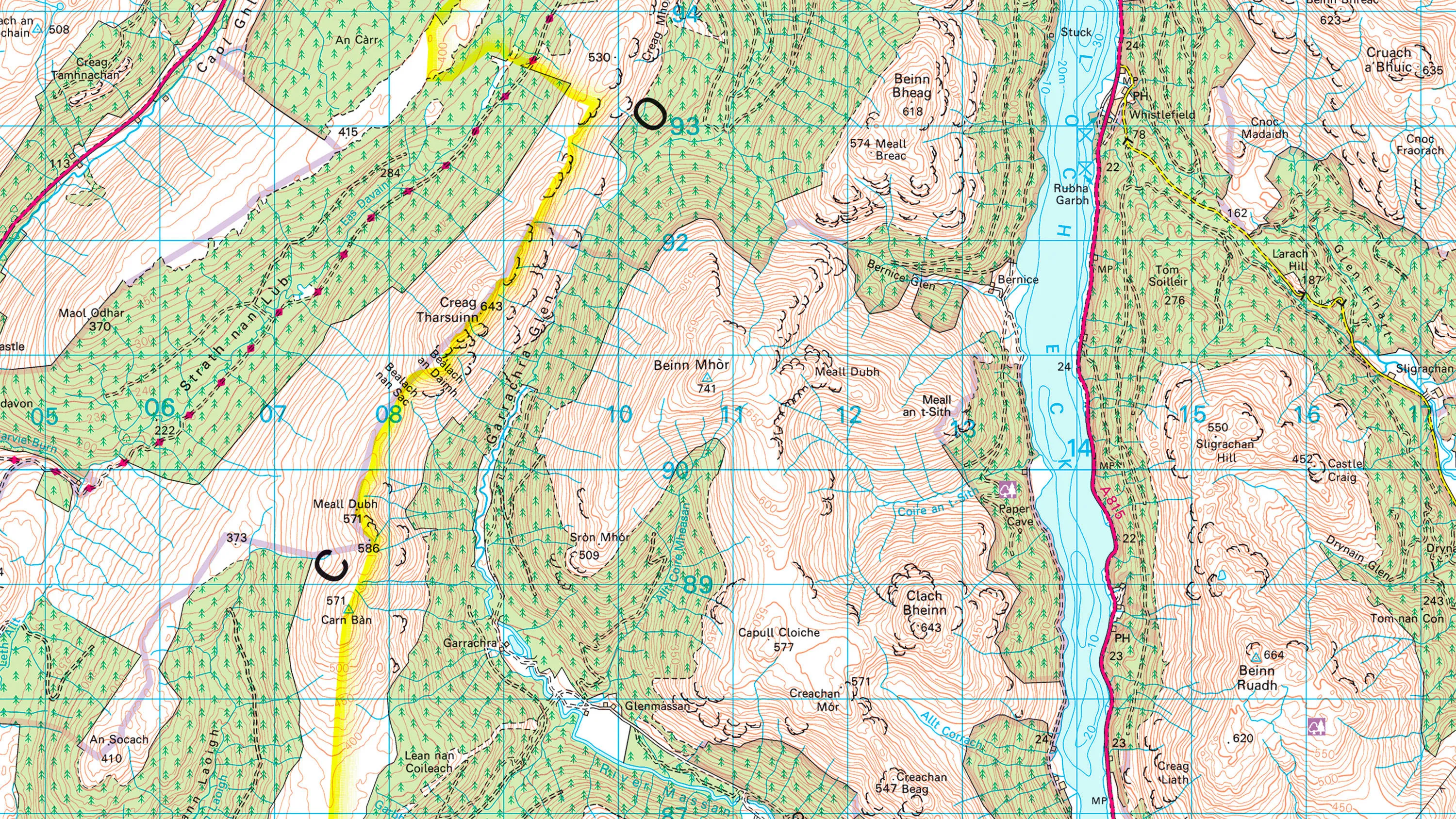
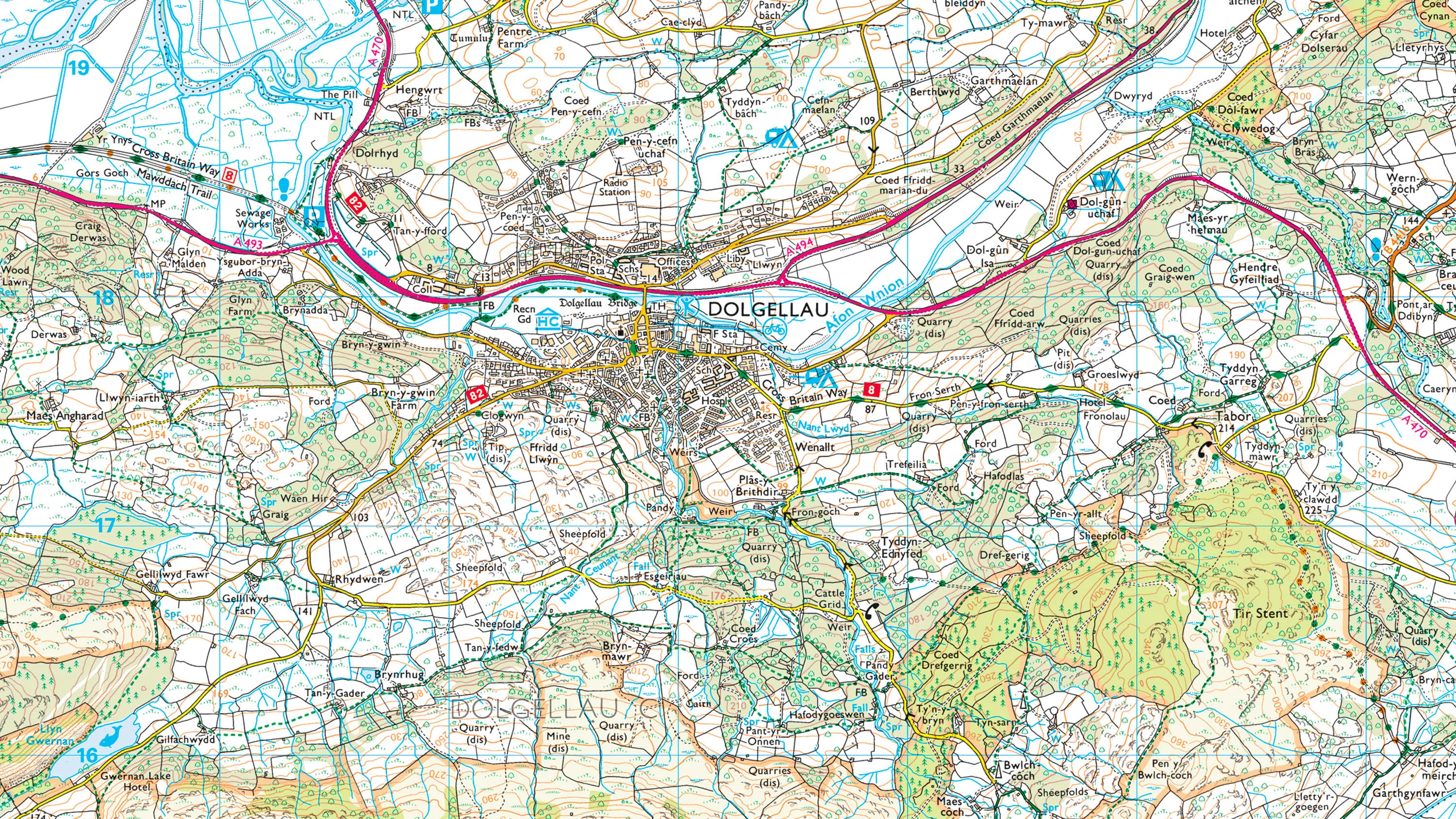
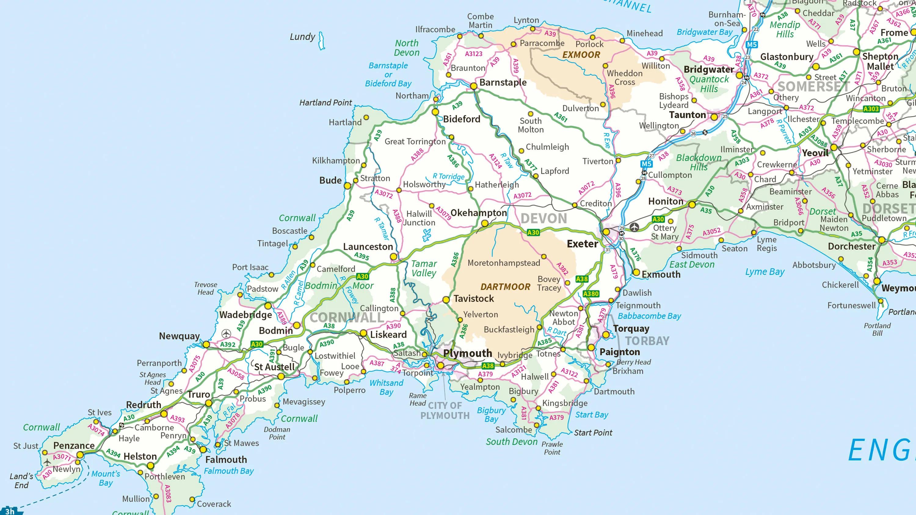
1:250 000 Scale Colour Raster is a small-scale, digital, raster mapping product giving a regional view, similar in content and appearance to a typical road atlas.

  • Contextual or derived mapping
  • Download
  • OS OpenData Plan (FREE)
  • Public Sector Plan
  • Premium Plan
  • Energy & Infrastructure Plan

This product is updated annually

Representation of data provided
© Crown copyright and database rights. Ordnance Survey 2024

What 1:250 000 Scale Colour Raster provides you with

Easy to manage

This is a raster (flat image) product, so it's quick to load and simple to use.

A regional backdrop map

Motorways and main roads stand out, but you can also see country lanes clearly.

Clearly see places of interest

Places of interest, including camping and caravan sites are clearly shown.

Save money and benefit from simple licensing terms

1:250,000 Scale Colour Raster is free to view, download and use for commercial, education and personal purposes.

1:250 000 Scale Colour Raster

Technical information

© Crown copyright and database rights. Ordnance Survey 2024

Specifications

Use cases

1:250,000 Scale Colour Raster product can aid with:

  • route planning;
  • geographic context; and
  • enhancing an Intranet or Internet site.

Encourage tourism in your area

With lots of tourist attractions featured, it’s a great map for your website to help visitors plan days out.

Enhance a leaflet or sales brochure with a map of your local area

You can open the files in image editing software and cut out the area you need.

Access
  • Download
Data theme
  • Contextual
Data structure
Raster
Coverage
Great Britain
Scale
1:250 000
Format
  • TIFF palette 8-bit (256 colours) with LZW compression
Ordering area
  • All of Great Britain
Publication months
  • June
OS Data Hub plan
  • OS OpenData Plan (FREE)
  • Public Sector Plan
  • Premium Plan
  • Energy & Infrastructure Plan

Documents and Support

Getting started guides

  • 1:250 000 Scale Colour Raster - Overview
    The overview introduces the product and gives context for all users. It highlights key features, provides examples of potential uses for the product and lists details like file sizes, supply formats, etc.
    pdf
    v1
    672 kb
    September 27, 2022

Technical specification

Supporting documents

Additional information

Colour raster in monochrome

Colour Raster is not available in monochrome. Some GIS applications let you load the colour image and choose a greyscale option from an on-screen menu. This will change the colours on an image to shades of grey (greyscale). On a true monochrome map, features would be either black or white. This wouldn’t be the best way to display 1:250 000 Scale Colour Raster.

Colour options

Palette of 256 colours

1:250 000 Scale Colour Raster

Get this product

What you get

Key features
  • Easy to manage
  • A regional backdrop map
  • Clearly see places of interest
  • Save money and benefit from simple licensing terms
Category
Contextual or derived mapping
Access
  • Download
Data structure
Raster
Update frequency
Annually

How to access

OS OpenData is free

Ready to get started with OS data?

Take the next step by signing up to the OS Data Hub and create your first project today.

Sign up to the OS Data Hub

Get this product

Access for free and benefit from using OS data

Get help

Further support

For further help about how our data can transform your organisation, contact us today

Contact us