#mydataday with surveyor Tom Watts

How long have you worked as a surveyor at OS?
I have worked for OS for 15 years. The time has flown by and it would be fair to say I’ve surveyed most of the new topographic features in places like St Albans and Watford. My area of responsibility stretches across west Hertfordshire into Buckinghamshire. This includes The Chilterns, which is always a pleasure to work within.
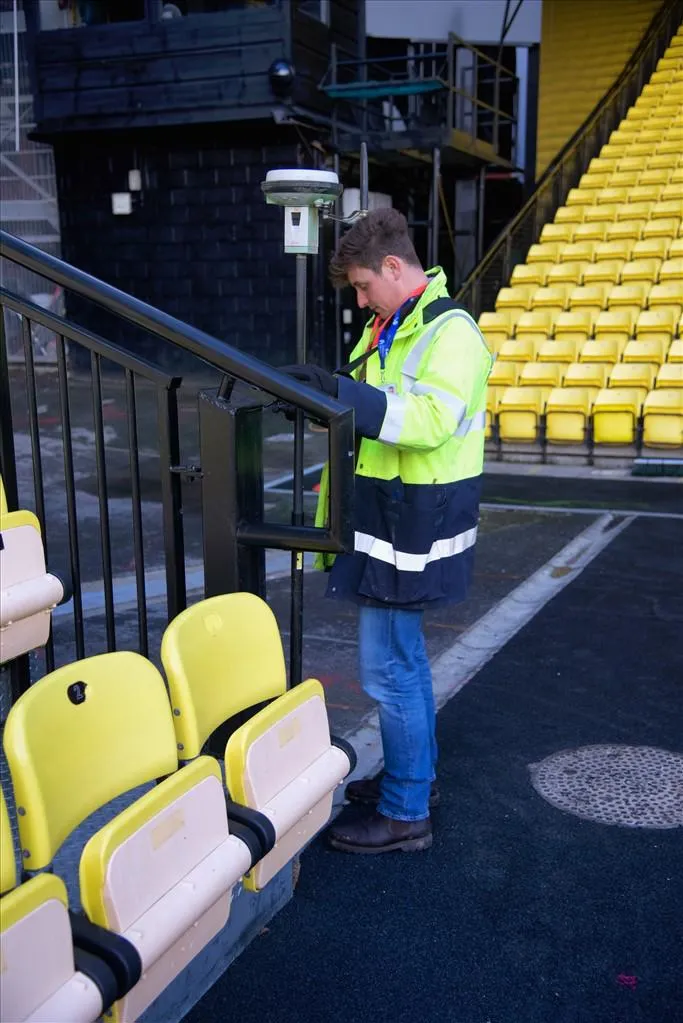
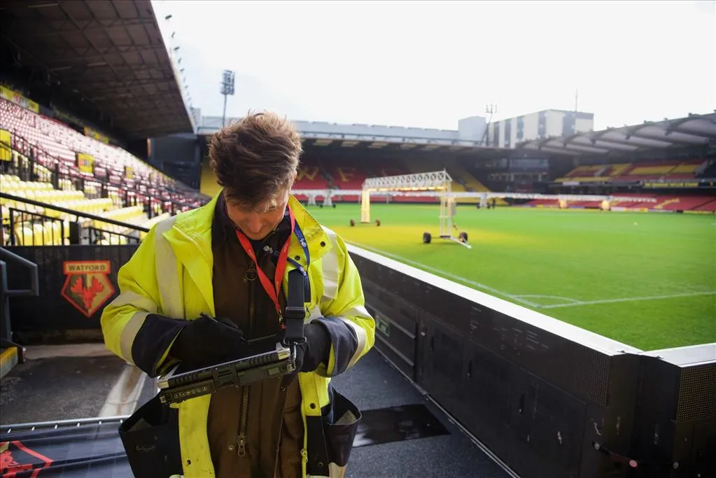
By surveying the countryside and the built environment, I get to survey and visit interesting places. Updating the large-scale OS map of Great Britain has taken me to places such as Vicarage Road, the home of Watford FC, Arsenal FC’s training ground and the Warner Bros Studio Tour.
When you are out surveying, what is the most common thing you get asked by the public?
The most common question is ‘what are you doing’ and in reference to the GNSS receiver (GPS), ‘what is that thing? Are you taking photos?’. Working outside and often in public spaces, I tend to attract attention. As a face of OS, it’s important to engage with the public and explain what I’m doing.
I start by introducing myself and explaining that I’m there to update the large-scale OS map. I am often asked about the surveying equipment, so I explain that the GNSS works on the same principle as the GPS device in your car, but with a correction service transmitted to my GNSS receiver, I can achieve a resolution of 1cm. At this point the individual either walks away with an information overload, or the conversation develops with further questions!
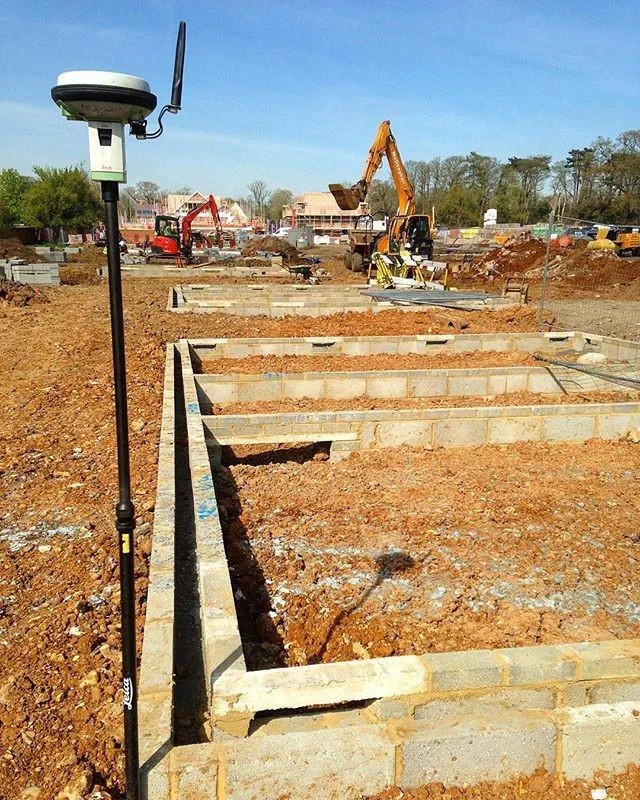
Working on building sites can be interesting too. The most common questions are ‘can you get Sky Sports on that thing?’ (referring to the GNSS receiver) and ‘are we in the right field?!’, because often brick layers assume you are there to check the positional accuracy of their work. I’m always quick to say it is spot on and I’m only conducting an ‘as built survey’ to update the OS map.
Another common question people ask is ‘how does OS know where and when changes to the landscape occur for surveyors to then update the map?’. This is a very good question and it is hard to keep the answer short! With so many changes to the topography, particularly in built environments, make the job no mean feat. OS gathers information using address data, looking for new addresses on the National Address Gazetteer (NAG). Other sources include Land Registry, local authorities, the general public, aerial imagery and OS surveyors out and about.
Are they surprised to learn OS do more than just paper maps?
Yes, most people are surprised that we do more than just paper maps. They appreciate we represent GB in small scale mapping in printed and possibly digital form, but probably not at large scale, which is where our small scales mapping is derived. Mentioning that we have 2 planes and drones that capture aerial imagery for map updates normally surprises people too.
The history and age of the organisation also catches people out. Many know our name and recognise the brand but don’t know the true extent to which OS underpins geographic data in Government, public and private sectors, and for how long we have been doing it.
Within your role, what do you survey the most and what is it used for?
My role as an OS surveyor is broad. Primarily I’m surveying changes to the topography for the purpose of updating the OS map of GB. Other roles include data collection for products which contain information on road routing and address location-based data.
The most common feature I survey is residential buildings such as blocks of flats or individual houses. Surveying new dwellings and the associated plots of land efficiently enables our customers, such as Land Registry, to register the ownership of land and property throughout England and Wales.
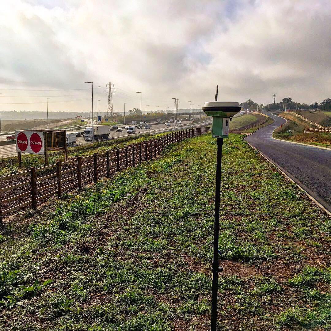
With new residential estates springing up in many towns across GB, a map update will include the new roads that serve the new settlements. Surveying a road means representing the limits of the carriageway and its associated verge and pavement on the map. OS also collect road routing information associated to the road such as height, weight and width restrictions. The road routing data that is collected and maintained by surveyors populates a product called Highways which in turn populates most sat–navs throughout GB.
How important is your role and how important is OS data to GB?
A surveyor’s role is crucial to OS, we are essentiality the fee earner for the business, surveying and collating data that populates our products. OS is not just about creating a map with point, line and area features, it is also about the geographic information imbedded within.
My 15 years in OS have whizzed by and each year I’ve seen a change in our customer requirements. The end user wants to know what a line on the map represents other than just its geographical position. For example, is a line an obstructing feature or ground feature such as a public road edge?
We pride ourselves on the accuracy of the geographical data within our mapping products, but also the richness of the attribution. Looking at the present and to the future, customers are requesting an increase in attribution and additional topographic features to be mapped. Having surveyor’s feet on the ground is vital to capturing and maintaining a rich dataset for now and in the future.
OS data to GB is as a surveyor is OS, essential. On one hand, our data printed in small-scale format will aid a group of walkers navigating The Pennines. On the other hand, our large-scale digital data underpins the cadastral processes for Land Registry. Government and the public sector have OS data at the heart of the delivery of many public services in Great Britain; including supporting new housing developments, protecting our environment, informing future transport planning and helping security services keep the country safe.
Research shows that on average people use our data 42 times per day – with your expertise do you think this is accurate?
I’m not surprised by the outcome of this research. From using sat-navs to arranging home insurance, I have always known that people carry out a number of process each day that is underpinned by OS data. As our name and brand can become hidden behind the scenes, I often reference this when speaking to members of the public. The research also confirms the importance of OS data to GB.
What challenges do you face as a surveyor?
Updating the map in general proves challenging from the start. Trying to represent reality in digital form can cause a headache as the real world is not black and white. OS has a Data Capture and Edit Guide which helps surveyors make informed decisions on how to represent a real-world feature on the map. Back in the day, this guide was in PDF format and was nearly 1000 pages long. Obviously the guide cannot provide answers for every scenario a surveyor will encounter, but complex buildings with elevated structures and variances in ground level around a building can lead to questions in how this feature should be best represented. A team in HQ who deal with map specification are always on hand to offer advice, as are other surveyors.
Gaining permission to access land and buildings for the purpose of updating the map can be the biggest challenge as a surveyor. Ideally OS visit a new topographic feature, such as a new house, once it has been completed. This ensures we capture all the relevant topographic features, such as overhangs and physical boundaries, without making multiple visits. As a result, often completed properties are occupied at the time of visit and occupants are not always expecting an OS surveyor to just turn up.
Cold calling can have a few outcomes. Either the occupant understands what you are there to do and knows about OS and what the business is, other times people are reluctant to give permission. At this point I give a detailed explanation of my role and purpose, listing the benefits to the occupant, such as having their address recorded in our address dataset and Land Registry receiving accurate mapping of their property. Other times, access can be refused because of health and safety concerns which we were not aware of. I then look at alternative survey methods to ensure this topographic feature is mapped, such as aerial imagery from either a drone or plane.
A different type of challenge can arise when the Great British weather is doing its worst. No matter how ruggedised a tablet PC is and, indeed yourself, some days you just know when to call it a day!
OS Net
Our surveyors use OS Net and Global Navigation Satellite System (GNSS) technology every day to instantly position new map detail to within a few centimetres.

Our highly accurate geospatial data and printed maps help individuals, governments and companies to understand the world, both in Britain and overseas.