OS data products
Search below to find the best geospatial data product for you
Showing 3 results
- Page 1
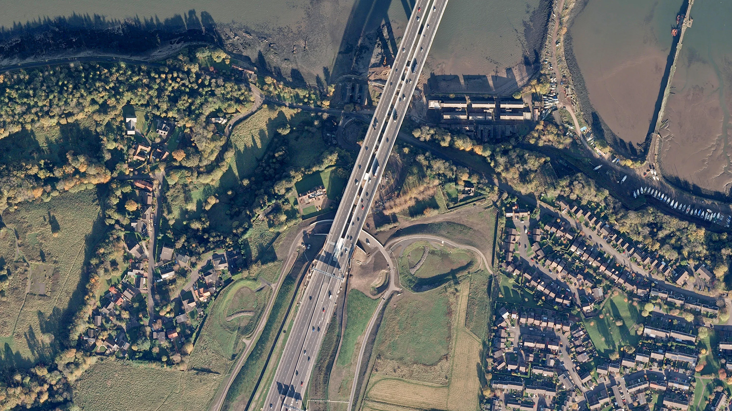
Digital colour-balanced and corrected for geometric distortions (orthorectified) aerial photography for Great Britain.
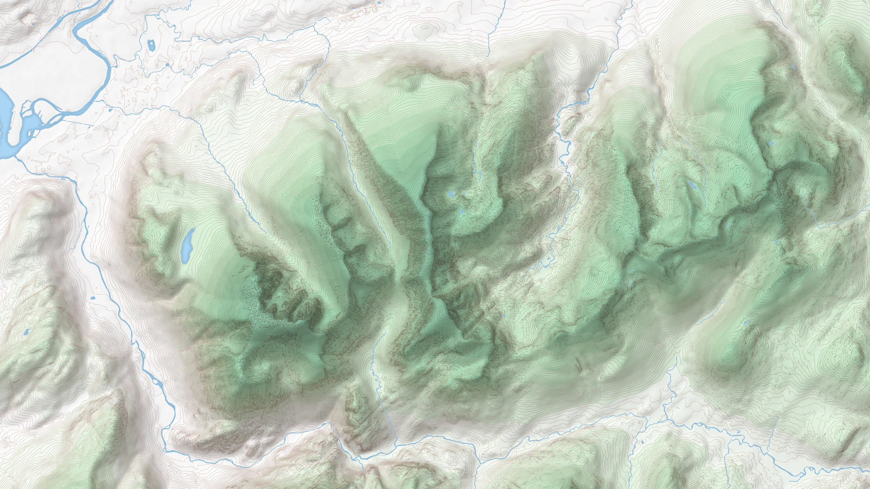
OS Terrain® 5 is a detailed digital terrain model (DTM) of Great Britain.
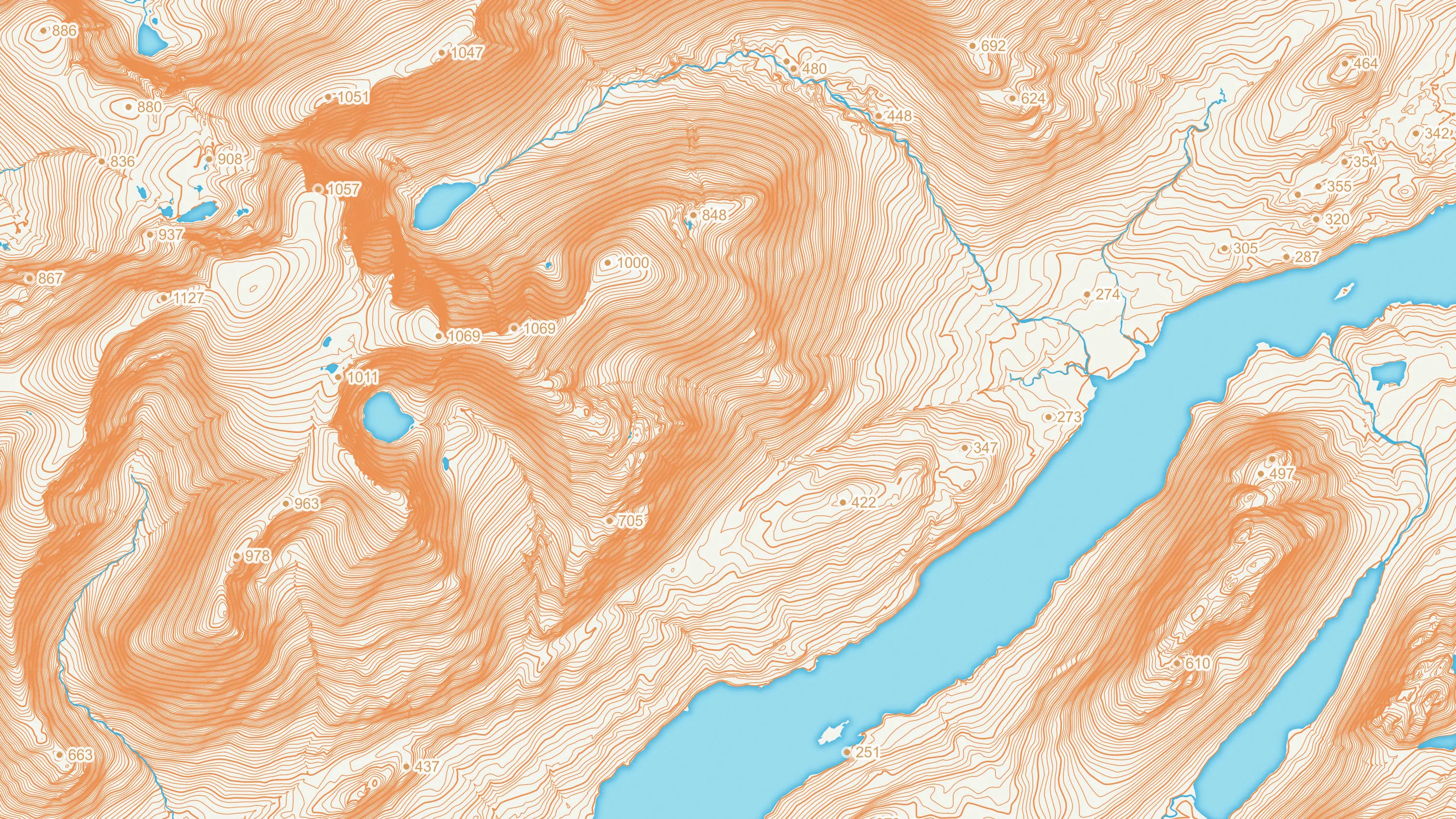
OS Terrain® 50 is an open height dataset of contours with spot heights, breaklines, coastline, lakes, ridges and formlines for Great Britain.