Challenge
CWP deliver community healthcare services covering three Clinical Commissioning Groups (CCGs). The Trust provides services from over 100 locations in a combination of its own premises, co-located clinics in GP surgeries and council premises, alongside other locations.
Providing care across a complex estate, coupled with a rise in those accessing mental health services, meant the right solutions were not always in the best location for people accessing their services.
The Trust, whose services are delivered by over 3,500 staff, also had to account for difficulties understanding how best to recruit doctors and mental health nurses, alongside rural travel issues.
Solution
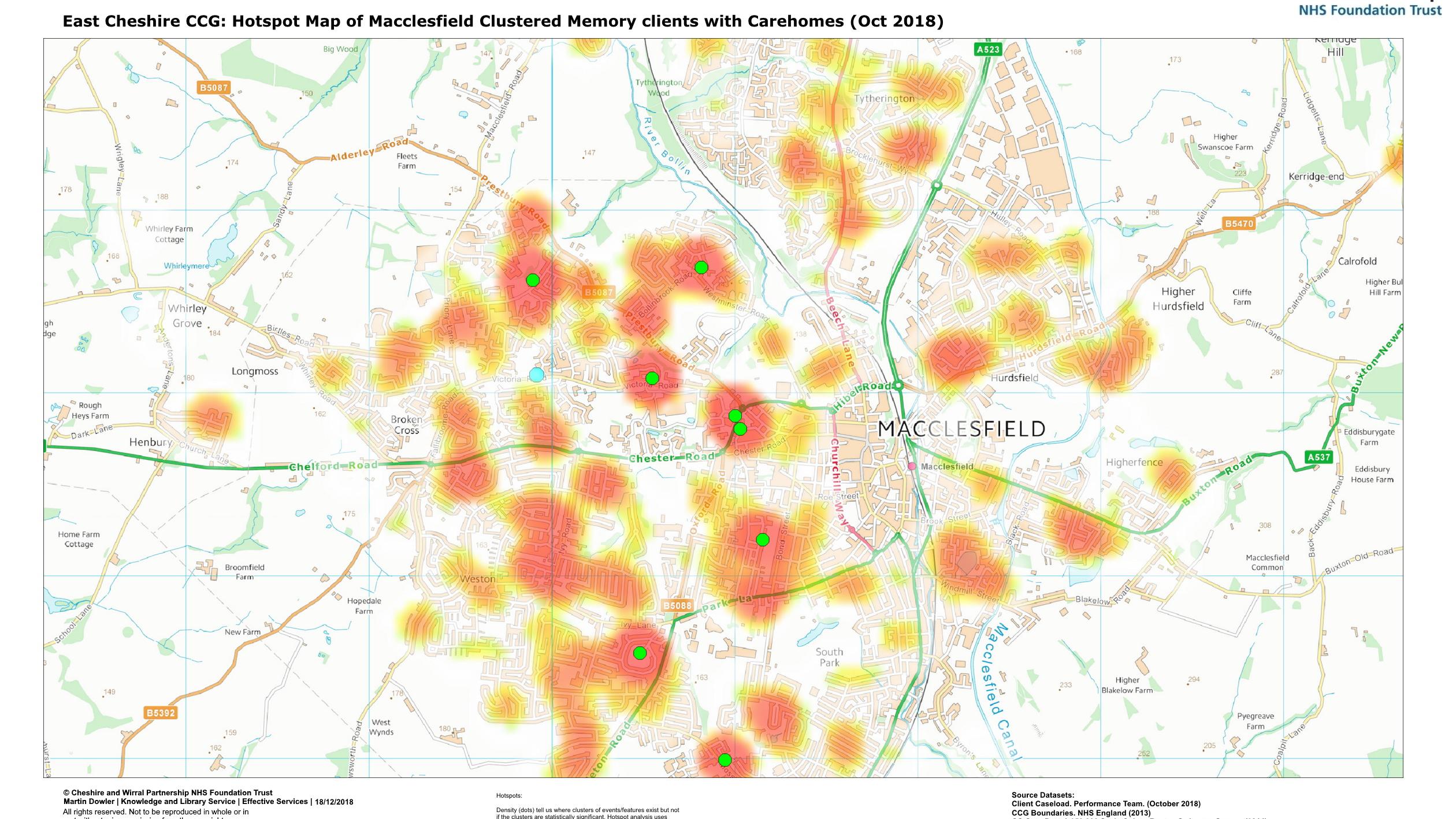
The Trust’s Knowledge Manager and GIS analyst, Martin Dowler used OS VectorMap District and 1:250 000 Scale Colour Raster datasets to map their clients’ locations, then compared this to service delivery locations, and important facilities such as care homes.
The Trust’s patients were grouped by diagnosis area (psychosis, non-psychosis or memory) to reflect the level of care required and need for on-going support. Around 100 maps were produced, identifying potential gaps in types of service provision.
Result
This gave CWP a greater understanding of where people accessing their services were and therefore where specific services were most needed. This insight supported decision-making around the redesign of offerings, as part of the redesign of community and acute mental health services review.
Reviews like this one contribute to the country-wide Mental Health Forward View and NHS Long Term Plan, where the review and improvement of mental health services is a key driver for the NHS.
"The work Martin did supported the redesign of mental health care by helping us understand who our current patients are and where they live. It helped us understand how easy it was to access our services in relation to travel distances. The data also helped us understand who wasn’t able to access our services and who may be suffering with mental ill health in silence. The work to understand our population, has helped shape our offer of care and will be instrumental in the further work mental health services are doing to improve access and care"