Slow down and stop!
Timmy Mallett reveals the ‘utterly brilliant’ secret to making the most of cycling Britain’s coast
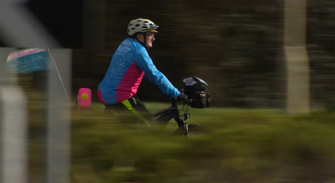
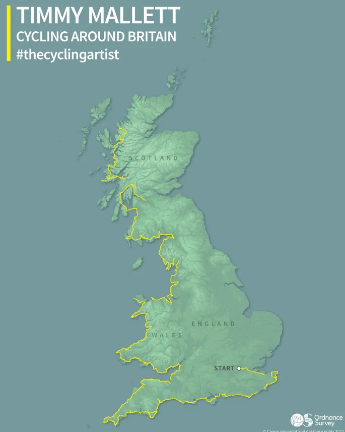
Inspired by his artistic heroes, and guided by custom printed OS maps of his route, Timmy has been in the saddle of his e-bike since leaving Paddington Station in March, stopping off each day to paint and sketch what he’s seen. Already he has cycled the coast of southern England, Wales, north west England and western Scotland for over 2,500 miles.
OS caught up for a quick chat with Timmy to find out how he’s been getting on.
So Timmy what does a typical day look like on this tour?
I will have a breakfast in my accommodation always and then I say to myself I will leave at 9am, but the earliest I ever leave is half nine or quarter to ten. Sometimes later than that. I find that first thing in the mornings I’m at my most slow, but they are also when I am at my most cheerful and looking to paint. I will do sketching in the morning for whichever town I am in, and look to do not very much before stopping for lunch. Maybe 10 to 15 miles. And then I will do the bulk of my cycling in the afternoon. And then between 4pm and 5pm that’s when I start looking for where I am going to stay for the night. I don’t pre-plan it or pre-book it.
What advice would you give on reading a map?
Look for the things that interest you on a map. Look for the things that make you curious. I think curiosity is a really fine thing. Maps show things like railway lines or old churches or castles. Or why is there a great big development there? What is that about? What does it look like? And then go and inspect.
The printed map that OS has given me of the entire route has been brilliant because that gives me things to look out for along the way, and also you can see where the hills are because you can see the contours on it. You read it because it tells you watch out here there is a steep climb or a really steep drop.
How do you decide what to paint?
Depends what mood I am in. It can be a quick pen and ink sketch. I came out with acrylics as well but it turned out to be more difficult than anticipated. Most of the time I would do the acrylic in the evenings in the accommodation. Turned out to be an issue carrying it – just doing it with watercolours.
There’s a pattern for this. There is a famous 19th century artist Constable who did this. He would go off on grand tours of Britain. They started when Napolean was rampaging all over Europe, and lo and behold we have got another dictator rampaging around Europe now so the pattern is familiar.
Also Turner looked to fill in his sketch books and he would do 20 to 25 miles a day walking, and his feeling was right I’ll fill my sketch books and then I’ll do some water colours or some larger works back home in the studio. He also carried some watercolours with him, some of his working dramatizes what is in a sense a pretty view. He’d put in a stormy sky or a wild weather to give it some extra drama. What’s interesting is that you can find the exact position where Turner stood. He stood on this bridge at this point and sketched it here. It is down to ten feet either way and you can get the exact spot. So I am finding I am standing in Turner’s viewpoints and it is absolutely brilliant. I thought mainly he painted around Margate and Kent which is where he favoured, but I was absolutely wrong – his stuff is absolutely everywhere. The whole of Wales and Scotland.
What have you learned from your journey so far?
Slow down. Less is more. Stop at every opportunity because ‘will I do this route again?’ I don’t know. You might not. So make sure you don’t miss anything. And the other thing is that people will stop and say hello, and to begin with that is a nod and a wave, but it’s not. Everybody has got a story to tell. Stop and listen, so I do, and I find I get a lot out of that, and awful lot. I am really enjoying it. I’m enjoying the whole process of looking for things to paint, following the history, following the art trail, following the cycle trail and bigging up Britain. I’m a big believer that this is a wonderful glorious country to be explored as much as possible. And thank God we have got those OS Maps so we can do that.
What goes through your mind while you are cycling?
There’s an interesting thing called the invisible peloton. It is a phrase I have come across recently. That when you are cycling, you often think of your friends, and you think of them quite a lot because they give you that bit of encouragement than everybody is on your side. I’m determined not to put any extra pressure on myself, so it’s not a race. I don’t have to do it in a time, I don’t have to do every single bit of the coast, I’m following the coast – the water is always on my left. I am following the water, meeting the people, seeing what the views are to paint.
What’s been your favourite experience so far?
I won’t make a judgement on any of the places I have been through. There is no favourite part of Britain. It’s all stunning. But I think it is the meeting of people. I’ve got a little notebook with me so when I’m with somebody or have an exchange of any sort, I get them to sign my little book. Because that means it’s a person I have met and it’s a story I will remember. I say put the date, where we are, what’s your name and leave a message. It’s a lovely thing.
The downsides are technology. I’ve had phone issues because you are reliant on your phone and I’ve lost several days’ worth of photos and videos because of a corrupted memory file I think, and that is very frustrating. But you go ‘nobodies dead’ and all you are whingeing about is losing a few photos, and let’s be honest I’ve got sketches, so it’s not the end of the world.
The most important thing to do is not to keep going, but to stop as often as possible and look at everything. Take it in, smell it, taste it, feel it, be part of it.
What are you most looking forward to you when you get home?
A fresh set of clothes because I wear the same thing day after day and I have to wash them out every night!

Our highly accurate geospatial data and printed maps help individuals, governments and companies to understand the world, both in Britain and overseas.