Areas and zones includes administrative, electoral and analytical boundaries, built-up and functional areas plus postcode data for Northern Ireland and Great Britain. It enables spatial analysis, policy development and demographic profiling.

Areas and zones data
Explore mapping data designed to provide information about areas used for administration and analysis

What is areas and zones data?
Features of areas and zones data
Definitive boundary coverage
Access seamless mapping of administrative and electoral areas, enriched with Government Statistical Service (GSS) codes for statistical linkage and reporting.
Urban extents
A consistent identification of built-up areas provides insights into developed land, supporting urban planning and policy analysis.
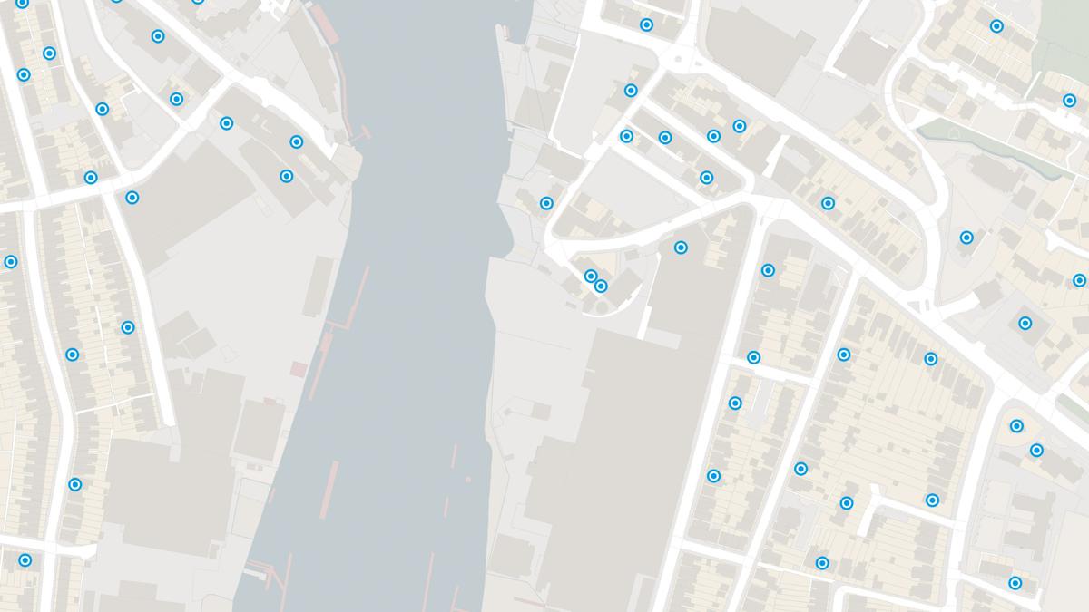
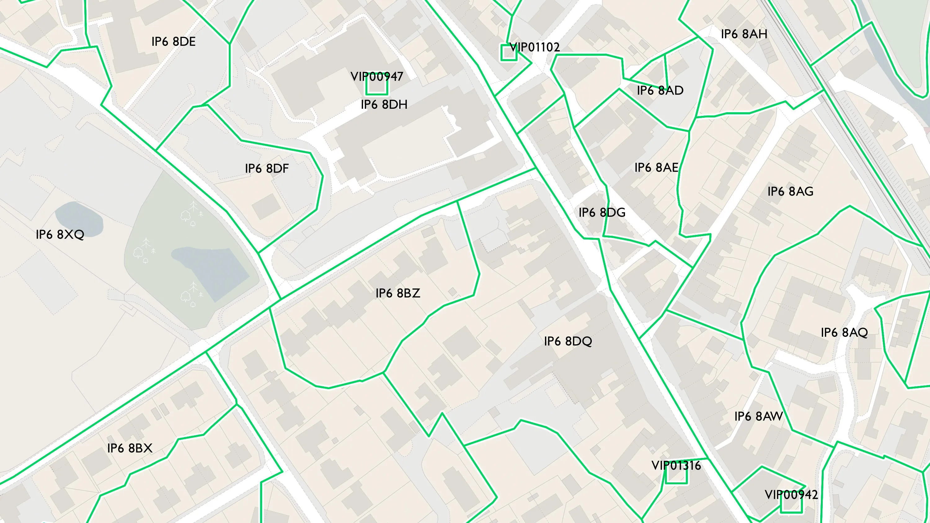
Postcode mapping
Visualise postcode points and areas to support geotargeting, asset management, and service delivery.
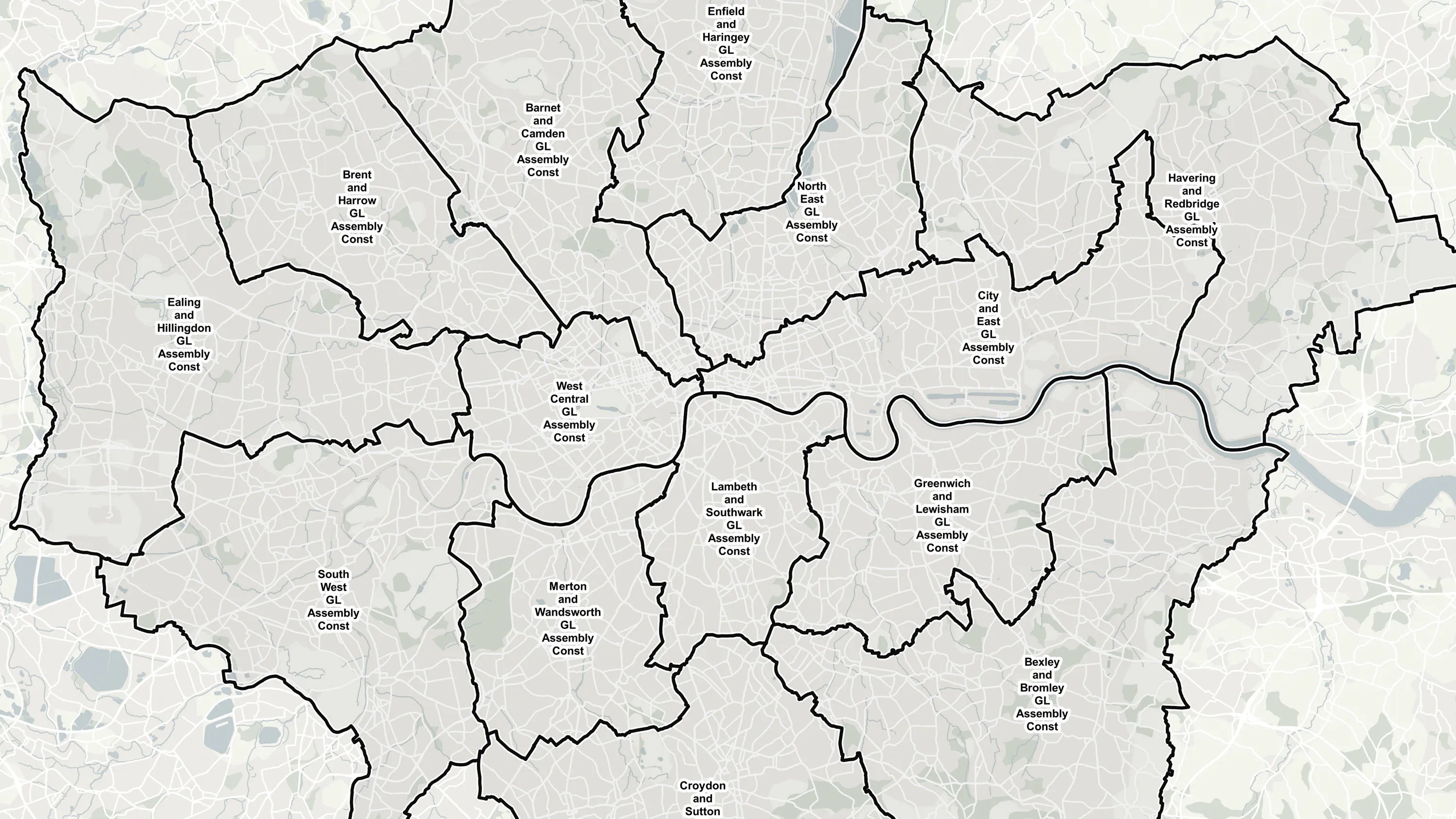
Boundary insights
Explore full boundary hierarchies from parish to country level, enriched boundary attributes such as borough status, and support advanced spatial analysis.
Sector-ready intelligence
From election planning and logistics, to policy analysis and public service delivery, areas and zones data supports a wide range of sectors with authoritative area-based data.
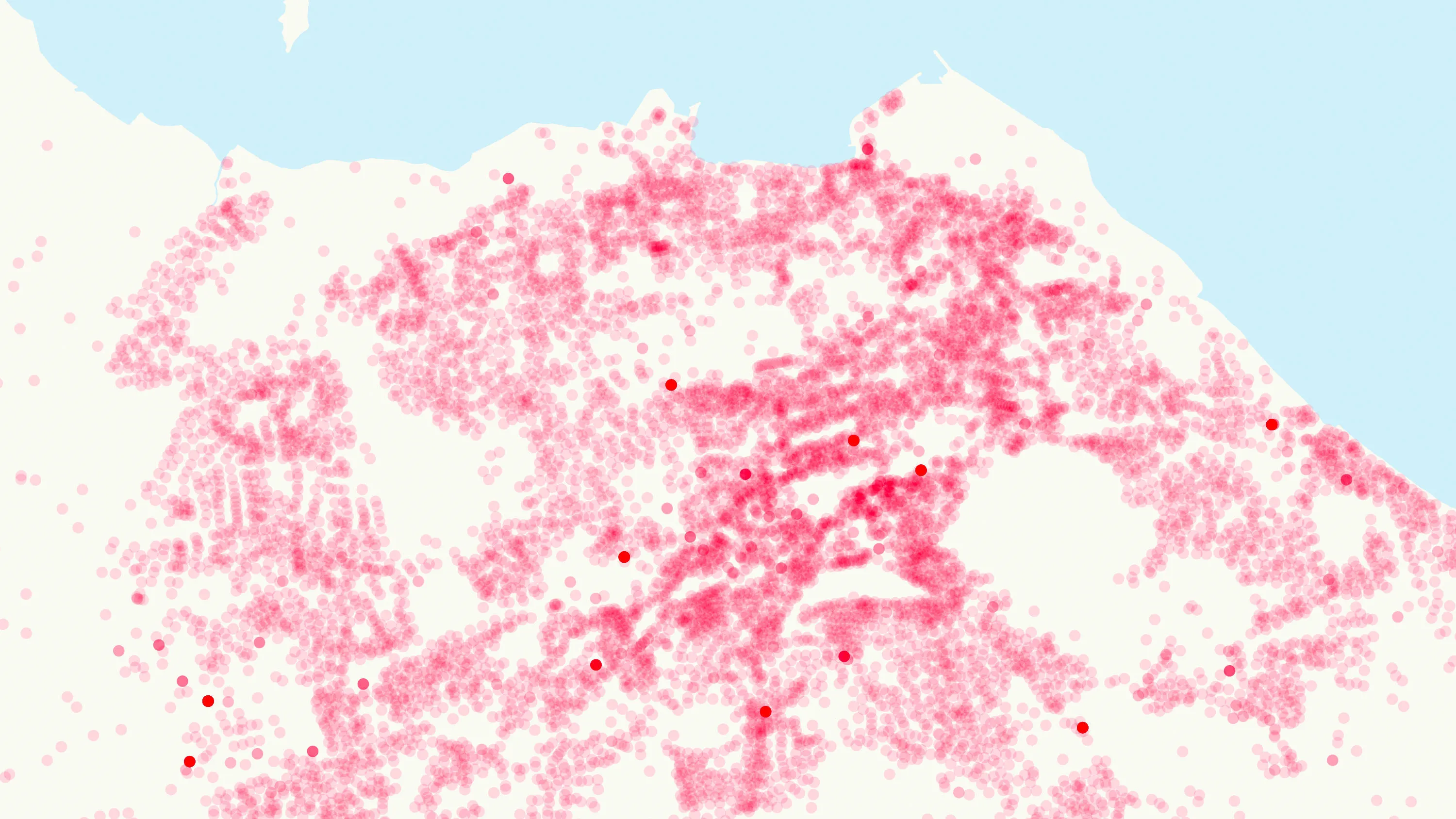
Retail areas
A consistent view of retail locations across Great Britain, including comparable data on where retail clusters exist and how they function.
Products offering these key features
This features table highlights which features are available in areas and zones products.
| Feature | Products |
| Administrative areas, e.g. county councils | |
| Electoral areas, e.g. Westminster constituencies | |
| Built-up extents | |
| Postcode points |
Code-Point, |
| Postcode areas | |
| Retail areas | |
| Postcode statistics |
Code-Point, |
| Unique identifiers |
OS Boundaries, |
Areas and zones products
OS Boundaries
Access the administrative and electoral boundaries for England, Wales, and Scotland.
Boundary-Line
Ordnance Survey's Boundary-Line is an open dataset of every administrative boundary in Great Britain.
OS Open Built Up Areas
The statistical geographies used by Government departments to analyse census data, deliver on policy and improve services.
Code-Point
Code-Point® is a postcode locator with postcode units in Great Britain and Northern Ireland.
Code-Point Open
Ordnance Survey's Code-Point Open is an open dataset of all the current postcode units in Great Britain.
Code-Point with Polygons
Code-Point with Polygons shows the notional shape of every postcode unit in Great Britain including buildings with multiple postcodes.
OS GB Postcodes
A consistent view of postcode geography that aligns with real-world buildings and land parcels across Great Britain.
OS NI Postcodes
A consistent view of postcode geography across Northern Ireland.
OS Functional Areas
A view of retail geographies across Great Britain at local, regional and national scales.


Data access APIs
OS Vector Tile API
A vector tile service providing detailed Ordnance Survey data as a customisable basemap.
OS NGD API – Tiles
Create beautiful, responsive, and interactive vector maps powered by the OS National Geographic Database (OS NGD).
See how others are using areas and zones products

OS pioneers smarter CCTV for Salford
Providing Ordnance Survey (OS) spatial intelligence for smarter surveillance in...

Improving prescription accessibility
NHS England recognises that collecting prescriptions from pharmacies can be a challenge...

Up-to-date maps in minutes
The National Library of Scotland (NLS) maintains one of the largest map collections in the...