







Trusted data to power a connected world

Discover trusted OS location data, products, and industry solutions, that help you and all our customers make better decisions, improve services, and unlock value from geography.

Why choose OS data?

Authoritative and comprehensive national coverage

Over 600 million geographic features, updated more than 30,000 times a day.

Flexible and modern access

Access via OS APIs - integrates with GIS, apps, BI tools.

Trusted and widely used

Used by 2,000 licensed partners.

Precision and detailed layers

Rich layers; roads, buildings, land-use, water, addresses etc.

High accuracy and consistency

Survey-grade precision data, giving businesses highly reliable and consistent geographic detail.

Continuously updated and fututre-ready

OS datasets evolve with new automation and AI processes.

How would you like to use OS data?

Use OS data in my business

For analysis, planning, internal decision-making or consultancy projects.

Build products with OS data

For apps, platforms, or services you'll sell or share with customers.

Slide 1 of 4

"With OS’s help and our new dashboard, having a clearer, more accessible view of collision data means we can analyse patterns with far greater clarity. It’s helped us identify high‑risk junctions sooner, and make more informed decisions to keep our roads safer."

Karen McAuley, Senior Engineer, Lancashire County Council Road Safety Engineering team

What our customers say

Brands that already trust and rely on our data

Microsoft logoNationwideSky logoSSETransport for West MidlandsZoopla logo
Slide 1 of 9
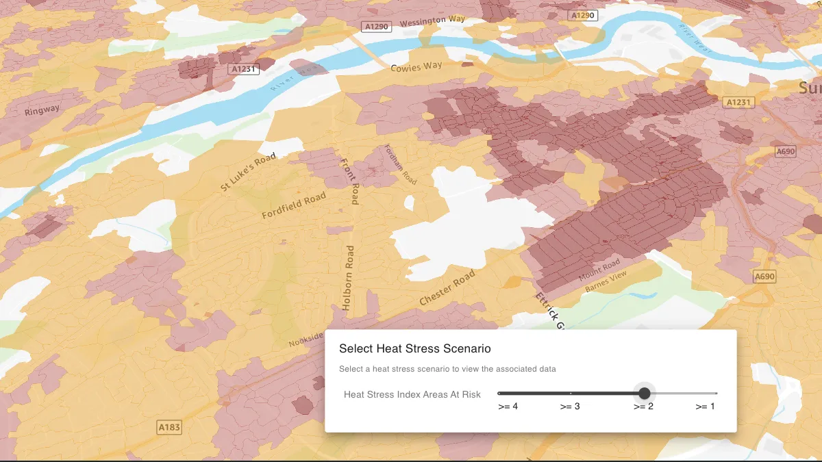
SimAnalytica delivers faster climate risk scenario modelling using OS location data
Logo

SimAnalytica delivers faster climate risk scenario modelling using OS location data

SimAnalytica, an OS Partner, provides place-based decision intelligence software applications, to help public and private sector organisations accelerate the transition to net zero and build climate resilience. High-quality OS location data is a core component...
Read more


Case studies

Slide 1 of 3
SimAnalytica delivers faster climate risk scenario modelling using OS location data
Logo

SimAnalytica delivers faster climate risk scenario modelling using OS location data

SimAnalytica, an OS Partner, provides place-based decision intelligence software applications, to help public and private sector organisations accelerate the transition to net zero and build climate resilience. High-quality OS location data is a core component...
Read more
Hiscox UK improves insurance risk management with OS location data

Hiscox UK improves insurance risk management with OS location data

Hiscox UK, a leading insurance provider for high-net-worth customers, faced a significant challenge in managing risks associated with high-value assets, and used Ordnance Survey (OS) data to determine exact locations of insured properties.
Read more
Lancashire County Council improves road safety planning with OS NGD Transport data

Lancashire County Council improves road safety planning with OS NGD Transport data

Lancashire County Council (LCC) is the local authority for the county of Lancashire, in England. The county council serves everyone living and working in Lancashire, providing key services and support for the region.
Read more

Case studies

Discover what's next for OS data products

We’re always optimising how you use location data. The OS data product roadmap unlocks a clear view of what’s coming – new features, upgraded datasets, and when we’ll retire older products. Expect rich enhancements across transportation, land, water, builds, addresses and more. And we’re doing it openly, with you able to get involved, every step of the way.

Explore the roadmap now and see what’s on the horizon.

View the roadmap
© Crown copyright and database rights. Ordnance Survey 2026