Challenge
The way that mapping and recording has been carried out over the last 30 years has changed a lot, but there has always been an appetite for a map of archaeological sites across England.
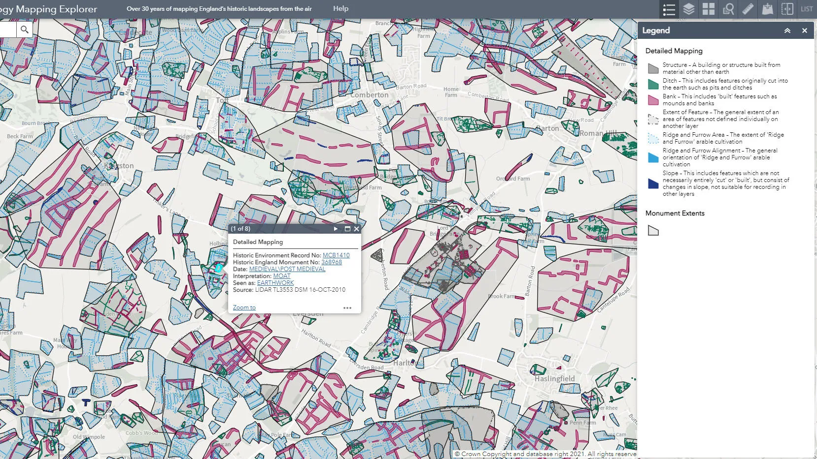
The results of aerial archaeology mapping have historically been archived by individual project and the use of attribute data has also developed over the years. This has meant that there was no single standardised dataset that could be used for national, regional, and local archaeological studies. Advancements in specialist software mean it’s now easier for the public to access and view.
Solution
Historic England, with help from various Historic Environment Records (HERs) worked to standardise the data. They used Ordnance Survey APIs, OS Maps API and OS Open Names, available through the Public Sector Geospatial Agreement (PSGA), to overlay their data on. Until now it’s not been possible for Historic England to make the results of its aerial archaeology mapping available in a user-friendly manner.
Result
Visualising the country in an interactive map helps transform understanding of historic landscapes. This is further enhanced when the mapping is used alongside site-based textual data available from local Historic Environment Records or the Heritage Gateway, and historic maps. The map provides a key visual aid to help communicate with landowners and members of the public.
"This new aerial archaeology mapping tool lets people fly virtually over England and drink in its many layers of history. On Ordnance Survey mapping, it will allow everyone to explore the hidden heritage of their local places and what makes them special. We hope it will give people a springboard to further investigation, whether for research purposes or simply to satisfy curiosity about what archaeological features they may have noticed around their local area"