Overview
- Type of mark
- Surface Block
- Flush bracket
- Not Available
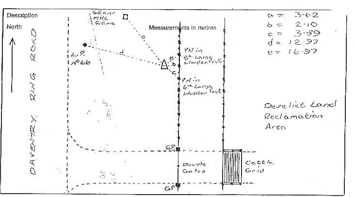
- Grid reference
- SP576634
- Access to mark
- 2WD Vehicle
- Keys required
- No
- On Landranger sheet
- 152
Click to buy - On Explorer sheet
- 222
Click to buy - Permission required
- No
Coordinates of this station
ETRS89 Cartesian
- X
- 3911081.7761
- Y
- -78986.7677
- Z
- 5020974.9973
ETRS89 Geodetic
- Latitude
- N 52 ° 15' 50.395095"
- Longitude
- W 1 ° 9' 25.081891"
- Ellipsoid height
- 176.942
National Grid (Transformed by OSTN15/OSGM15)
- Eastings
- 457630.676
- Northings
- 263203.435
- Height
- 128.804
NB: If 'permission required' is Yes at top of this form, the land owner or agent's permission must be obtained before accessing the mark.