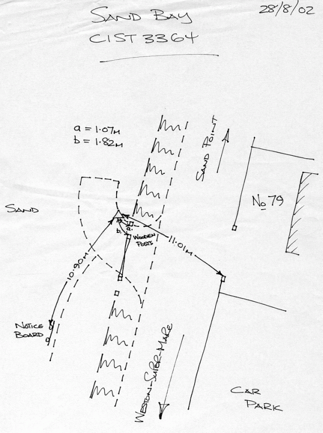
Overview
- Type of mark
- Rivet
- Flush bracket
- Not Available
- Grid reference
- ST331647
- Access to mark
- 2WD Vehicle
- Keys required
- No
- On Landranger sheet
- 182
Click to buy - On Explorer sheet
- 153
Click to buy - Permission required
- No
Coordinates of this station
ETRS89 Cartesian
- X
- 3984054.8053
- Y
- -206104.0026
- Z
- 4959882.4083
ETRS89 Geodetic
- Latitude
- N 51 ° 22' 37.373339"
- Longitude
- W 2 ° 57' 41.032831"
- Ellipsoid height
- 60.083
National Grid (Transformed by OSTN15/OSGM15)
- Eastings
- 333183.041
- Northings
- 164660.807
- Height
- 9.698
NB: If 'permission required' is Yes at top of this form, the land owner or agent's permission must be obtained before accessing the mark.