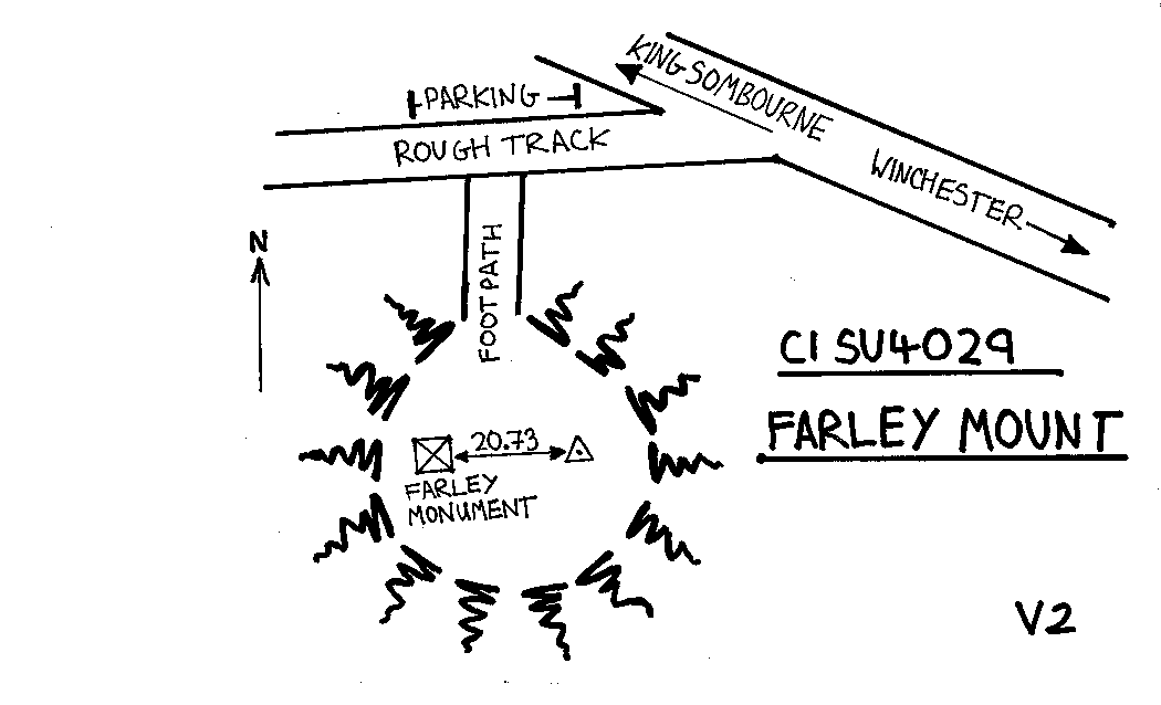
Overview
- Type of mark
- Pillar
- Flush bracket
- 11621
- Grid reference
- SU403290
- Access to mark
- foot
- Keys required
- Yes
- On Landranger sheet
- 185
Click to buy - On Explorer sheet
- 132
Click to buy - Permission required
- Yes
Coordinates of this station
ETRS89 Cartesian
- X
- 4015792.2996
- Y
- -99960.0211
- Z
- 4937869.4047
ETRS89 Geodetic
- Latitude
- N 51 ° 3' 33.66833"
- Longitude
- W 1 ° 25' 33.228038"
- Ellipsoid height
- 221.290
National Grid (Transformed by OSTN15/OSGM15)
- Eastings
- 440329.931
- Northings
- 129047.664
- Height
- 174.759
NB: If 'permission required' is Yes at top of this form, the land owner or agent's permission must be obtained before accessing the mark.