Overview
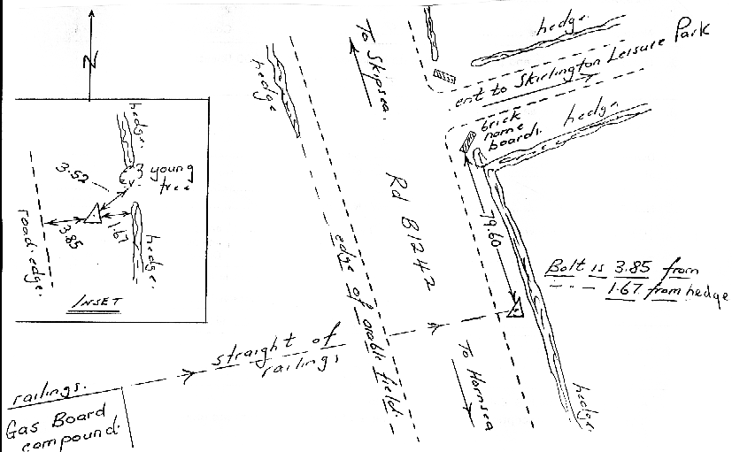
- Type of mark
- Bolt
- Flush bracket
- Not Available
- Grid reference
- TA183523
- Access to mark
- 2WD Vehicle
- Keys required
- No
- On Landranger sheet
- 107
Click to buy - On Explorer sheet
- 295
Click to buy - Permission required
- No
Coordinates of this station
ETRS89 Cartesian
- X
- 3761395.3537
- Y
- -13027.9385
- Z
- 5133765.3566
ETRS89 Geodetic
- Latitude
- N 53 ° 57' 13.403403"
- Longitude
- W 0 ° 11' 54.414256"
- Ellipsoid height
- 62.811
National Grid (Transformed by OSTN15/OSGM15)
- Eastings
- 518317.672
- Northings
- 452347.804
- Height
- 17.195
NB: If 'permission required' is Yes at top of this form, the land owner or agent's permission must be obtained before accessing the mark.