Overview
- Type of mark
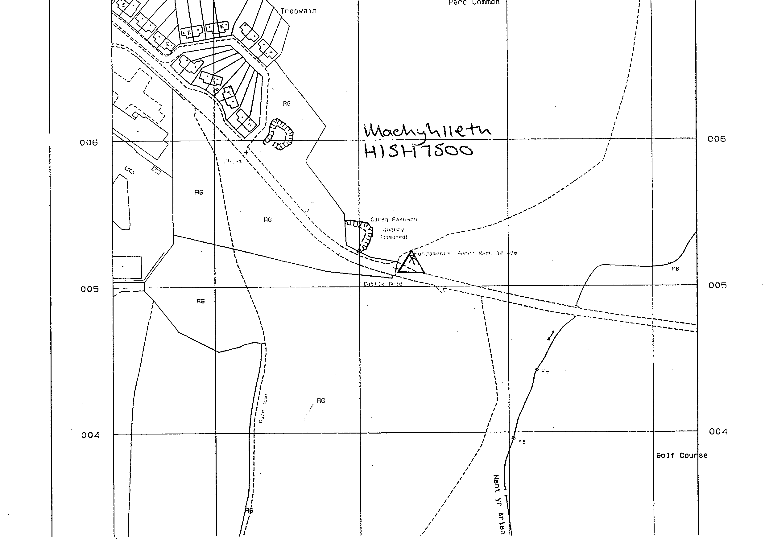
- FBM
- Flush bracket
- Not Available
- Grid reference
- SH755005
- Access to mark
- 2WD Vehicle
- Keys required
- No
- On Landranger sheet
- 124
Click to buy - On Explorer sheet
- 23
Click to buy - Permission required
- No
Coordinates of this station
ETRS89 Cartesian
- X
- 3874519.7462
- Y
- -259973.8954
- Z
- 5042904.2760
ETRS89 Geodetic
- Latitude
- N 52 ° 35' 17.545774"
- Longitude
- W 3 ° 50' 19.31466"
- Ellipsoid height
- 88.630
National Grid (Transformed by OSTN15/OSGM15)
- Eastings
- 275532.975
- Northings
- 300520.353
- Height
- 34.398
NB: If 'permission required' is Yes at top of this form, the land owner or agent's permission must be obtained before accessing the mark.