Overview
- Type of mark
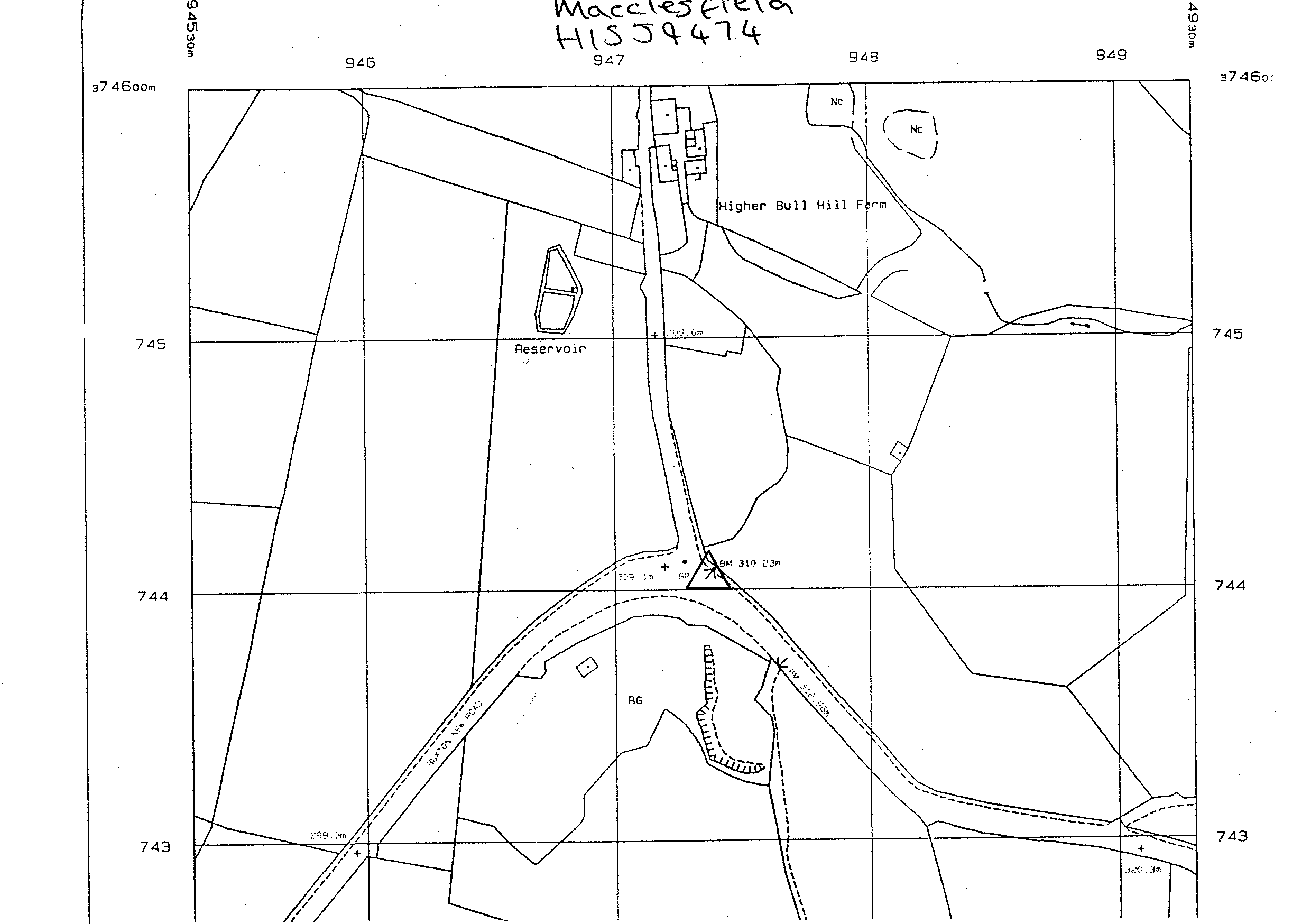
- FBM
- Flush bracket
- Not Available
- Grid reference
- SJ947744
- Access to mark
- 2WD Vehicle
- Keys required
- No
- On Landranger sheet
- 118
Click to buy - On Explorer sheet
- 268
Click to buy - Permission required
- No
Coordinates of this station
ETRS89 Cartesian
- X
- 3820633.8734
- Y
- -138785.1642
- Z
- 5088637.4316
ETRS89 Geodetic
- Latitude
- N 53 ° 15' 59.977585"
- Longitude
- W 2 ° 4' 49.310637"
- Ellipsoid height
- 361.222
National Grid (Transformed by OSTN15/OSGM15)
- Eastings
- 394737.072
- Northings
- 374408.546
- Height
- 310.239
NB: If 'permission required' is Yes at top of this form, the land owner or agent's permission must be obtained before accessing the mark.