Overview
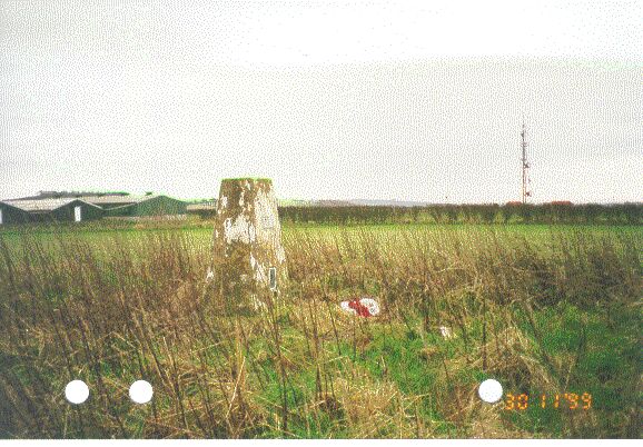
- Type of mark
- Pillar
- Flush bracket
- S1518
- Grid reference
- SE795623
- Access to mark
- 2WD Vehicle
- Keys required
- No
- On Landranger sheet
- 100
Click to buy - On Explorer sheet
- 300
Click to buy - Permission required
- No
Coordinates of this station
ETRS89 Cartesian
- X
- 3752468.9123
- Y
- -51515.5973
- Z
- 5140275.4941
ETRS89 Geodetic
- Latitude
- N 54 ° 3' 2.069984"
- Longitude
- W 0 ° 47' 11.519052"
- Ellipsoid height
- 277.775
National Grid (Transformed by OSTN15/OSGM15)
- Eastings
- 479544.662
- Northings
- 462302.501
- Height
- 230.586
NB: If 'permission required' is Yes at top of this form, the land owner or agent's permission must be obtained before accessing the mark.