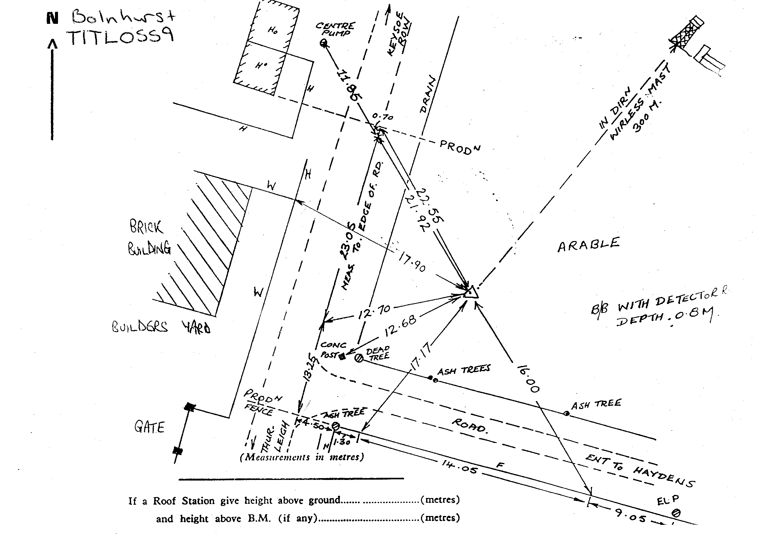
Overview
- Type of mark
- Buried Block
- Flush bracket
- Not Available
- Grid reference
- TL059598
- Access to mark
- 2WD Vehicle
- Keys required
- No
- On Landranger sheet
- 153
Click to buy - On Explorer sheet
- 208
Click to buy - Permission required
- No
Coordinates of this station
ETRS89 Cartesian
- X
- 3915067.2220
- Y
- -30836.9697
- Z
- 5018352.5077
ETRS89 Geodetic
- Latitude
- N 52 ° 13' 33.796066"
- Longitude
- W 0 ° 27' 4.608133"
- Ellipsoid height
- 129.790
National Grid (Transformed by OSTN15/OSGM15)
- Eastings
- 505879.629
- Northings
- 259778.373
- Height
- 82.985
NB: If 'permission required' is Yes at top of this form, the land owner or agent's permission must be obtained before accessing the mark.