Challenge
NatureScot wanted to encourage more farmers and crofters to take account of biodiversity in their farm business management – to help deliver Scottish Government’s ambitions to restore nature, and increase future resilience.
Farmers and crofters also required help to create a habitat map – to meet the biodiversity requirements for their Whole Farm Plan, which is needed to claim government agricultural payments throughout Scotland.
Solution
NatureScot developed a mobile app and web platform called FarmBioScot – to test a standard approach to farm biodiversity auditing and planning, using a four-step ‘map, measure, manage and monitor’ process. This simple, free-to-use tool is being tested by and co-designed with farmers and crofters.
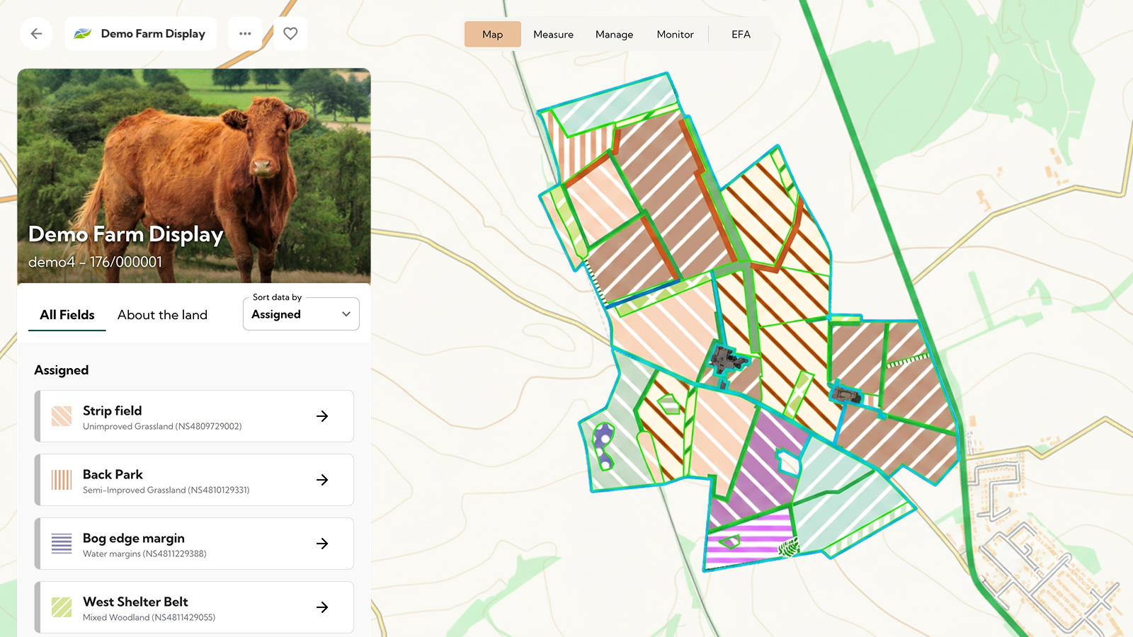
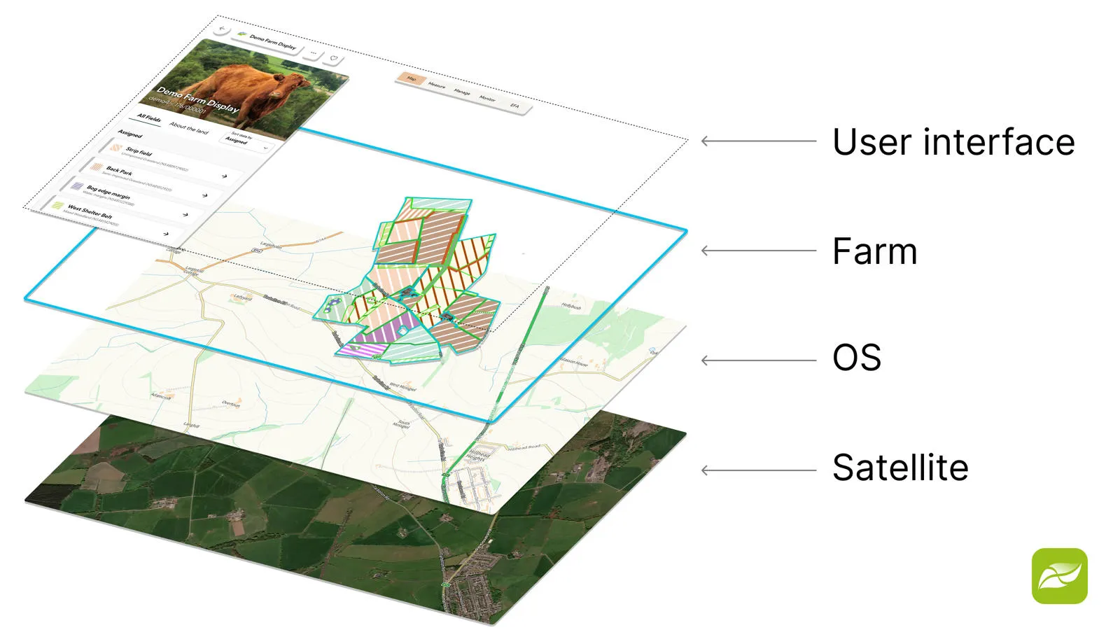
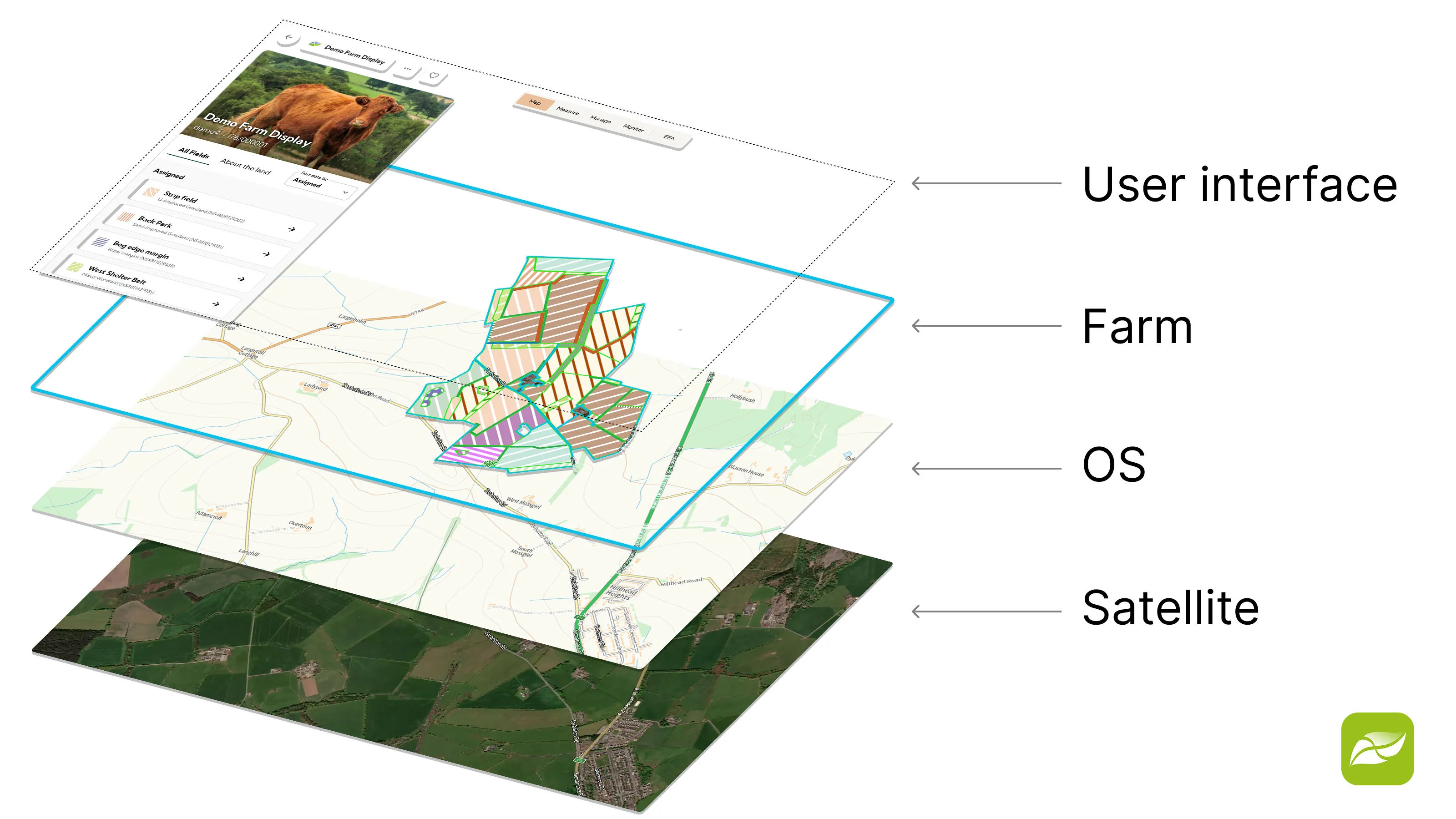
FarmBioScot uses OS data, such as OS Maps API as a base layer, OS Features API (with the magic wand functionality) for more detailed features, as well as OS Open data for further details, such as OS Open Rivers for watercourses.
"We work with farmers and crofters to develop and improve the skills, tools and support needed for a future where nature recovery and high-quality food production go hand in hand. Farmers and crofters who've already tested FarmBioScot say they find it a simple digital tool for habitat mapping using OS data, that shows the extent to which they're providing valuable contributions for nature and their businesses."
Result
Using FarmBioScot for habitat mapping initially, many farmers and crofters proceed through the farm biodiversity auditing and planning process, increasing their interest and engagement with nature.
"Modern crofting and farming can be quite complicated but FarmBioScot provides me with a clear, easy-to-use solution for monitoring biodiversity across our croft, which I can easily update. It’s saved me a significant amount of time and effort in mapping and assessing habitat types, while providing a simple way to pass the required standardised return to Scottish Government that can hopefully find a wider benefit for Scottish wildlife."
Future plans include using the OS National Geographic Database (OS NGD) on their mission to capture the value of nature. NatureScot have also developed a Natural Capital Tool.