Case studies
Discover how Ordnance Survey data is driving more efficient decisions in organisations like yours
Found 8 results
Page 1

Newark and Sherwood District Council improves decision-making with OS NGD data
Newark and Sherwood District Council has used OS data to enable confident decision-making for public benefit.
Read case study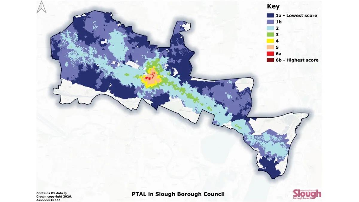
Slough Borough Council improves public transport accessibility planning with OS NGD Transport data
Slough Borough Council has used OS data to map public transport accessibility. Gaining a clearer picture means the council are now able to more effectively target interventions – to improve accessibility, and make public transport more inclusive throughout Slough.
Read case study
NatureScot helps farmers assess biodiversity with FarmBioScot and OS data
NatureScot, Scotland’s nature agency, has developed a new digital tool for farmers to assess the environmental value of their land. NatureScot’s tool, Farm Biodiversity Scotland, known as FarmBioScot, is being tested by farmers and crofters – allowing them to map habitats, asses...
Read case study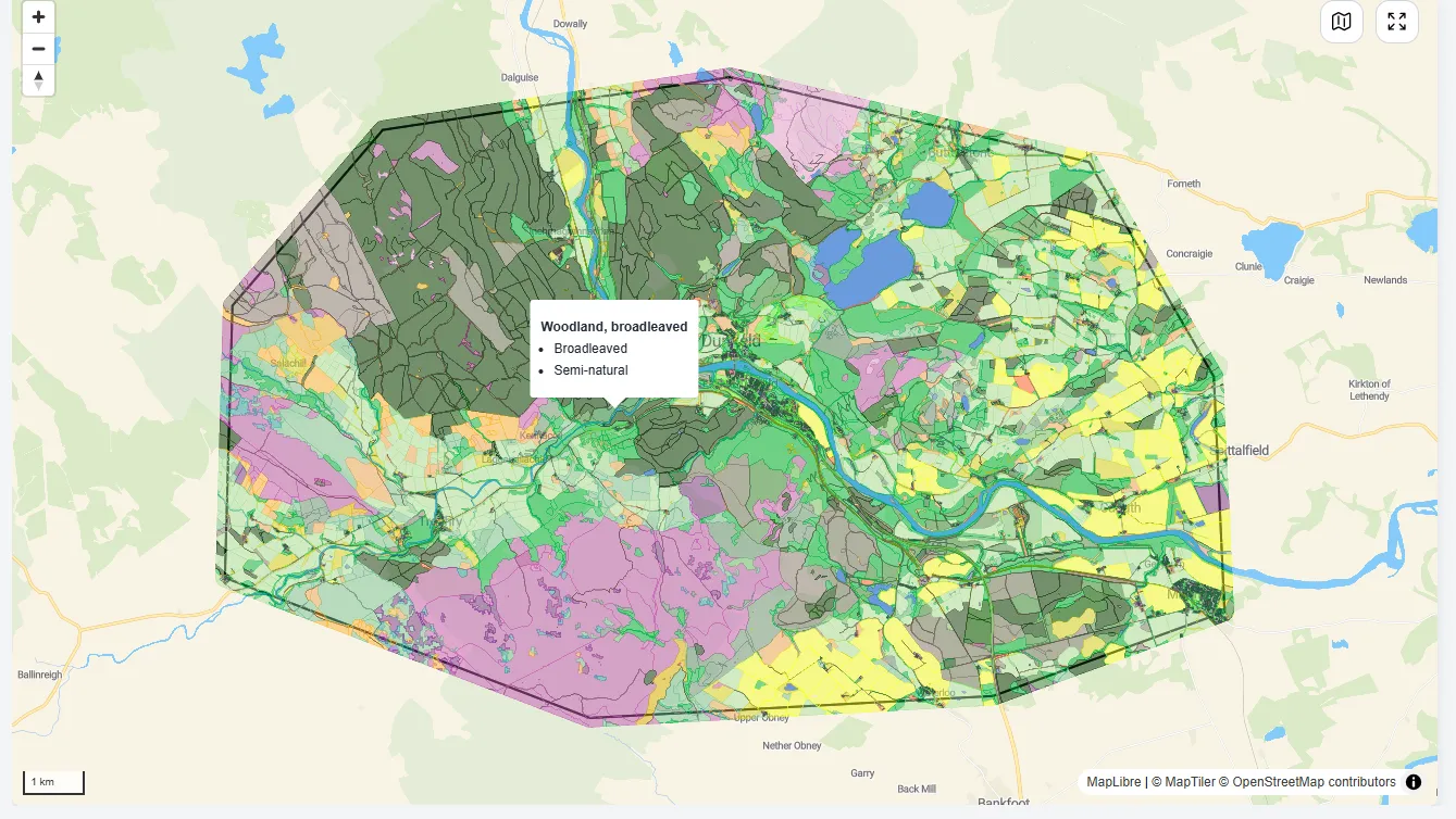
NatureScot enables natural capital decision-making with OS MasterMap data
NatureScot is Scotland’s nature agency, working to improve the natural environment (such as biodiversity, geodiversity, and the natural elements of land and seascapes). NatureScot has used OS MasterMap data to create a Natural Capital Tool, enabling people to put nature at the heart of deci...
Read case study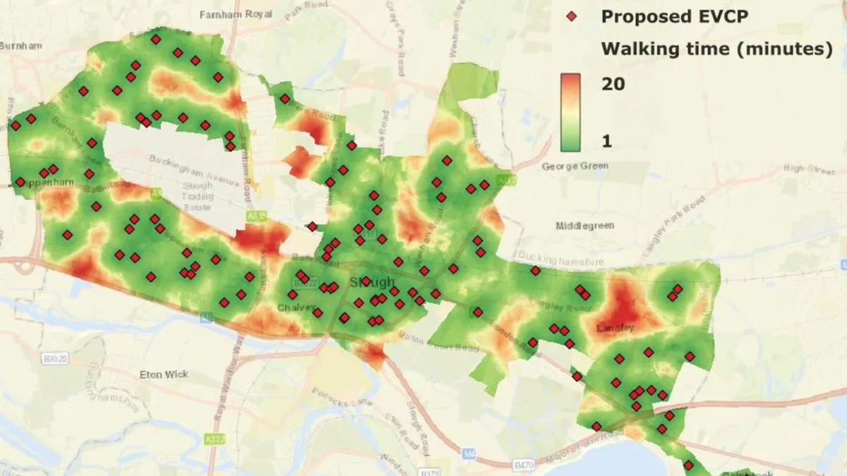
Slough Borough Council improves electric vehicle charging planning with OS NGD data
Slough Borough Council is on a mission to increase coverage of electric vehicle (EV) charging locations.
Read case study
Southern Housing improves sustainability and biodiversity planning with OS data
Southern Housing is one of the largest housing associations in the UK, owning and managing over 80,000 homes across London, the Midlands, and the South East. A not-for-profit housing provider, its social purpose is the foundation for all its work. Southern Housing is determined to maximise...
Read case study
NHS South, Central and West improves prescription accessibility with OS location data
NHS England recognises that collecting prescriptions from pharmacies can be a challenge for some patients.
Read case study
National Highways improves highway boundary management with OS MasterMap data
National Highways are the government appointed authority responsible for operating, maintaining, and improving England’s motorways and major A roads – totalling 4,300 miles of Strategic Road Network (SRN). The RedLine Operational Boundary that surrounds England’s Strategi...
Read case study